
Dangerously stormy day in SE and Central Queensland
Storms are roaring their way through Brisbane and areas to the west of the Queensland capital as we write this story, on what looms as a potentially dangerous weather day for much of Southeast and Central Queensland.
The Bureau of Meteorology issued a Severe Thunderstorm Warning for heavy rainfall for parts of Darling Downs and Granite Belt and Southeast Coast Forecast Districts at 8:46 am local time (9:46 am AEDT), and some of the rainfall totals already recorded this morning are quite intense:
- 72mm was recorded Ma Ma Creek in just one hour to 7 am.
- 45mm recorded landed in the gauge at Gatton in just 30min to 6:30am.
- 23.6 mm fell in Brisbane between 6 am and 9 am with heavy rain continuing as we write this story and looking likely to stick around for an hour or so at least, especially in western parts of the city.
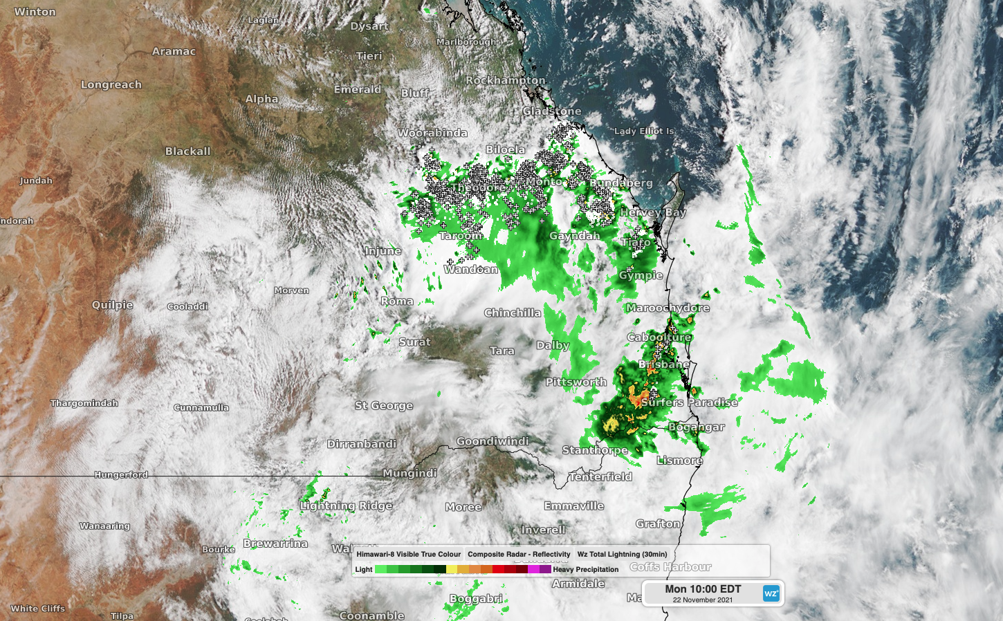
And that's just this morning. Later today…
For the next few hours, the highest storm risk is in inland areas of Southeast Queensland, where an upper level low pressure system is currently centred.
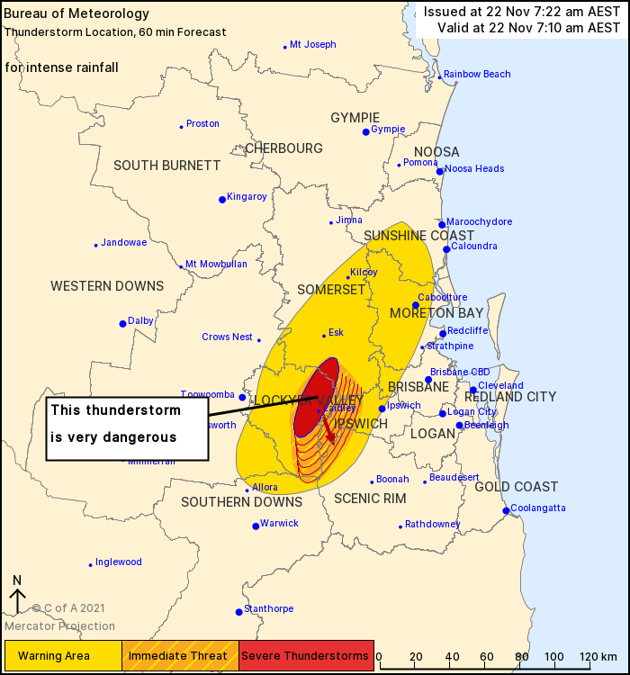
The BoM makes the danger pretty clear in this graphic:
Later on this afternoon, the Capricornia coast and cities like Gladstone and Rockhampton will potentially be in the firing line, with the chance of supercell thunderstorms.
We'll keep you posted as this situation evolves, and as ever, we encourage you to share your images of severe weather by tagging #weatherzone on social media, which is your way of giving us permission to publish your images.
Stay safe today, Queenslanders!