
Tropical Cyclone Alfred to intensify before landfall
Tropical Cyclone Alfred, which is bearing down on Queensland’s southeast coast as a category two system, is expected to intensify before making landfall on Thursday night.
Alfred is currently moving towards southeast Queensland as a category two tropical cyclone. At 7am AEST on Wednesday, it was located about 425 km east of Brisbane moving towards the west at around 11 km/h.
Satellite images captured on Wednesday morning reveal that Alfred doesn’t look like a typical tropical cyclone. The thick convective clouds that usually surround a tropical cyclone’s core are missing from Alfred’s centre and its northern and eastern quadrants are also sparsely covered by cloud. This shows that the system is being affected by dry air intrusion and wind shear, which have both prevented the system from strengthening over the last 24 hours.
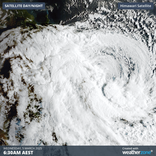
Image: Visible true-colour satellite images showing Tropical Cyclone Alfred off the southeast coast of Queensland on Wednesday morning.
However, conditions should become more favourable for Alfred to gain strength as it approaches Queensland’s southeast coast during the next couple of days.
One of the main reasons forecasters think Alfred will strengthen as it approaches the coast is that the cyclone will be tracking over the warm East Australia Current (EAC).
Tropical Cyclones draw their energy from warm oceans and require sea surface temperatures of 26.5°C or higher to develop. Once a tropical cyclone has formed, sea surface temperatures in the mid-twenties can be enough to support the system and temperatures in the high-twenties or low-thirties can help it intensify more rapidly.
Alfred has spent the last couple of days hovering over sea surface temperatures around 25 to 26°C. As the system moves further west on Wednesday and Thursday, it will track over a tongue of water where surface temperatures are around 27°C.
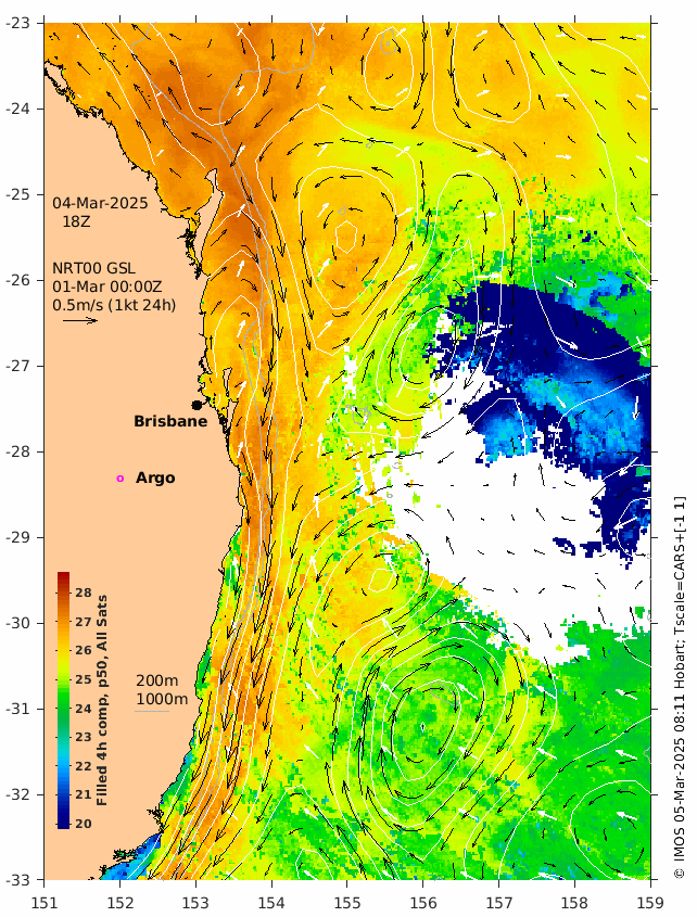
Image: Satellite-derived sea surface temperatures along Australia's east coast on Tuesday, March 4, 2025, showing a warm tongue of water near the coast due to the East Australian Current (EAC). Source: IMOS
In addition to these warmer waters providing more energy to Alfred, a reduction in vertical wind shear (change of wind speed with height) will also help Alfred become more consolidated as it gets closer to the coast.
Tropical Cyclone Alfred is predicted to make landfall as a high-end category two tropical cyclone, with wind gusts reaching around 155 km/h near its core. There is a chance that Alfred could become a low-end category three system before crossing the coast, although this is considered a low risk at this stage. Category three tropical cyclones produce wind gusts of 165 km/h and higher near their core.
Alfred is currently expected to cross the coast near or south of Brisbane on Thursday night or Friday morning. The strongest wind, heaviest rain and largest waves are likely to occur near and to the south of Alfred’s centre as it makes landfall.
Anyone living in southern Queensland and northern NSW should keep a close eye on the latest official tropical cyclone advisories and weather and flood warnings in the coming days.