Yet more heavy late spring snow
Is this winter or the last couple of weeks of spring?
Residents of the mountain districts of southeastern Australia and Tasmania could be forgiven for asking that question, after yet another cold front swept through the region overnight, delivering up to 20 cm of snow – and it's still snowing today to quite low levels.
By our count, this is at least the sixth Australian snowfall event of note in October and November.
November snowfalls
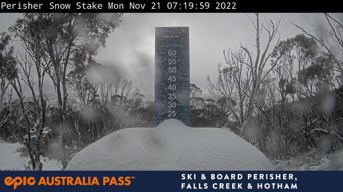
There is today's event, which left the Perisher ski resort snow stake looking like this.

Image: Is this July? Not according to the date stamp. Source: ski.com.au.
There was the event last week that brought heavy snow to the mountains of Tasmania and southern Victoria, and even snow near Canberra plus a snow-like form of hail called "graupel" to the capital.
There was the heavy snow event on Melbourne Cup Day and the day after, which was one of the heaviest November falls in recent memory, and even triggered back-country avalanches.
October snowfalls
There was a light snow event on October 28 and a much heavier snowfall earlier in the month in a system which only brushed eastern Australia but caused snow to sea level in New Zealand.
There was also an unusual snowfall in areas along the NSW South Coast on October 10.
September saw several snowfalls, and mostly these were unremarkable as you expect the odd wintry system to arrive in the first month of spring.
However one huge dump of September snow is worth mentioning as it brought Snowy Hydro's official snow depth at Spencers Creek (roughly halfway between Perisher and Thredbo) to a season high of 232 cm on September 20, exceeding the previous season peak of 204.5 cm on August 24.
Long story short, it has been a very, very snowy spring by Aussie standards, and Weatherzone meteorologist Joel Pippard actually wrote a pretty good explainer last week about the influences behind this weather. Spoiler: you can blame the unusually strong and cold stratospheric polar vortex.
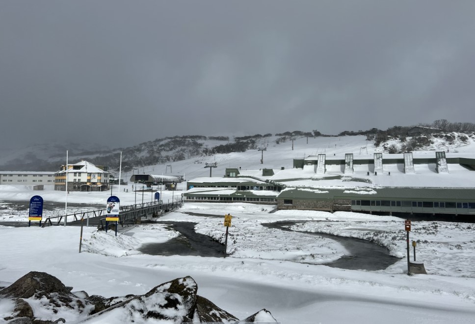
Meanwhile this was the scene at Perisher Valley, NSW, early on Monday morning, the 21st of November.

Image: Somebody, crank up the lifts! Source: Perisher ski resort.
The final aspect of this current snow system which is worth mentioning is the altitude at which snow is falling.
- Your typical winter snow system might deliver snow to about 1200m above sea level.
- Occasionally snow falls to lower levels. Canberra sits between about 550m and 650m and it's more or less the extreme limit of how low snow can fall in New South Wales and the ACT.
- In Victoria, it's more like 200m to 300m while light snow at sea level is possible in Tasmania.
- But this Monday and into the early hours of Tuesday, snow is tipped to fall as low as 800 metres in southern NSW, 700m in Victoria and as low as 500m in Tasmania. That'd make this system cold by midwinter standards.
We hope you haven't packed away the heavy doonas yet, although you won't need them for too many nights, as most of the areas mentioned will warm up significantly by the end of the working week and into the weekend.