
Yet another deluge for flood-weary North Queensland
Another round of extremely heavy rainfall totals is expected in parts of northern Queensland, just days after some areas experienced some of their heaviest rainfall on record.
In a deluge earlier this week that was rarer than a one-in-2000 year event, numerous locations between Townsville and Cairns received around 1500 millimetres of rain within three days, resulting in major flooding, widespread evacuations, and two flood-related deaths.
Now a new burst of heavy rain is setting in over the same area again, and while totals won’t be as phenomenally huge as last week, extremely heavy falls with flooding are still expected:
- The BoM is predicting six-hourly rainfall rates of 140 to 200mm this weekend.
- 24-hour totals are likely to exceed 200mm in places.
- In total, we could see more than 500mm in some areas in the next three days.
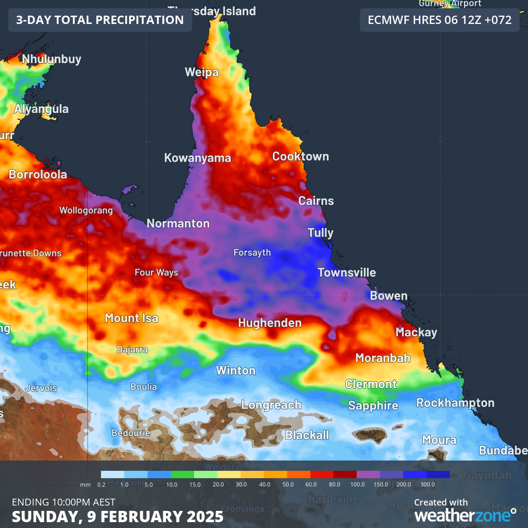
Image: Rainfall totals for North Queensland expected up until 10pm on Sunday February 9, 2025.
What is causing this latest deluge?
There are two main reasons fuelling this latest soaking:
- The monsoon trough is active over northern Queensland (see our recent story for information on the monsoon).
- Copious amounts of tropical moisture are being drawn into the monsoon trough, with winds converging over northern Queensland, again producing the perfect setup for heavy rain across Qld's northeast tropical coast and adjacent inland areas.
For the weekend, Townsville can expect falls in the vicinity of 40 to 80mm across both days, while Cairns can also expect heavy rain, albeit with possibly slightly lower totals. Inland areas within an hour or two of the coast can expect heavy falls too.
Meanwhile, rivers are still swollen from the recent rain, with ongoing flooding likely to worsen over the weekend, so please check the Weatherzone warnings page for the latest information.