Yet another bout of wintry weather on its way to southwestern WA.
A strong cold front moved through WA on Sunday, producing strong winds, rain and thunderstorms across the far southwestern corner of the state.
The highest falls were seen in the Busselton to Margaret River area, with up to 50mm falling in some parts during the 24 hours to 9am on Monday.
This wintry weather is set to continue today, with yet another cold front predicted to reach southwestern WA this evening.
This evening's cold front is expected to bring another bout of cool, wet and windy weather, with Western Australian’s feeling like they can’t catch a break.
Gusty thunderstorms are expected in the far southwestern corner of WA this afternoon and evening. These thunderstorms may produce wind gusts strong enough to damage infrastructure.
Thunderstorms are predicted again on Tuesday and are likely to affect the Perth area this time. A freezing airmass on Tuesday also brings the risk of small hail during the morning and early afternoon.
Strong west to southwesterly winds may average around 25-35 km/h today in the southeast of WA, peaking along the coastal fringe with 40 km/h winds. Winds may be even stronger with showers and storms. The blustery winds will likely ease of from Tuesday morning, as the front moves away.
Dangerous surf conditions could develop Monday evening into Tuesday, thanks to the combination of the strong winds, the cold front and higher than astronomical tides.
Another burst of rainfall may reach as far north as the southwestern Gascoyne district today, as the cold front sweeps across the state.
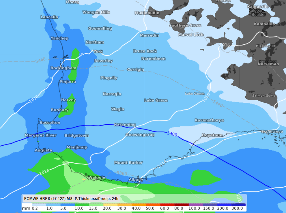
Broadly across the far southwestern parts of WA, 24-hour rainfall totals are predicted to reach between 5-10mm during today and tomorrow (figure 1). The heaviest rain is predicted along the South West coastline down to Walpole, with isolated pockets of 15-20mm forecast.

Figure 1: ECMWF 24-hour accumulated rainfall totals up to Tuesday, June 29 at 11am WST.
Perth may see up to 5mm of rainfall on Monday and between 4-8mm of rain on Tuesday, before the rain eases.
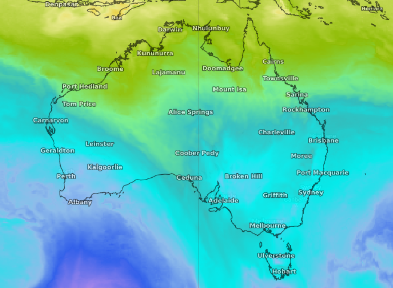
Behind the cold front, a cool airmass is expected to move through southern WA (figure 2).

Figure 2: Upper-level cool pool moving through southwestern WA on Tuesday, June 29 at 11pm WST.
After Perth had its coolest morning in five years on the weekend, with temperatures dropping to a chilly one degree, another burst of cool weather will move through tomorrow.
Perth’s temperatures on Tuesday and Wednesday are not expected to reach any higher than 18 degrees. The maximum temperatures for these days are 2-3 degrees below the June average, which may have plenty of locals turning their heaters on.
There will be some respite from the wintry weather from Wednesday through until the weekend, with the sky remaining mostly clear.