Wintry weather returns to southeastern Australia
Cold southerly winds are today reminding a large swathe of southeastern Australia that summer is still two and a half months away.
Chilly southerlies have been spreading across Australia's southeastern states during the last couple of days in the wake of a cold front.
After causing a dusting of snow in Tasmania and alpine areas of Victoria and NSW on Sunday and Monday, this frigid early-spring air mass also delivered some light snow in central NSW on Monday night.

Image: It was snow good in Miena, Tasmania on Sunday. Source: @katypotaty77 / Instagram
In addition to the snow, cold mid-level air has also caused small hail in multiple states during the last 24-48 hours, including Canberra and Sydney.
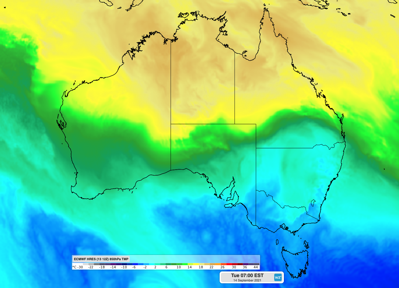
By 9am on Tuesday, temperatures were struggling to reach the low-teens across coastal areas of SA, Victoria and NSW, while most areas in Tasmania and inland southeastern Australia were still sitting in single digits.
Melbourne, Sydney and Adelaide and all forecast to reach tops of 16-17 degrees on Tuesday, with Hobart and Canberra expected to top out at 13-14 degrees. These maximums are all about 2-4 degrees below average for this time of year.

Image: Forecast 850 hPa air temperature on Tuesday morning, showing a cold air mass sitting above southeastern Australia.
Cold southerly winds will linger in southeastern Australia for another couple of days, before warmer air starts to spill in from the west.
Adelaide will bounce back to the mid-twenties by Thursday, with Melbourne, Hobart and Canberra also warming up from Friday. Sydney will see temperatures returning to the mid-twenties from Saturday.