Winter, of a sort, finally arriving for southwest WA
After a summer and autumn where mean daily temperatures were the highest on record for large parts of southwest WA, more wintry temperatures have finally arrived.
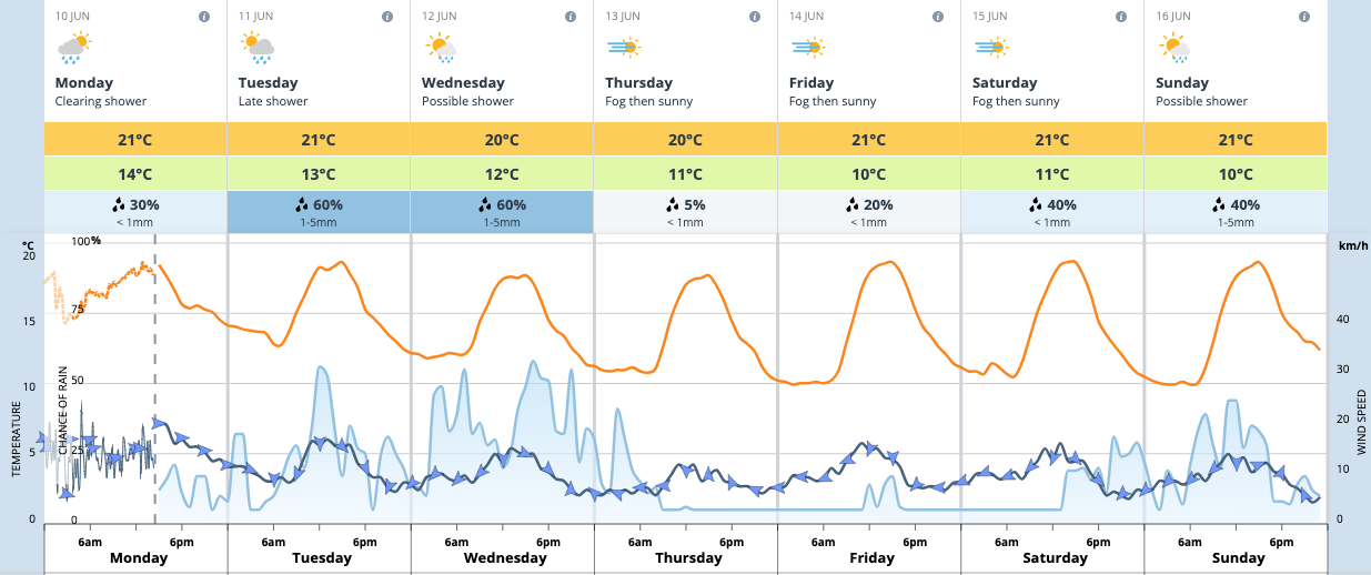
Perth today has so far reached just 20.1°C and is not expected to exceed a rounded 21°C. This is only the coolest day since the end of May but, unlike late May, the cooler weather is expected to persist. All of the next 7 days, and potentially the next 10-11 days, are expected to remain at or below the 22°C mark, which would make it the coldest string of days since last August.

Image: Forecast for Perth for the next week.
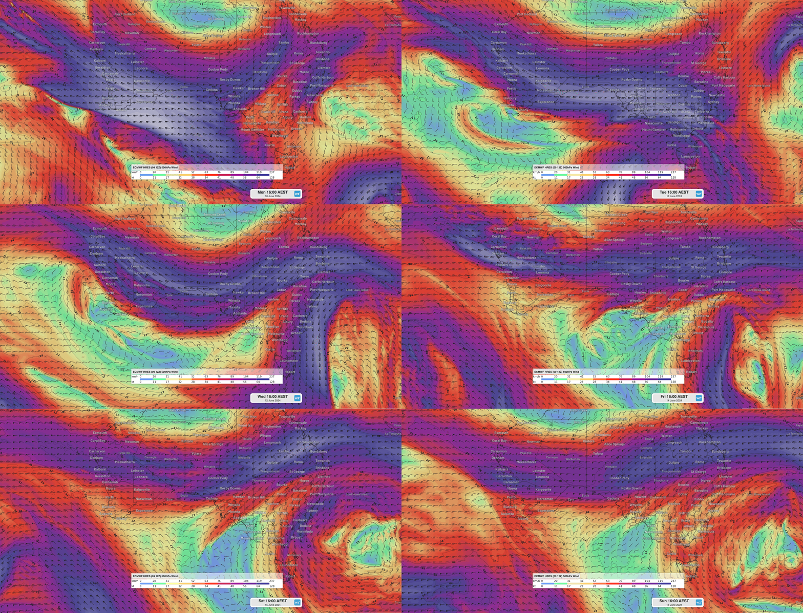
Thanks to the sub-tropical ridge finally shifting northward, southwest WA is being buffeted by seasonal and showery westerly winds. These will be enhanced on some days as cold fronts or troughs pass by, looking most prominent mid this week (Tuesday and Wednesday) and mid next week.

Image: Animation of forecast winds over southern WA and Australia this week at 500hPa (approximately 20,000ft) which help steer and enhance surface weather systems. Winds at 500hPa are indicative of jetstream winds above. Their position mostly north of southwest WA this week will allow both showery westerly to southerly winds to dominate over the southwest and also for passing cold fronts to push northward over some southwest land areas.
Despite the cooler turn, forecast temperatures are still above the long-term mean for June of 19.4°C, with no cold front in the next week looking particularly strong.