Winter is coming
Winter will make its presence felt this week with several strong cold fronts sweeping across the country.
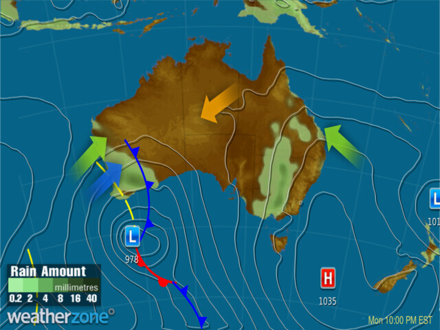
The start of winter has been unusually warm across Australia, thanks to a broad high-pressure system and northerly winds blowing across Australia. From Monday, this will change as a powerful cold front starts to cross southern parts of Western Australia.

Image: Synoptic Chart at 10pm EST Monday 5th June.
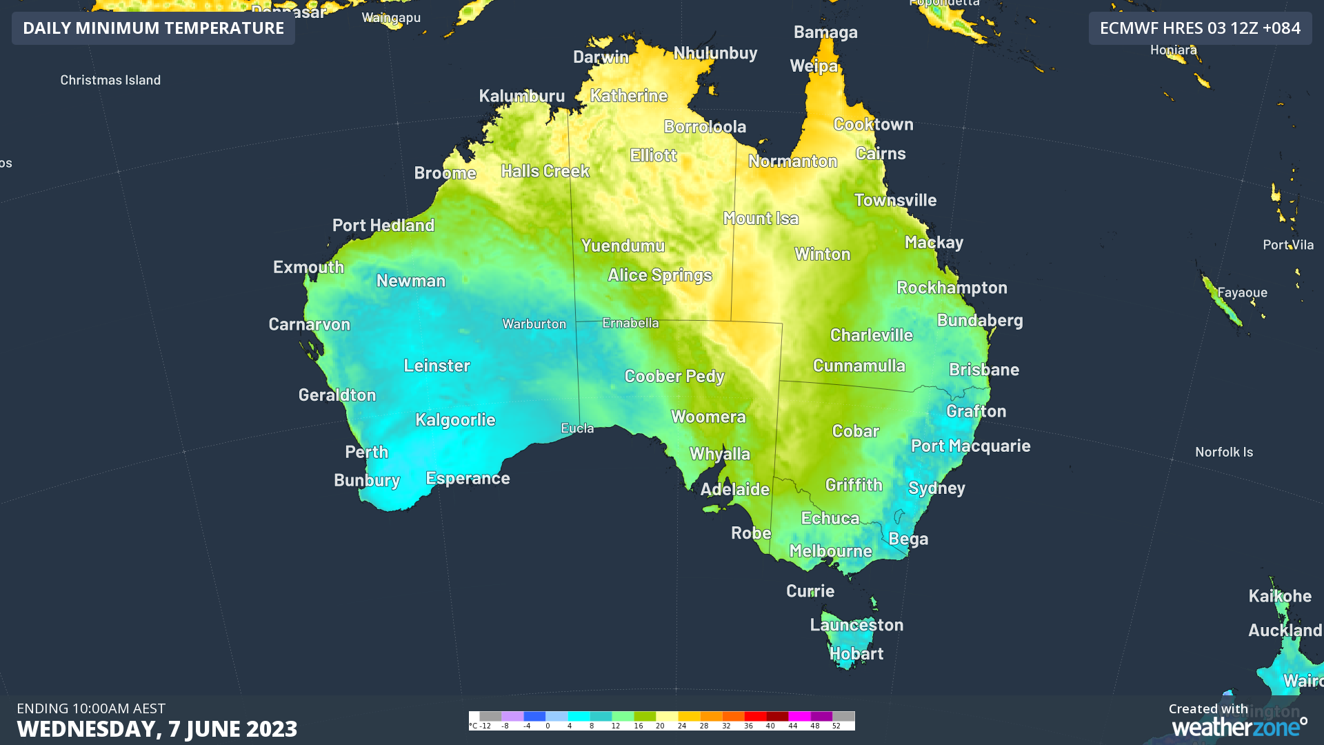
This system will move across the Great Australian Bight, bringing cold air into South Australia by the end of Wednesday. Later into the week, the cold air will spread to Victoria, Tasmania, and New South Wales. Along with the drop in temperature, this system will also bring cloud cover, rain, storms, and strong winds, making it feel even colder. For example, residents of Adelaide can expect to feel 3°C cooler than what the thermometers indicate on Thursday.

Image: Minimum temperature at 10pm EST Wednesday 7th June. Cold air in blue will push across southern and central Aus this week.
Looking ahead, another weaker cold front will arrive over next weekend, bringing another surge of cold air. This will truly give the feeling that winter has arrived in Australia. However, further details about this event will be covered in another story.
It is important to prepare for the colder temperatures and adverse weather conditions that lie ahead. To stay updated on how cold it will be in your region, follow the Weatherzone forecast and remember to keep warm.