Windy Wednesday in southern Australia
Damaging winds could affect parts of South Australia on Wednesday as a cold front passes over southern parts of the state.
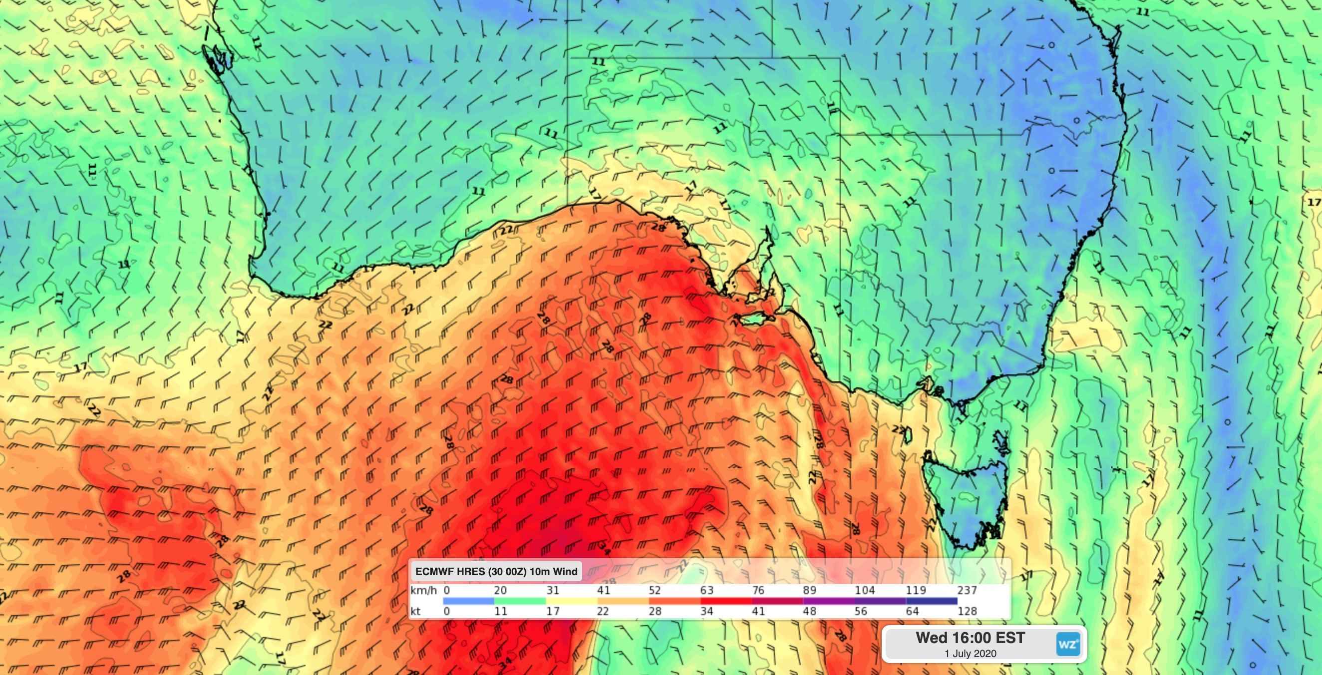
North to northwesterly winds will strengthen from Wednesday morning ahead of the approaching front. These pre-frontal winds may cause damaging gusts on and east of the Eyre Peninsula, most likely near the coast and about the Mount Lofty Ranges.

Image: Surface wind direction and speed forecast for Wednesday afternoon, according to the ECMWF-HRES model.
Later in the day, a squally wind change will be accompanied by showers as it sweeps over southern parts of the state from west to east. This change will reach the West Coast, Lower Eyre Peninsula and Kangaroo Island districts around midday and Adelaide in the afternoon. Damaging winds are also possible near and just behind this change, particularly with any shower activity.
The front will move further east on Wednesday night and Thursday, causing gusty winds over parts of Victoria, Tasmania and NSW. Severe weather warnings may be issued for damaging winds in parts of these states during the next 24-48 hours, most likely about the alps.
Cold air will sweep across southern and southeastern Australia in the wake of the front. Adelaide is forecast to reach a top of 19 degrees on Wednesday and just 14 on Thursday in the wake of the change. Further east, Melbourne is tipped to top out at 12 degrees by Friday.