
Windy Wednesday in NSW, VIC
Damaging winds, blustery showers and highland snow will hit parts of NSW and Vic on Wednesday.
A cold front and associated low pressure system will drag showers and cold air across southeastern Australia on Wednesday. Westerly winds will strengthen ahead of the approaching front, before a burst of colder and gusty southwesterly winds sweep through in the wake of the front.
This system will cause damaging wind gusts on Wednesday in some elevated and exposed coastal areas of Vic, and along the ranges in southern and central NSW, including parts of the ACT.
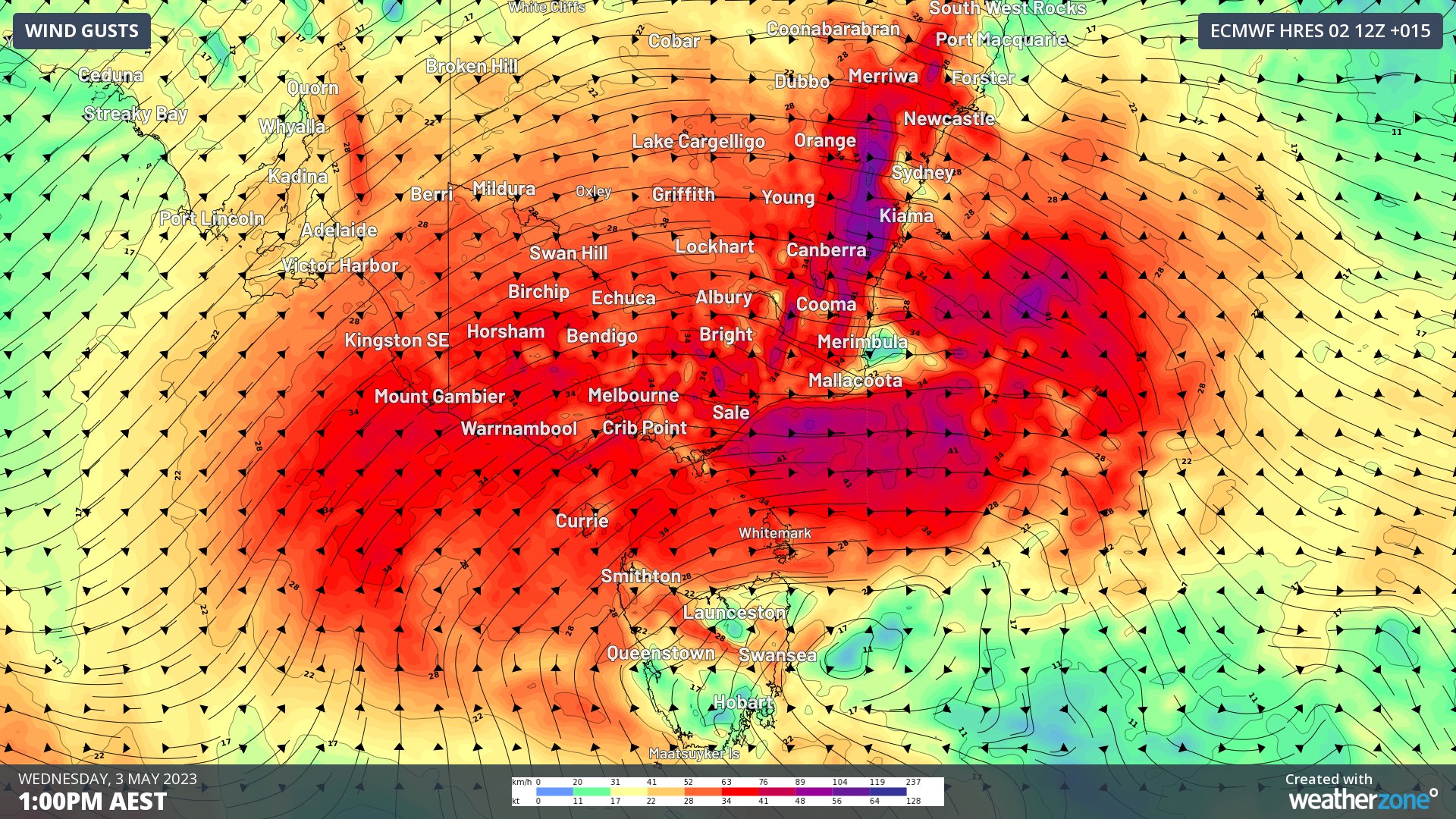
Image: Forecast wind gusts on Wednesday afternoon according to the ECMWF-HRES model.
A few places had already clocked wind gusts above 110 km/h between 4am and 7am on Wednesday, including 119 km/h at Mt Buller and 115 km/h at Thredbo Top Station and Frankston Beach.
In addition to the wind, showers will affect most southern, central and eastern districts of Vic and southern NSW/the ACT. These showers will likely fall as snow above about 1400-1500 m in the mainland alps.
There could also be a few thunderstorms in southern Vic as the front sweeps through, which bring an additional risk of isolated damaging wind gusts.
Check the latest warnings for the most up-to-date information on this dangerous weather during Wednesday.