Windy night ahead for southeastern Australia
Damaging winds will develop in parts of Tas, Vic, NSW and the ACT tonight and on Thursday as a strong cold front hits southeastern Australia.
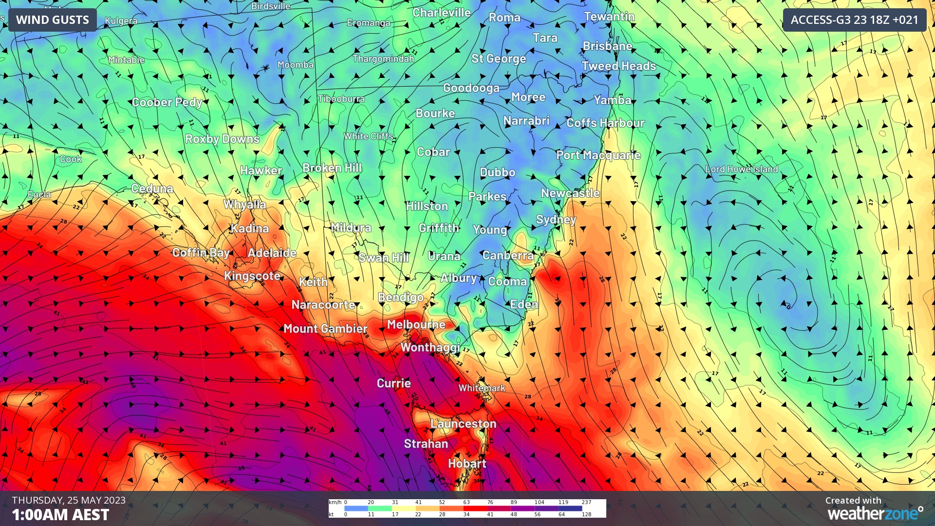
A vigorous flow of northwesterly winds will develop across southeastern Australia on Wednesday night into Thursday ahead of an approaching cold front.
These pre-frontal northwesterly winds should get strong enough to cause damaging gusts in parts of Tas from Wednesday night and Vic, NSW and the ACT from early Thursday morning.

Image: Forecast wind gusts (speed and direction) at 1am AEST on Thursday, May 25, according to the ECMWF-HRES model.
The strongest winds will generally spread from Tas up to NSW from Wednesday night and throughout Thursday with the progression of the cold front.
Image: Forecast wind gusts (speed and direction) at 1pm AEST on Thursday, May 25, according to the ECMWF-HRES model.
Severe weather warnings have been issued in parts of all four states and territories, with widespread wind gusts likely to exceed 90 km/h and isolated gusts possibly reaching 125 km/h.
After lashing southeastern Australia with damaging winds on Wednesday night and Thursday, the front will then push further north and drive cool and dry air across central and eastern parts of the country on Friday. This will include a burst of cool and blustery westerly winds in northeast NSW and southeast Qld.
Some areas in central Australia will see daytime maximum temperatures dropping by around 10ºC in the wake of this week’s front. This wintry system will also cause rain, snow and hail across several states and territories in southeastern Australia.
Be sure to check the latest severe weather warnings during the next couple of days for the most up-to-date information on this system.