
Wind and rain lashes Tasmania
Late Saturday and into Sunday morning, a low-pressure trough delivered bursts of heavy rain and gusty winds to parts of the Apple Isle, triggering the release of Severe Weather Warnings to northeast parts of the state.
The East Coast district recorded the highest daily total to 9am on Sunday, with 68mm reaching the rain gauge at Friendly Beach. This was their highest 24-hour total in over 10 months, and more than they would get in an average full month of March. The rain was particularly heavy in the small hours of Sunday morning, when 43mm was recorded in hour, and 14.6mm in just 10 minutes.
Other noteworthy rainfall stats include:
- Liawenee – 30.8mm in total (including 7.2mm in 10 minutes), their highest March daily total rainfall in five years
- Verwood – 17.6mm in 30 minutes
- Lake Augusta 45.2mm in 2 hours
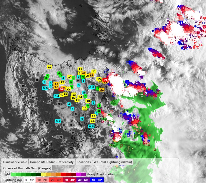
Image: Himawari sattelite image showing storms and showers clearing to the east of Tasmania. 24-hour rainfall totals to 9am Sunday
Some of the strongest winds were recorded at the usual haunts - exposed coastal and elevated areas. Wind gust reached:
- 83km/h at Tasman Island
- 80km/h at Eddystone Pt, Mt Read and Cap grim
- 78km/h at Flinders Island Airport
Conditions have eased during Sunday as the trough responsible moves away from Tasmania. After a brief reprieve from wild weather, Tasmania is bracing for what may be their first autumn snowfall of the year.