Will it snow in Queensland next week?
There is a big wintery blast coming over the southeast over the coming days, but will it be enough to bring snow to parts of Queensland?
Early on Wednesday next week, a front will push cold air well into southern and central parts of Queensland, with rain and possible thunderstorms occurring along this front.
Following the front, both daytime and mornings temperatures will drop to 4-7 degrees below average. For a large portion of the Darling Downs and Maranoa & Warrego, and even inland parts of the Southeast Coast and Wide Bay & Burnett regions, the mercury will fall below zero on Thursday morning.
The difference between this cold and the regularly occurring frosts that happen in winter, is that the atmosphere above the ground will also be below freezing. This setup allows for a rather uncommon phenomenon to occur in Queensland: snow.

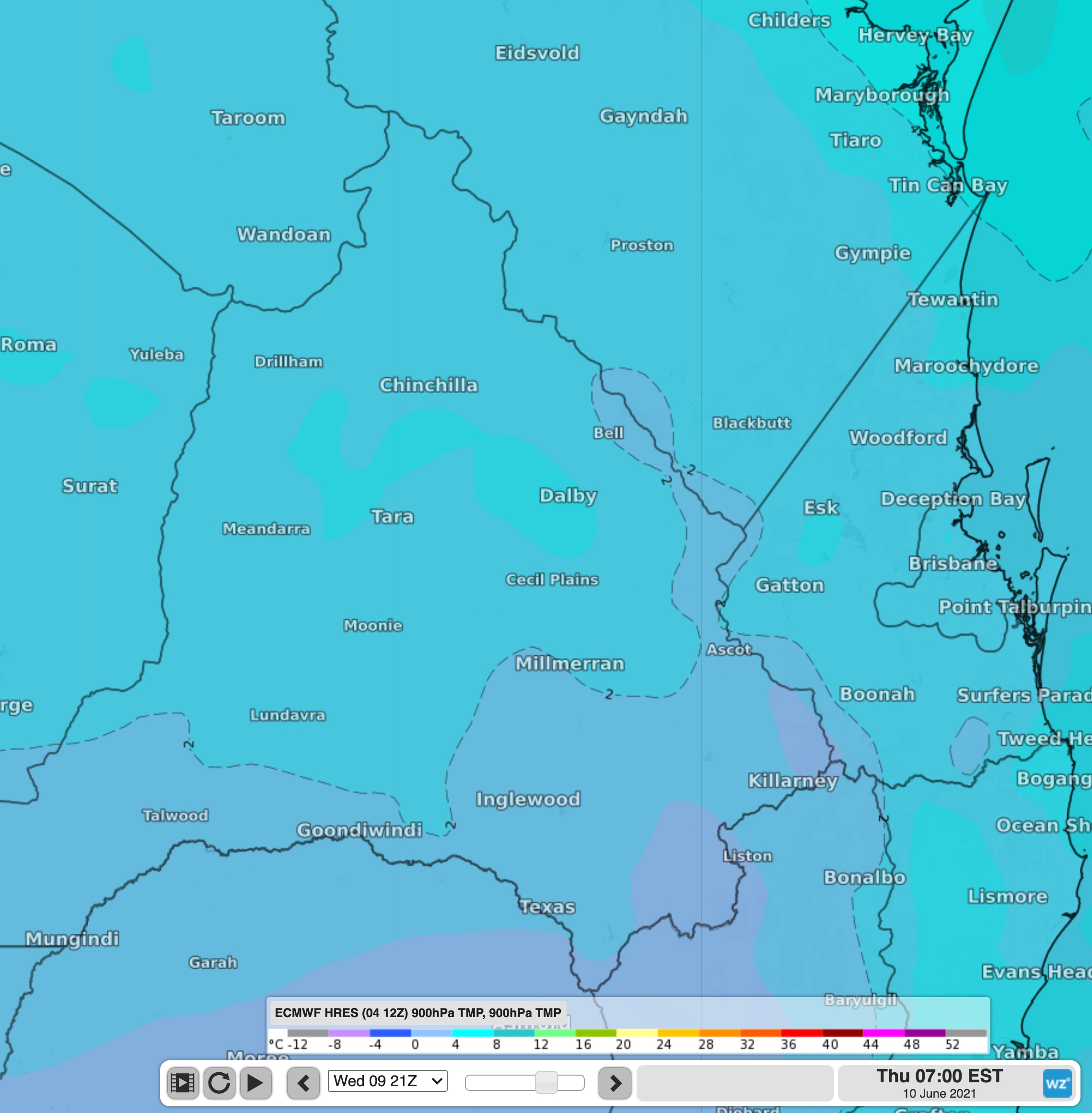
Image: Temperatures at approximately 900m elevation on Thursday morning.
There is the potential for snow to fall as low as 900m over the southern ranges of Queensland on Thursday morning. The question therefore is not will it be cold enough for snow, but rather will there be enough moisture for showers to fall as snow?
Models are in disagreement if there will be the moisture required, but it is definitely on the cards. The most likely areas to see some flakes are the ranges near Stanthorpe and Warwick.
Whatever happens, it will be a bit of a cold shock to the system for many Queenslanders, so enjoy this weekend's fairly warm weather while it lasts.