Will Australia see its tenth Tropical Cyclone of the season?
A tropical low offshore to the northwest is showing signs of intensification, and may become the 10th tropical cyclone in Australian waters this season.
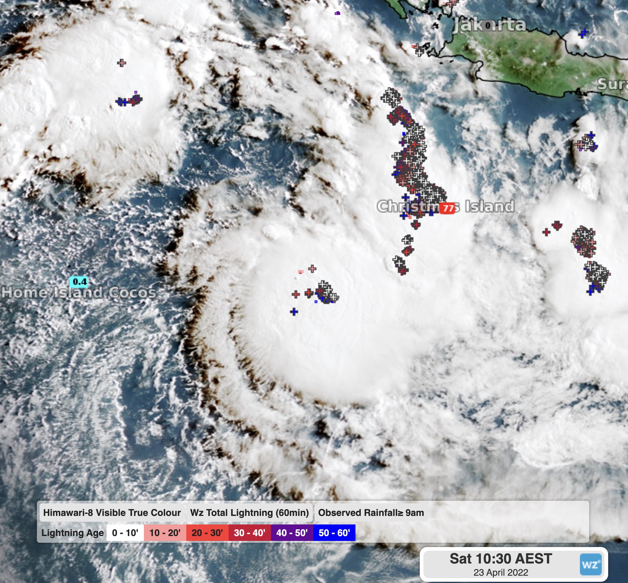
The tropical low in question is situated to the southwest of Christmas Island, east of the Cocos Islands and about 1600km northwest of Exmouth.

Image: Cloud, lightning and 24hr rainfall showing the tropical disturbance on Saturday morning.
Over the last few days, a trough in the region has been building strength, causing thunderstorms to become more frequent and more intense. In the tropics, when this happens in a concentrated area, the storms often start to slowly spin around one-another. These are the first steps that help to spawn a tropical low.
Overnight, the system has been strengthened by further thunderstorm activity, projecting moisture throughout the atmosphere and forming thick clouds. This includes both low level clouds starting to spiral into the centre (inflow), and very high level clouds spiraling away from the centre (outflow). Some of this high outflow cloud is crossing the Australian mainland today, crossing over Broome and Alice Springs.
While these steps are all very important to the formation of a tropical low, they don’t necessarily mean that the system will turn into a tropical cyclone.
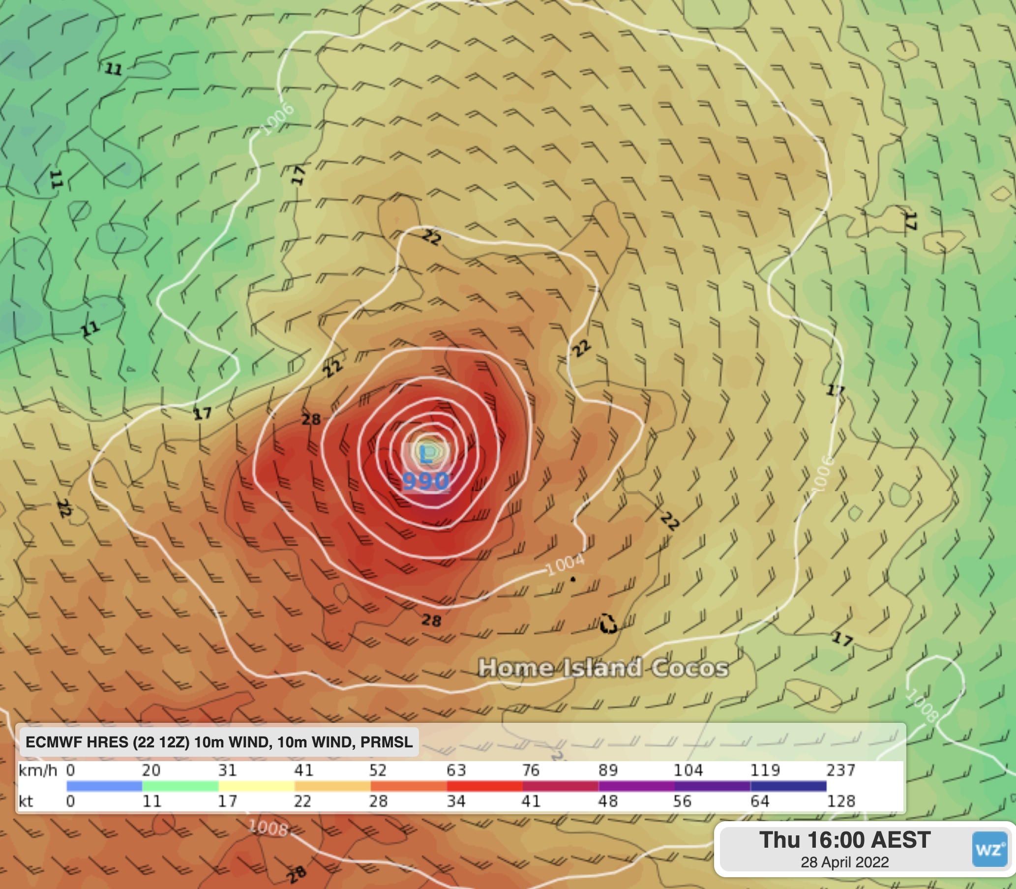
Over the coming days the system will drift towards the Cocos Islands, likely increasing the chances of rain and storms over the islands. Depending on the strength of the low, winds may also start to become quite strong.
As of 12pm Saturday, the tropical cyclone risk is rated as a low (5-20%) chance of formation by the Bureau of Meteorology as early as Monday, with the risk likely to linger for much of the coming working week. If the system does form, it is more likely to do so later in the week.

Image: Surface winds and pressure from ECMWF hinting at possible tropical cyclone formation during the week near the Cocos Islands.
If this tropical cyclone does form, it would be the first one since Tropical Cyclone Charlotte formed on March 21st, and would be forming right at the end of the official tropical cyclone season that ends next week on April 30th.
While this system is unlikely to directly to affect the Australian mainland, warnings can be viewed at Weatherzone here.