
Wild, windy, weird, warm night
It was a wild night of temperature contrasts across southeastern Australia, with a wave of warm air baking eastern NSW well into the small hours, wild winds buffeting Sydney, and snow blanketing elevated parts of southern Victoria and Tasmania
Let's start with the warm air. As we've seen a couple of times already this spring, the Sydney region was the bullseye for the warmest air moving across the southeast. For example:
- At 3 am, it was 28°C at Sydney Airport
- At 3 am it was 16°C at Brisbane Airport
- At 3 am it was 8.4°C at Melbourne Airport
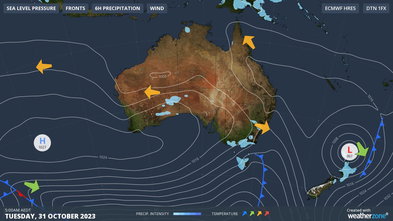
The orange arrow near Sydney on Weatherzone's 5 am synoptic chart does a good job of showing why the night was so warm, with warm air from Australia’s northern interior funnelled towards the city and nearby areas.
It was actually a very unusual night in Sydney, and here's why:
- Some suburbs in the city's west reached their minimum temperature before midnight, after which the wind picked and brought a fresh surge of warmth. Normally you'd expect the min temp just after dawn.
- For example, Penrith had its minimum of 23°C at 9 pm. Temperatures then jumped back up into the mid-twenties for the rest of a wild, windy, very warm night.
- It was also extremely windy, with a gust of 104 km/h just after 4 am at Badgerys Creek in the city's west, the strongest gust in any month since 2006. Badgerys Creek is of course home to Sydney's second major airport currently under construction, but the existing airport on the shores of Botany Bay was also lashed by winds up to 80 km/h, disrupting early morning air traffic.
Whenever there's a surge of warm northwesterly air across eastern NSW in springtime, you can bet that the engine driving it is a low pressure somewhere way down south.
Just such a system, and the cold front associated wiht it, were indeed the culprits – and the front caused big temperature drops in Melbourne as it passed through early on Monday evening.
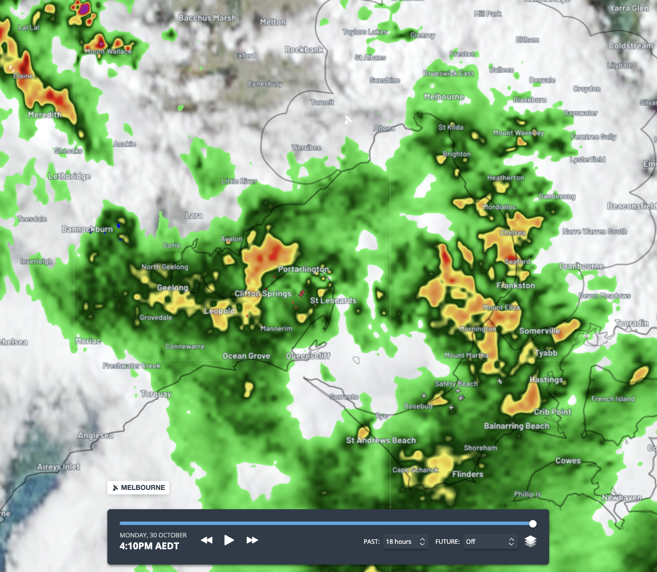
There wasn't widespread moisture associated with the cool change, but an impressive line of quick-moving storms crossed southern Victoria late in the day, delivering 1.8 mm of rainfall to Melbourne, 5.6 mm to Geelong, and a few falls of 10 mm or slightly higher in Gippsland.
Speaking of Gippsland, it's snowing up at Mt Baw Baw this Tuesday morning but nowhere else on the Australian mainland.
Baw Baw is mainland Australia's lowest ski area, but it's also the southernmost. That southern location means that occasionally in spring it will see snow that doesn't make it to the higher peaks of northern Vic or southern NSW.
As mentioned at the top of this story, Tasmania also saw some light snowfalls overnight.
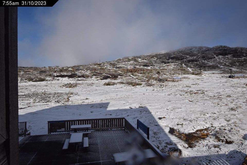
Image: Not quite enough for skiing but a heavy dusting. Source: ski.com.au.