
Wild winds set to topple trees in eastern NSW
A surge of damaging southerly winds and large waves will sweep up the NSW coast on Tuesday night into Wednesday morning, threatening to bring down trees and erode beaches.
A developing East Coast Low produced heavy rain in parts of eastern NSW on Tuesday, with the biggest falls targeting Sydney’s Northern Beaches over several hours during the afternoon.
Video: Composite satellite and radar animation showing a near-stationary band of heavy rain sitting over Sydney’s Northern Beaches on Tuesday afternoon.
Tuesday’s deluge prompted evacuation orders for people living downstream from Manly Dam and in low-lying areas around Narrabeen Lagoon. Roads in Dee Why and The Corso in Manly were also turned into rivers as drains buckled under the immense rainfall.
A rain gauge at Forestville collected 134 mm of rain during the 12 hours to 9pm on Tuesday. Nearby, Mona Vale had 102 mm in the three hours ending at 2:30pm.
Fortunately, rain is likely to ease over eastern NSW during Tuesday night into Wednesday morning as the East Coast Low start to drift further offshore.
However, powerful southerly winds and large waves will remain a threat for at least the next 24 hours.
Sydney Airport had already recorded a gust of 95 km/h at 9:20pm on Tuesday. South to southwesterly winds are likely to strengthen further along the NSW coastal fringe between the South Coast and Hunter on Tuesday night into Wednesday morning. Wind gusts could reach around 90-110 km/h near the coast, which should be strong enough to bring down trees in the rain-softened soil.
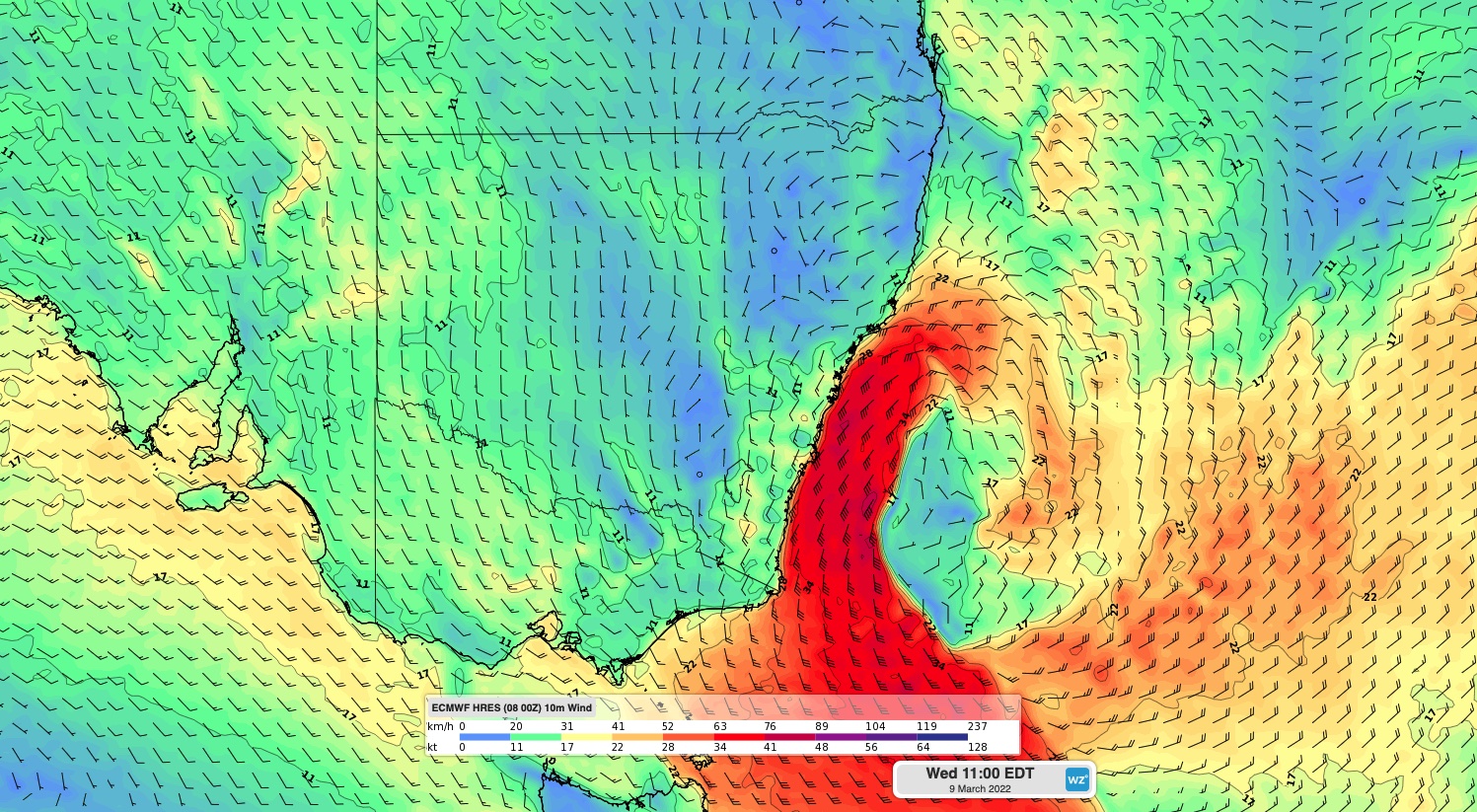
Image: Forecast surface wind speed and direction at 11am AEDT on Wednesday, March 9, according to the ECMWF model.
These powerful winds will also whip up big waves, causing hazardous surf from the South Coast to the Hunter on Tuesday night and Wednesday. Large surf will also extend north to the lower Mid North Coast by Thursday. Wave heights of around 3-to-5 metres are likely to cause coastal erosion at some south-facing beaches over the next few days.
As the low pressure system moves away from NSW, rain will ease from Wednesday, wind will back off from Thursday and waves will gradually drop from Thursday and Friday.