Wild storms in Adelaide Hills turns roads and backyards white with hail
It's a seriously stormy afternoon in the Adelaide Hills this afternoon, with plenty of precipitation – some of it of the loud frozen variety.
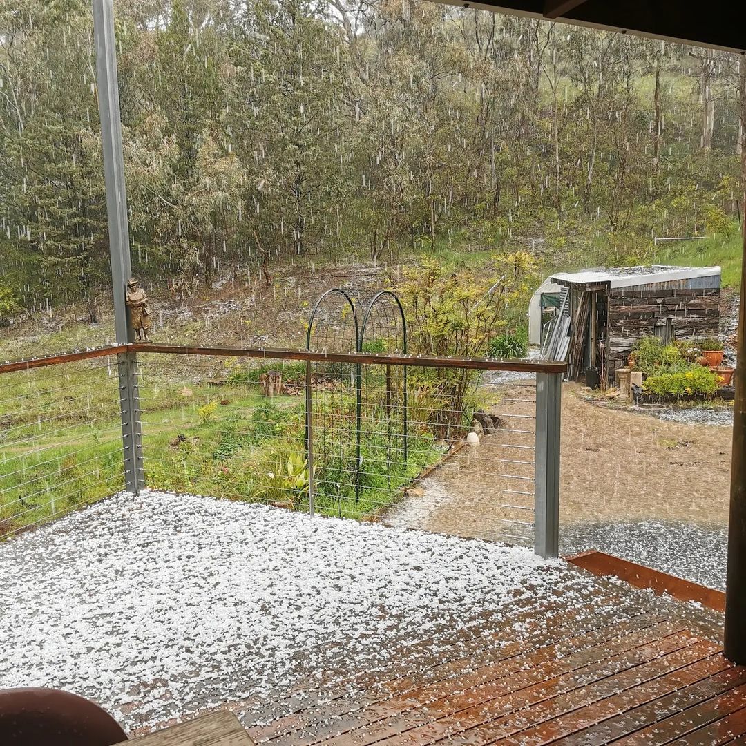
This was the scene up in the Adelaide Hills around 2 pm local time, with hail looking very much like snow as it accumulated on locals' back decks.

Image: Deck the hails! Source: @waltzingmatti via Instagram.
Hail fell so heavily in parts of the Adelaide Hills that it soon coated the road, making for treacherous driving conditions, as you can see in this video.
- Meanwhile, the rain gauge at Mt Lofty recorded 56.8 mm of rain between 12:30 pm and 2:30 pm, with lighter rain continuing after the two-hour deluge.
- That's more rain in two hours than in the 16 previous rain days this month (days on which at least 0.2 mm of rain has fallen), which have netted 43 mm in total.
So what's causing today's wild spring weather?
It's all thanks to a line of slow moving thunderstorms which developed over parts of the Adelaide Hills early on Wednesday afternoon, causing localised heavy rain and thick accumulations of small hail in places.
These storms have been forming near an upper level low pressure system that is passing over South Australia today. This upper low is also contributing to the widespread storms and showers over Australia's eastern states.
Video: The Wednesday arvo weather was wilder than the residents at the local wildlife park. Source: @clelandwildlifepark via Instagram.
Meanwhile, some light-to-moderate rain has now made its way into Adelaide city proper. While the heaviest showers and storms have remained mostly over the Adelaide Hills, there's the strong likelihood that today's city forecast of between 2mm and 10 mm will come to fruition.
At 3:30 pm local time, 1.8 mm of rain had been recorded in the city, with nothing at the airport, a few kilometres to the west.
It's possible that the airport and coastal suburbs will remain dry this afternoon, however storms over the hills and nearby ranges look like they'll stick around for a while yet – as you can see from this afternoon's radar image taken just after 3 pm.
Adelaide and nearby areas should see a slow clearing trend as the week progresses, with any showers from Thursday onwards likely to be much lighter.