
Widespread rain returning to eastern Australia
While the weekend will remain generally dry across eastern Australia, another moisture-heavy system looks to wreak havoc next week.
Another low pressure system and trough in what seems to be a never-ending conveyor belt of troughs will intensify and push across the NT and SA early next week, before moving into and settling over QLD, NSW, VIC & TAS for several days. Widespread rain and storms will likely renew and cause more riverine flooding as soil moisture reaches its limits.
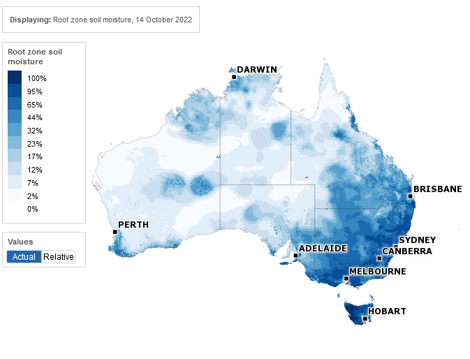
Image: Root zone soil moisture for October 14th 2022. Source: Bureau of Meteorology
As you can see from this soil moisture image from the Bureau of Meteorology, the 'root zone soil moisture' (roughly the upper 200cm of soil) is at the higher end of its capacity for large areas of southeast Australia, meaning any further rain is likely to run straight into river catchments and increase the chances of flooding.
Why so many days of rain next week?
You might be asking, "why do some rain events last days while others last 'a' day?" Having a look at the synoptic chart we can understand why there will be several days of rain & storms across eastern Australia next week.
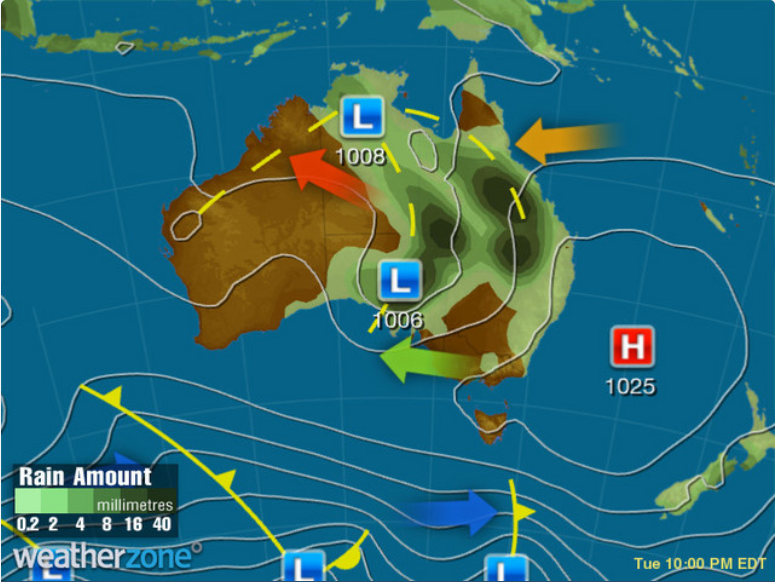
Image: Synoptic chart for Tue 18th at 22:00 AEDT
From the above image you can see the troughs moving across central Australia, likely arriving in the east late on Tue 18th, and lingering until at least Fri 21st. The main issue isn't the troughs, but the high pressure system to the east of Australia sitting in the Tasman Sea.
Not only is that high pressure system stopping the troughs from pushing through, but it is also feeding moisture back into the system (anti-clockwise motion of winds shown by the orange arrow). You can view our full 6-day synoptic charts here. This is commonly referred to as a blocking high, which as the name suggest blocks the typical west-to-east motion of weather systems, causing events to slow down and last several days.
How much rain can be expected?
Here are two models showing the accumulated precipitation up to almost midnight on Fri 21st.

Image: Accumulated precipitation to Fri 21st 23:00 AEDT using ECMFW model

Image: Accumulated precipitation to Fri 21st 23:00 AEDT using ACCESS-G model
We can see widespread falls of 20-40mm are likely, but heavier localised falls of 100-150mm are possible over recently impacted areas. While rainfall amounts might change in the lead up to this event, widespread rainfall is likely, and it won't take a large amount to see rivers rise again.