Why the western Pacific currently has high cyclone potential
As typhoon Yinxing continues to move west in the South China Sea, clouds bubbling in the tropical western Pacific are showing the telltale signs for possible typhoon development.
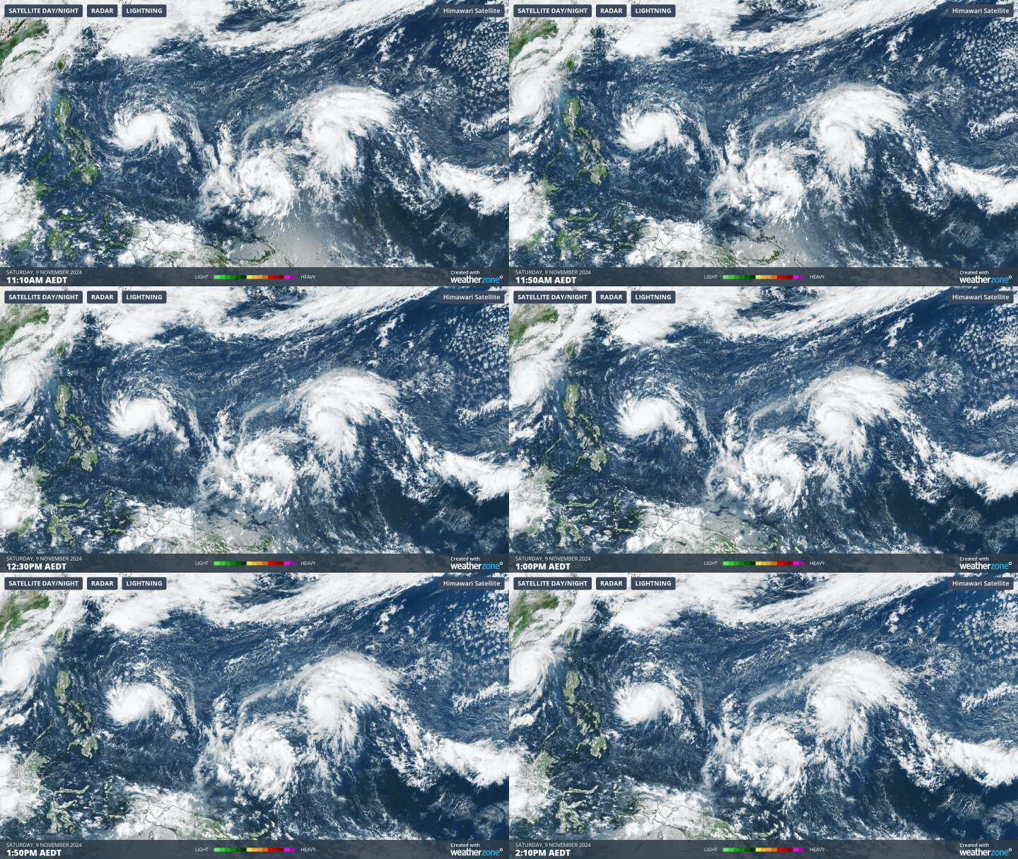
Fig. 1) Clouds in the western Pacific becoming more organised as independent low pressure systems persist.
There are currently three low pressure areas of concern in the western Pacific (92W, 93W and 94W). For any of these systems to develop the following conditions need to be met:
- Surface ocean temperatures greater than 26.5 degrees
- Moisture in the atmosphere to feed the system
- Little change to winds through the atmospheric profile, so that the cyclonic movement of the low is maintained throughout the atmosphere
To understand whether these systems could develop, one must examine the current meteorological and ocean conditions of the western Pacific. These are as follows:
1. Sea surface temperatures
The waters around Asia and Indonesia are the warmest worldwide at the moment (excluding the Red Sea), with temperatures around 30 to 32 degrees Celsius. This means that surface ocean temperatures are sufficient for typhoon formation.
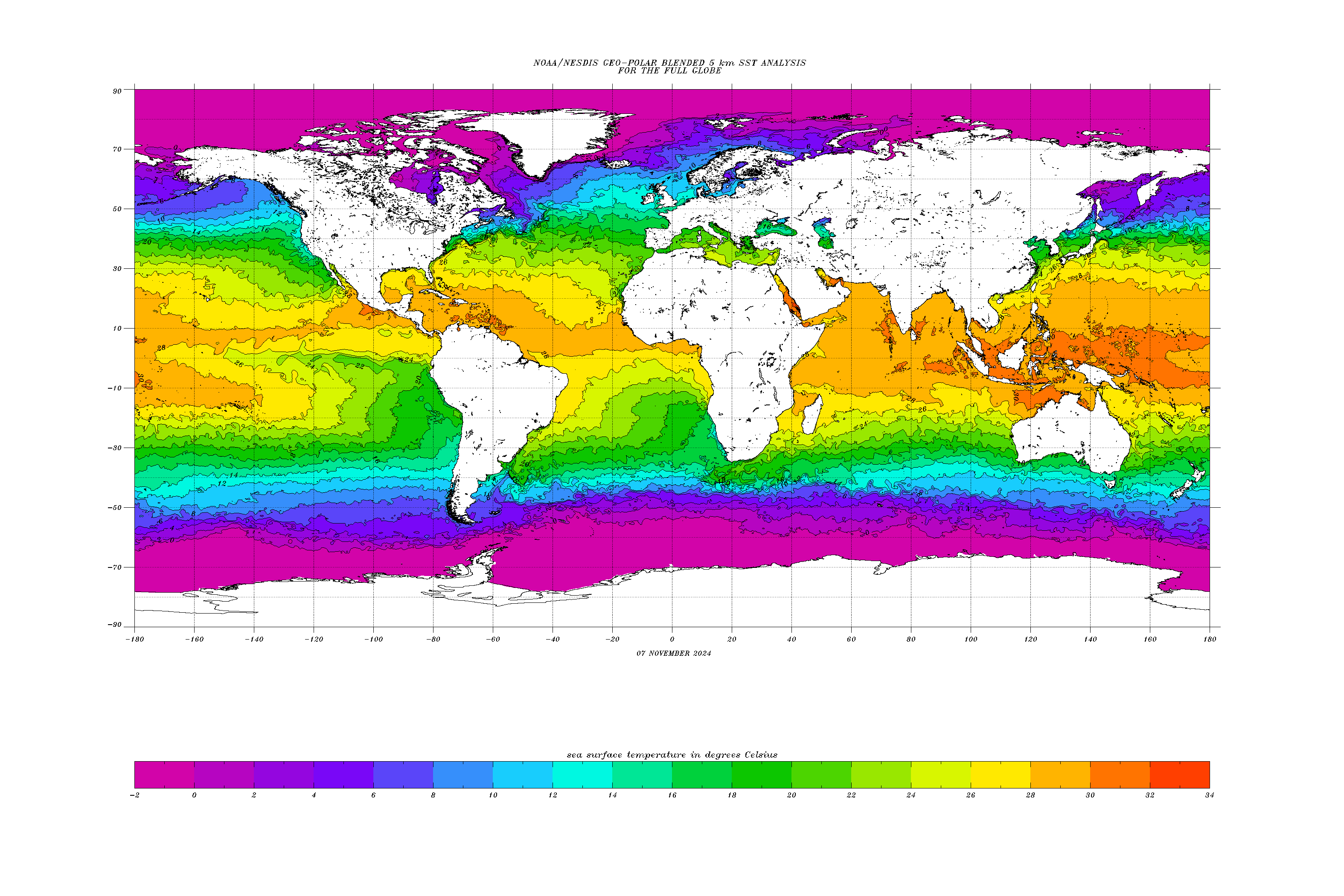
Fig. 2) Global sea surface temperature on the 7th of November.
2. Atmospheric Moisture
Observed surface water vapour is concentrated around the low pressure systems given they are producing rain and thunderstorms. However, another indicator of moisture to dewpoint temperature. As defined by the Bureau of Meteorology, dew point temperature is the temperature the air must be cooled (at the same pressure) for dew to form. In general, the tropics have the highest dew points (which makes them very humid), with surface dew point temperatures being greater than 24 degrees in the west Pacific. Dew point temperatures in the mid-atmosphere (around 2km high) dew point temperatures are around 16 degrees, which means that the atmosphere is fully saturated aloft.
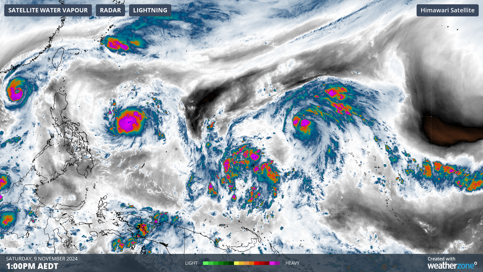
Fig. 3) Observed water vapour over the western pacific
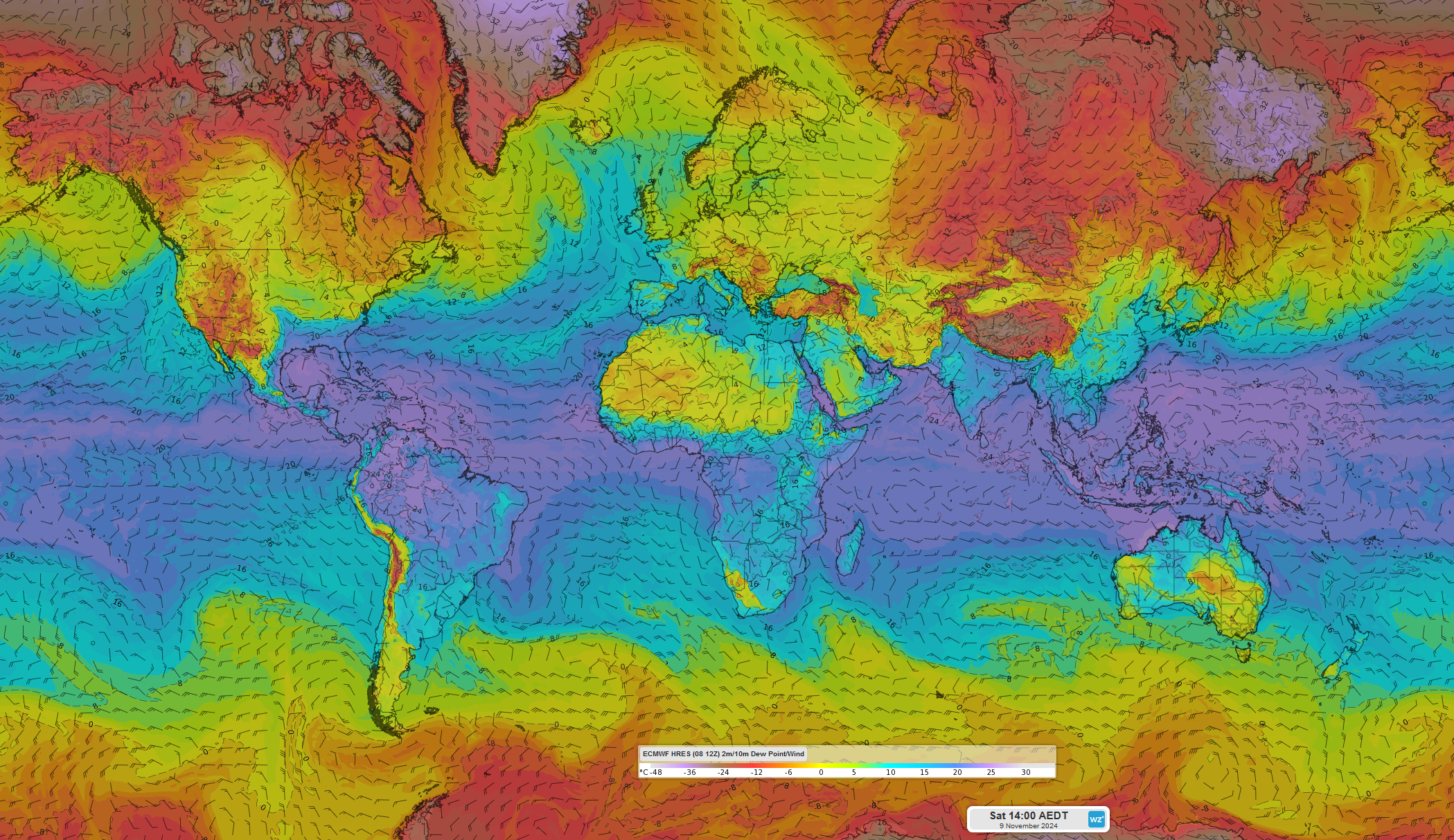
Fig. 4) Forecast global surface dew point temperatures at 2pm AEST 9th Nov with surface winds
3. Difference in the winds at the surface and aloft
Comparing the winds at the surface and winds around 1.5km high, wind directions are consistent, moving from east to west and moving cyclically around 92W and 94W. The areas of increased wind are also similar at the surface and aloft, though the upper atmosphere has stronger winds approximately 10km/h greater than the surface.
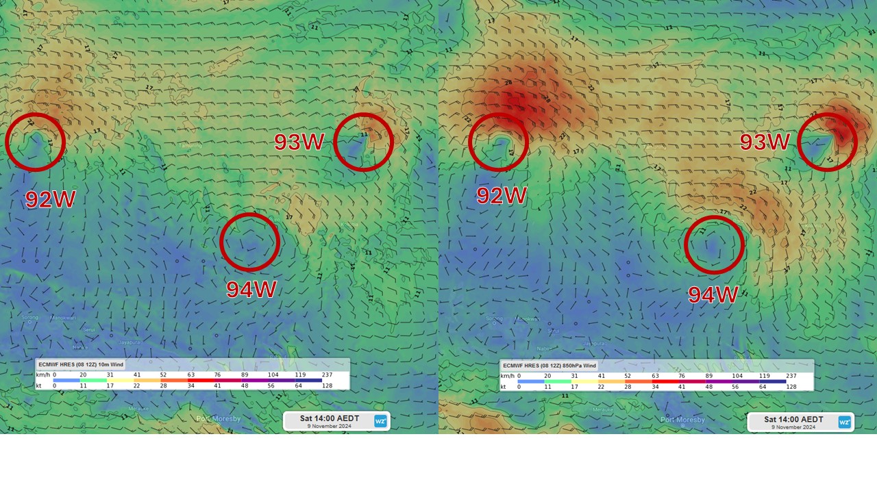
Fig.5) (left) Forecast surface wind strength and direction at 2pm AEST Sat 9th Nov. (right) Forecast wind strength and direction 1.5km above the surface at 2pm AEST Sat 9th Nov.
Current conditions look to conform to the conditions needed for typhoon formation, however it is important to note that if any one of these systems develops it will change the atmosphere-ocean conditions in the region, thus changing the potential of another system to develop. It is still too early to determine which of these systems may intensify, if any.
For now, all three low pressure systems are being monitored to see the course they will take.