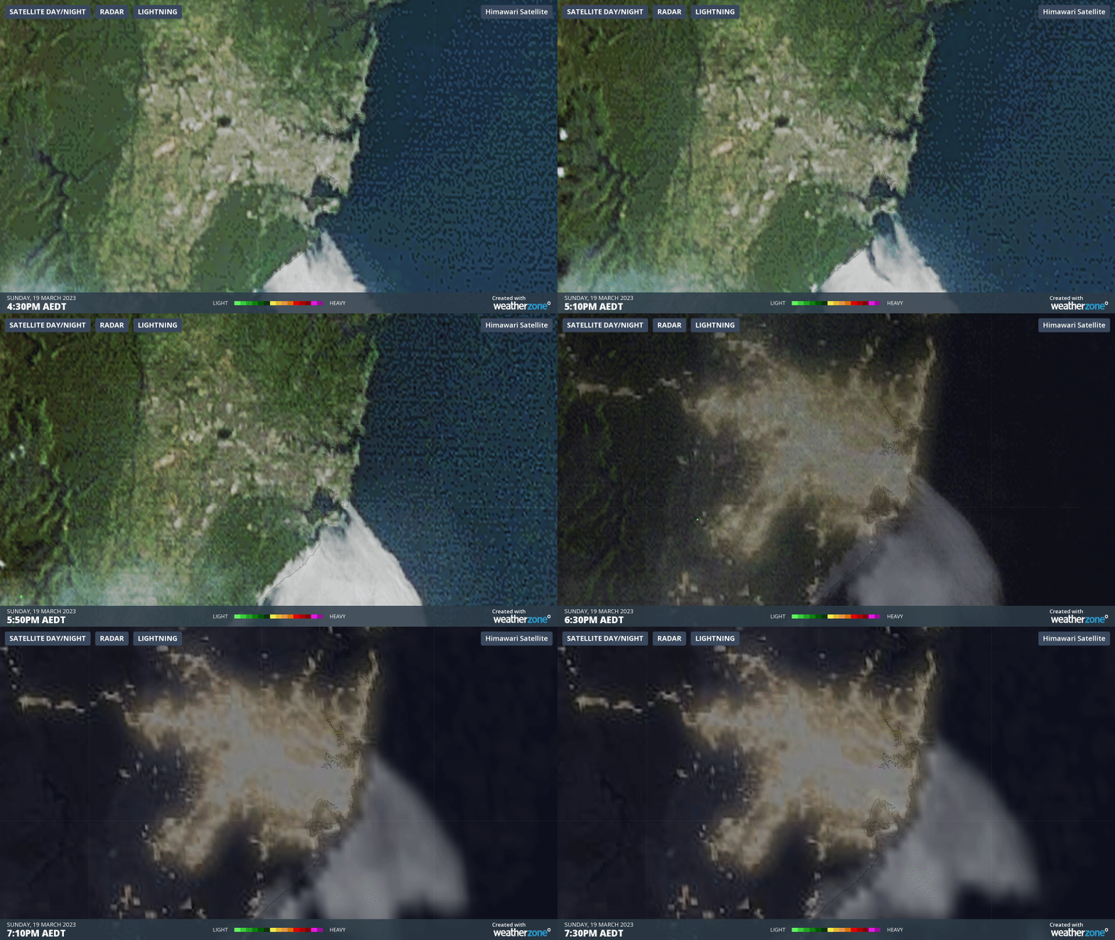
Why spooky sea fog enshrouded Sydney
Late on Sunday afternoon, people along Sydney’s coastal strip and nearby areas were taken back by an unexpected sight, as a thick sea fog enveloped the landscape.
— Ann Arnold (@ann_arnold) March 19, 2023
After an extremely hot spell day by March standards, which culminated in temperatures nearing 40°C in the city's outer west on Sunday afternoon, fog rolled in off the sea as a cool southerly change moved up the coast and pushed cloud inland.
You can see the fog moving in on the three-hour loop below, which ends at 7:30 pm Sunday evening as the city's lights are switched on.

What caused this unusual event?
As mentioned, Sydney had several hot days leading up to Sunday, with northerly winds funnelling hot air from Australia's interior to the east coast, and persistent northeasterly winds along the NSW coastal fringe.
When northeasterlies blow for several days, surface water is deflected to the east. This causes an upwelling of cooler water from below the ocean's surface near the coast.
Sea fog rolling into Bondi this evening, behind one of the hottest days of the year.
— Tyson Millar (@TysonMillar) March 19, 2023
Pics from Star_Hawk of https://t.co/I7O47DaD0h forums.#sydneyweather #sydney #bondi #heatwave #auswx pic.twitter.com/9Mfs3zGiRw
When warm air forms flows over those relatively colder waters, sea fog forms.
Eerie, creeping sea fog enveloping Sydney’s beaches today. From the top of the hill I can see it hugging the coast right down towards Wollongong. pic.twitter.com/6IA9jf7o2a
— Dr Darren Saunders (@whereisdaz) March 19, 2023
There were actually pockets of sea fog in Sydney on Sunday morning which largely dissipated throughout the day, but the fog returned later on as it was blown onshore by the southerly. Again, the loop higher up the page shows that clearly.
Sea fog has rolled in tonight on the wharves in Sydney ðŸ˜¶ðŸŒ«ï¸ pic.twitter.com/MAMcGMLq6p
— Mich-Elle Myers (@MichMyersMUA) March 19, 2023
Sydney has grey skies of a more common variety as we move into Monday afternoon, with light showers and drizzle scattered across the city, albeit more frequent near the coast.
Showers will likely stick around all week, with maximum temperatures rising from the low-to-mid-twenties in most suburbs on Monday and Thursday to the mid-to-high-twenties later in the working week.