
Why so cold, Kalgoorlie?
The mercury is heading for a top of 28 degrees today in Kalgoorlie, but much colder weather is on its way.
A sprawling low and trough currently situated over central WA will gain moisture and deepen over the next few days.
Widespread thick cloud and rain will develop on the southern flank of the low and trough by Tuesday; this will significantly limit daytime heating across parts of WA's Central Wheat Belt and Goldfields districts.
Kalgoorlie's forecast maximum temperature on Tuesday, currently 15 degrees, is more akin to a typical July day. The winter-like daytime temperatures will also be felt in Southern Cross, Bencubbin and possibly Merredin.
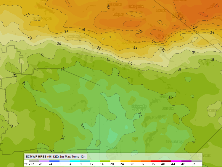
Image: Forecast maximum temperature on Tuesday according to ECMWF.
To add insult to injury, brisk SE'ly winds will make it feel several degrees colder than the actual temperature!
Watch out for some heavy falls of rain on Tuesday across the region too, with 20-50mm expected to fall quite widely over a fairly short space of time.
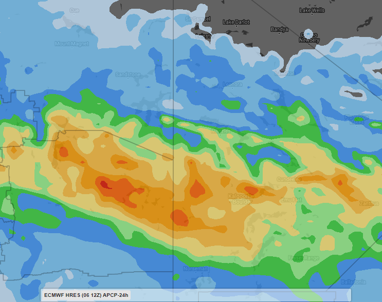
Image: Forecast rainfall in the 24 hours to 11pm AWST on Tuesday according to ECMWF.
Kalgoorlie's average rainfall for the month of November is 18.8mm, but there is a good chance that the city will exceed that in less than 24 hours on Tuesday.