
Why is Australia's weather so extreme this week?
Australia is enduring a dynamic mix of severe weather this week, with flooding rain in northern Australia, bushfires in southern Australia, heatwaves baking part of every state and territory, severe thunderstorms in several states, and two severe tropical cyclones spinning over Australian waters. So, what is making this week’s weather so unhinged?
Perfect setup for severe weather
Late January and early February are smack bang in the middle of summer in the Southern Hemisphere. The intense heat that builds over the Australian continent and its surrounding oceans at this time of year creates an idea environment for volatile weather.
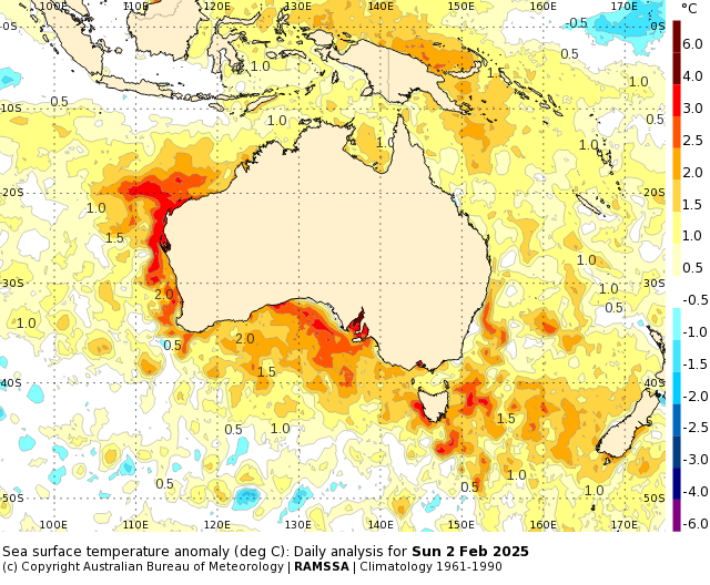
Image: Sea surface temperature anomalies on Sunday, February 2, 2025. Source: Bureau of Meteorology
This is also the middle of the wet season in northern Australia, a time when monsoon bursts and tropical waves in the atmosphere cause periods of heavy rain and tropical cyclones.
This week, all of the features mentioned above are occurring at the same time over Australia:
- A very hot air mass is sloshing around the country, causing temperatures to reach the mid-to-high 40s over several states
- Sea surface temperatures are running about 1 to 3°C warmer than average around much of the Australian coastline
- The monsoon is active over parts of northern Australia
- An active pulse of the Madden Julian Oscillation (MJO) is enhancing tropical rain and thunderstorm activity in the Australian region
- The combination of the warm ocean temperatures, the monsoon trough and MJO have helped spawn two tropical cyclones off Australia’s northwest coast
These atmosphere-stimulating influences are causing a range of weather extremes this week.
An ongoing deluge in northern Queensland has resulted in widespread flooding over the past week, with particularly intense rainfall occurring over the weekend and on Monday. While this rain has eased a bit since the weekend, there is likely to be more heavy rain in northern Qld and some other northern areas of the NT and WA in the coming days.
The hot air mass that has taken up residence over Australia has been sending temperatures soaring in the last few days. This heat will intensify further towards the end of the week, with parts of northern WA possibly in line for temperature approaching 50°C on Friday or Saturday. Melbourne also just had its hottest three-day spell in 11 years by exceeding 37°C from Sunday to Tuesday.
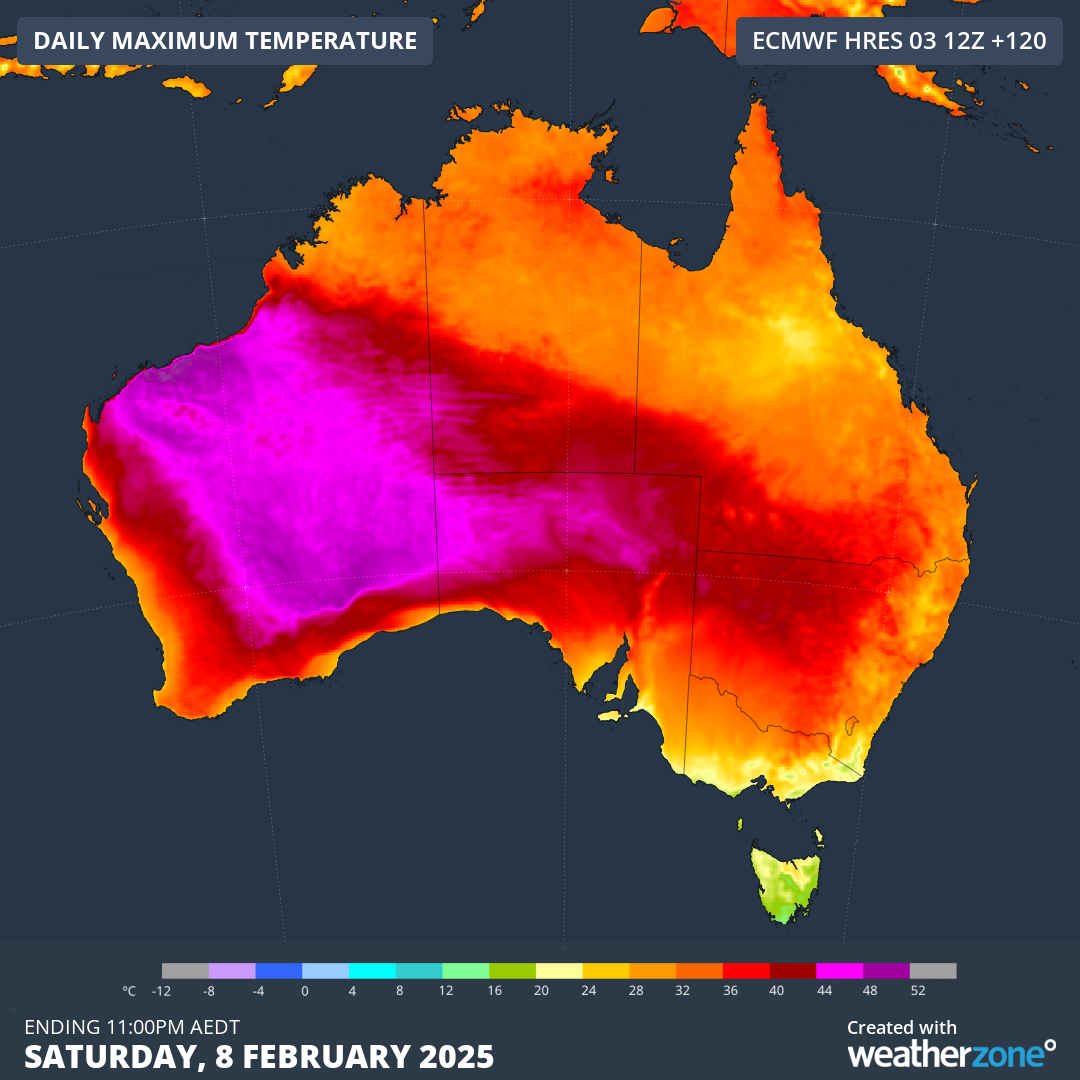
Image: Forecast maximum temperature on Saturday, February 8, 2025.
The hot air over southern Australia is also helping produce thunderstorms. Storms are likely to develop over parts of Vic, Tas and southern NSW on Tuesday before focusing on NSW, the ACT and northeast Vic on Wednesday. Severe thunderstorms are likely on both days.
Numerous fires are also burning in southern Australia this week, many of which were started by lightning over the last few days. Some of these fires have even produced dangerous pyrocumulonimbus clouds, spawning their own thunderstorms near the existing fireground.
As if all this dangerous weather on land wasn’t enough, there are also two severe tropical cyclones spinning over water to the northwest of Australia. The satellite image below shows Severe Tropical Cyclones Taliah and Vince, which were both category three severe tropical cyclones on Tuesday. Fortunately, neither system is expected to directly impact the Australian mainland.
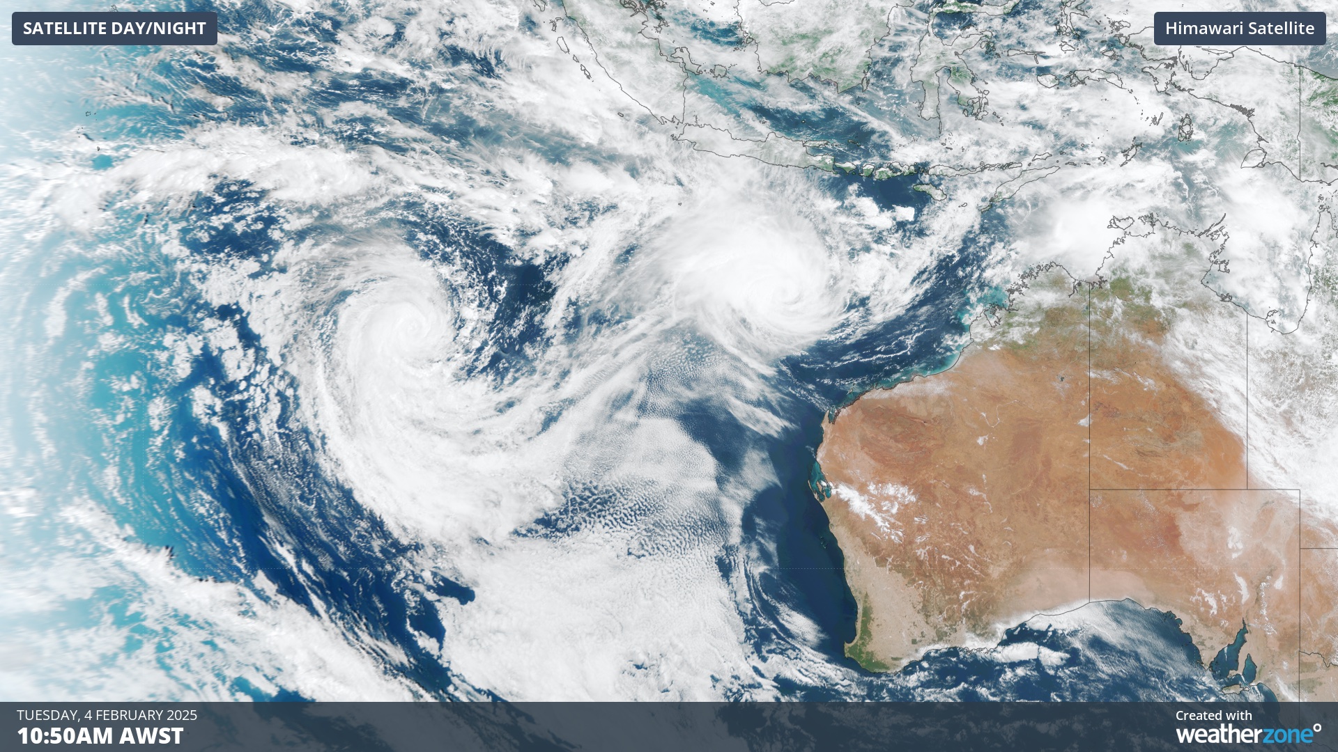
Image: Two severe tropical cyclones to the northwest of Australia on Tuesday.
With so much severe weather across Australia this week, be sure to check the latest forecasts and warnings to see what’s going on in your part of the country.