
What is a cold front?
Winter is making itself known early this year, with a strong cold front bringing a mix of rain, snow, hail and thunderstorms to the southeast this weekend.
We wrote yesterday about the conditions that can be expected across the weekend, the details of which can be found here: https://www.weatherzone.com.au/news/wintry-weekend-to-strike-southeastern-australia/1252350, but what exactly is a cold front, the phenomena bringing this blast of cold?
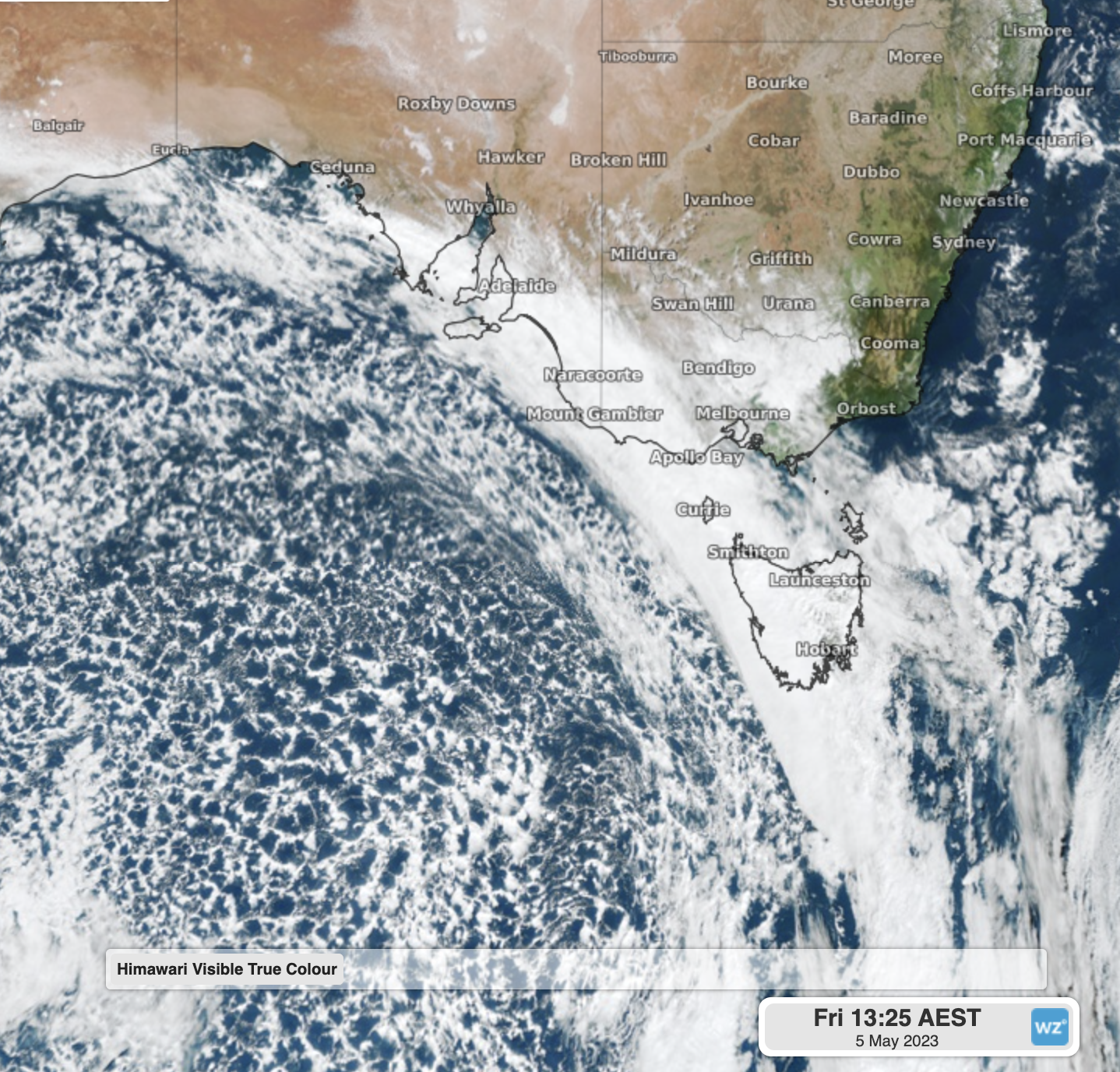
Himawari Satellite showing the cold front crossing the southeast yesterday (Friday 5th) afternoon.
By meteorological definition, a front is the transition zone between two air masses of different densities. As differences in density are most often caused by temperatures differences, it follows that a front separates air masses of different temperatures.
There are a few different types of front, but what is a cold front? We already know that a front marks the boundary between two different temperature air masses, but now we need to know if the colder air is behind or ahead of the front. In the case of a cold front, the colder air is behind the front, and advances east, replacing the warmer airmass ahead of it, with the colder air near the surface and the warm air rising above it.
Knowing this, it follows that as a cold front crosses a region, temperatures will drop. Here in Australia, ahead of the cold front, winds will generally be from a northerly direction, drawing air from the warmer interior. As the front passes the winds shift to south, drawing much cooler air originating over the Southern Ocean.
It should be noted that these cold fronts don't just impact south-eastern Australia, they also bring significant periods of cold and unsettled weather to the southwest. As we head deeper into winter, we’ll see more of these strong cold fronts crossing southern Australia – good news for those snow lovers out there, with these fronts needed to bring snow to our Alpine regions.