
Wettest weekend in decades eases drought over southwest WA
Healthy rain falling over this past weekend, and the last few months, is seeing drought conditions in southwestern parts of Western Australia back off slightly, but conditions are still abnormally dry overall.
Southwest WA has been no stranger to rain-bearing cold fronts this winter during their climatological wet season. This weekend's cold front, and associated low pressure system, was one of the wettest of the season. Some notable 3-day rainfall totals to 9am Monday include:
- 116.4mm at Jarrahwood (including 83.2mm in the 24hrs to 9am Saturday, its wettest August day in 49 years of records)
- 101.8mm at Ludlow (including 83.8mm in the 24hrs to 9am Saturday, its wettest day since April 9th, 1985)
- 97.6mm at Busselton (including 78.8mm in the 24hrs to 9am Saturday, its wettest August day since records began in 1877)
- 71.2mm at Bunbury
- 37.8mm at Esperance
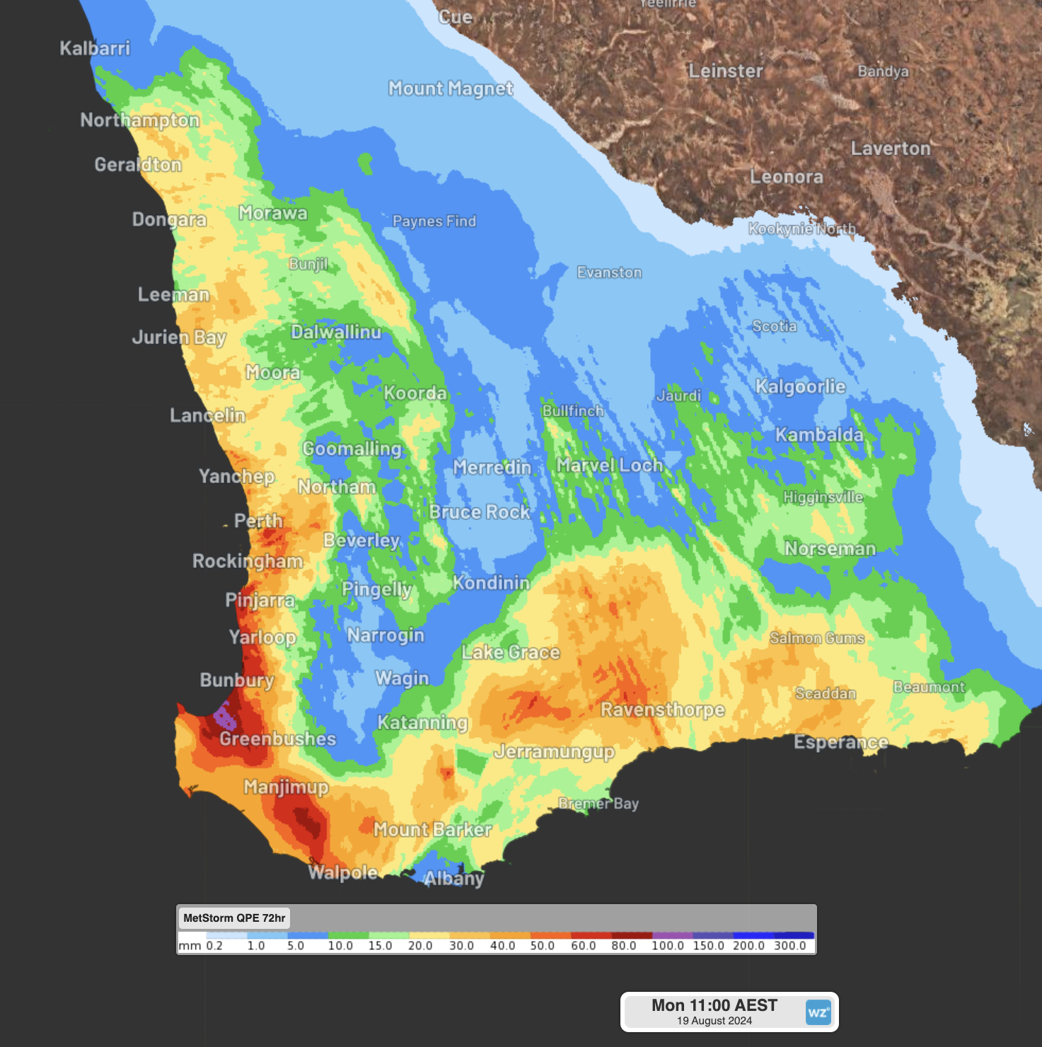
Image: Observed rainfall in the 72 hours to Monday 9am WST
The rainfall from this and several other similar cold fronts this season is coming as a stark contrast to their virtually dry start to the year. Bunbury is a clear standout, having seen its driest 7-month period on record from October 2023 to April 2024, including a measly 0.4mm in the first 4 months of the year. Since then, May to August have all had above average rainfall during their wet season. This year's rainfall total is now sitting at 751mm, above their annual average total of 726.1mm.
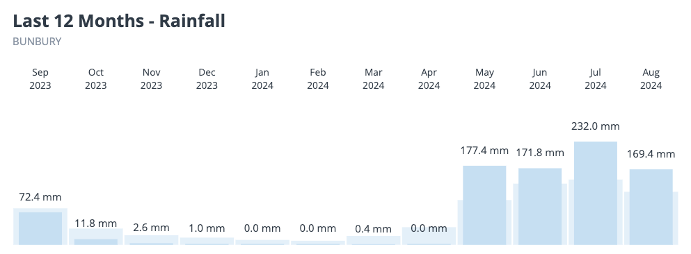
Image: Observed rainfall in Bunbury over the last 12 months. The extended run of low rainfall from October to April is contrasted by the above average rain falling in the last four months.
With above average rainfall in the wettest time of year, recent short-term drought indices have relaxed significantly over the region. However, longer-term indices are still showing severe drought conditions continuing.
This can be seen clearly in the soil moisture. In the images below, root zone (0-1m depth) soil moisture is now above average (blue shading) along much of the coast and adjacent inland, while deep layer (1-6m depth) soil moisture is still very much below average (red shading) throughout the region.
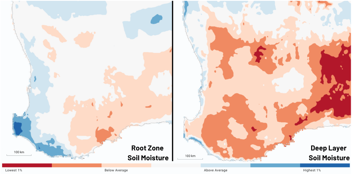
Image: Root zone (left) and deep layer (right) soil moistures as of Sunday August 18th 2024. Source: BoM
Water storages around the Perth Metro area are also still struggling to make up for the losses in the last 12 months. While dam storages are trending up, they are currently sitting at 44.8% of capacity, making it the lowest August balance since 2017. Typically, dam storages in the southwest will peak right at the end of their wet season in October, so there is still time to recover ahead of summer.
Looking ahead, climate outlooks are suggesting September could be another wetter than average month, before turning closer to average from October. This makes sense with the current negative Southern Annular Mode (SAM), meaning more cold fronts are crossing southern Australia, and above average ocean temperatures sitting just off the WA coast. This combination increases the chances and frequency of heavier showers and thunderstorms moving in from the northwest and southwest in the next few months.