
Wet weekend for Tassie
The east coast of Tasmania has had a wet and cold weekend with some of the heaviest August rain seen in nearly a decade.
Mount Wellington recorded some heavy falls of 44mm in the 24 hours to 9am Sunday, its wettest August day in nine years. Unfortunately, this did fall as rain over the mountain, not snow, as temperatures hovered around five degrees overnight.
Fingal to the northeast recorded over 50mm of rain over both Saturday and Sunday, with Saturday’s falls of 38mm, also its wettest August day in nine years. Some nearby heavy falls of 44mm at Gray, and 39mm at St Patricks Head were recorded in the 24 hours to 9am on Sunday. St Helens also looked like it collected some decent falls over the weekend based on radar images, but unfortunately the official rain gauge in the area went down on Friday.
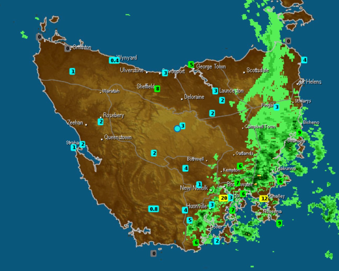
Image: A band of heavy showers crossing eastern Tasmania early on Sunday morning
Due to this rain on top of heavy falls caused by a similar system just a fortnight ago, a whole host of Tasmanian rivers have reached minor flood levels. The most significant flooding is at Fingal, where the South Esk River has reached the moderate flood level and is expected to peak between 5.8 and 6.1 metres overnight Sunday into Monday.
A low pressure system and trough has lingered off Tasmania’s east coast throughout the weekend, directing very mild and humid air over the east. This is the second of such systems that have impacted eastern and southern Tasmania this August, meaning a large number of locations, including Hobart, have now exceeded their average August rainfall.
While the severe weather warning for heavy rain that remained in place since Saturday morning has now been cancelled, further falls are still expected in the east overnight into Monday. The rest of Tassie will also be very wet this week as a series of wintery fronts cross the region.