Wet to windy, where's peaceful spring?
Humidity over eastern NSW dipped below 50% for the first time in weeks on Wednesday, but the clearing skies came with a price—wind. Pleasant time outside is going to have to wait a bit longer. But not too much longer.
Winds will ease during the rest of Saturday and Sunday is the day. Persisting clear skies and weaker winds will bring a typical spring day, something that's been absent of late.
But it won't last.
A cold front is forming over southern WA and will bring a very cold day there on Sunday before rolling east to share the cold with eastern states from Monday.


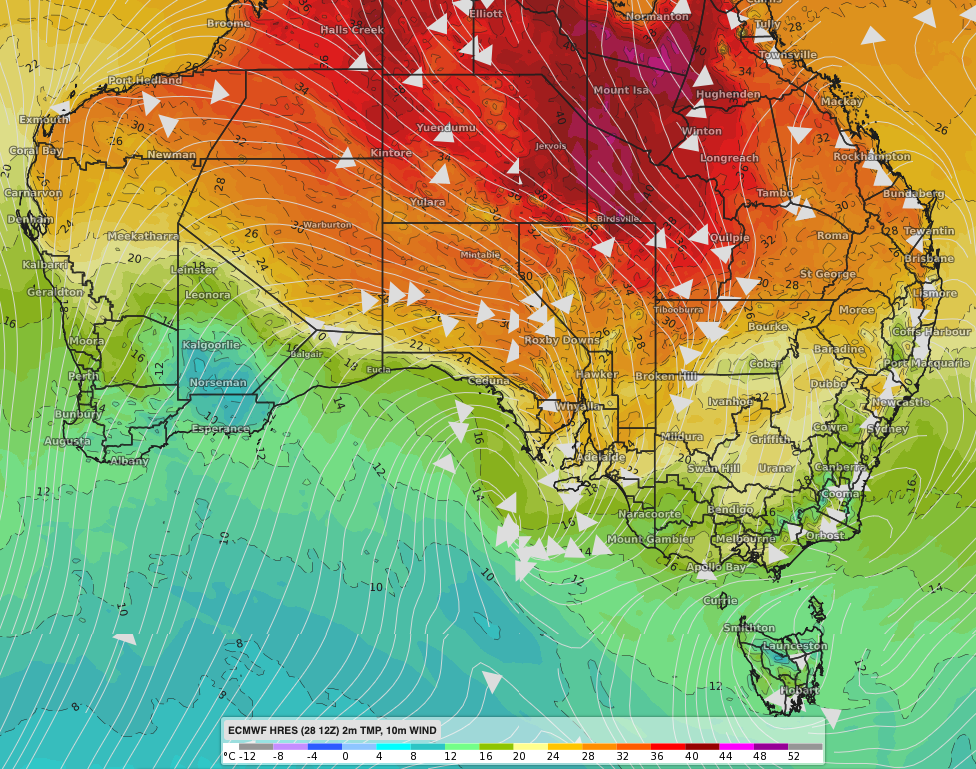
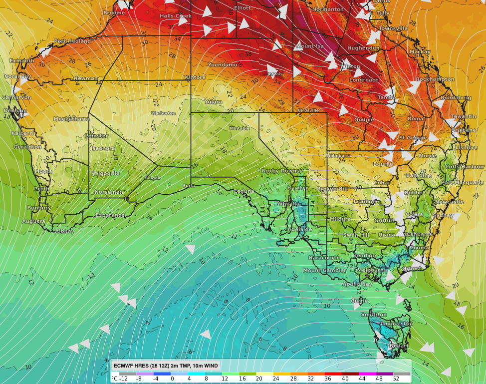
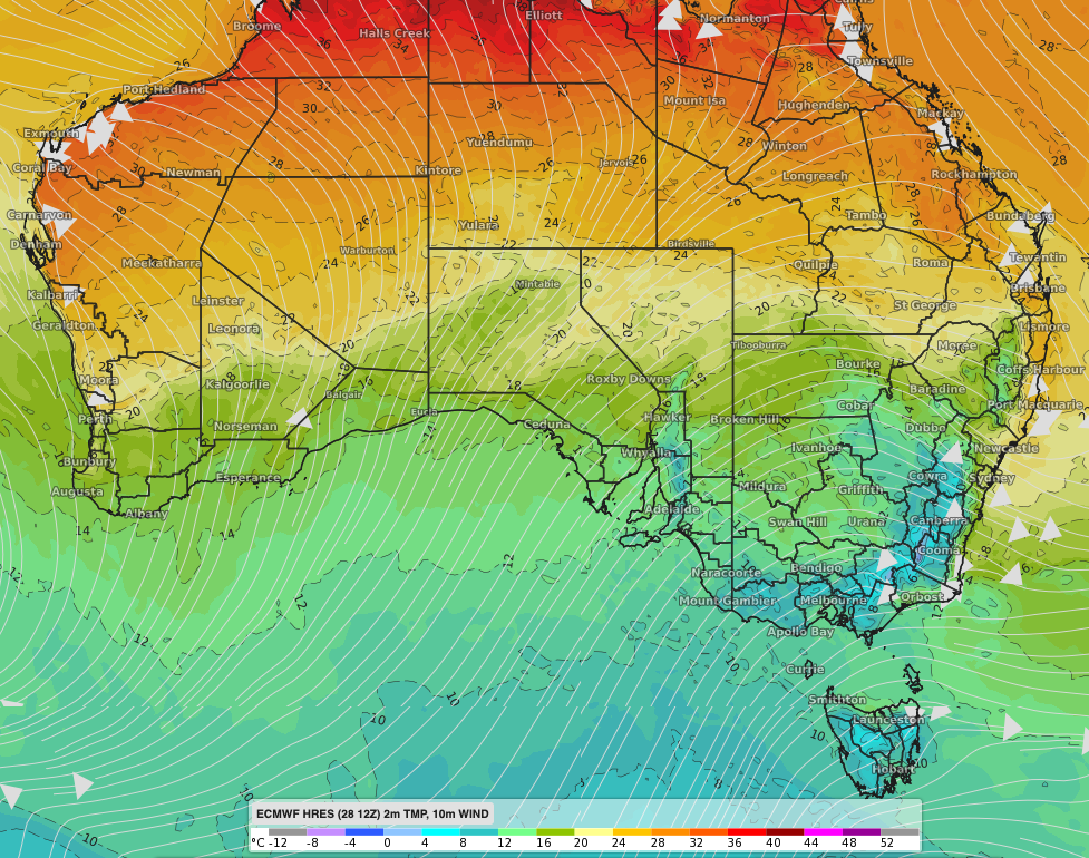
Image: Afternoon near-surface temperature and wind streamlines showing cold air rolling from west to east across the south of the country between Sunday and Tuesday.
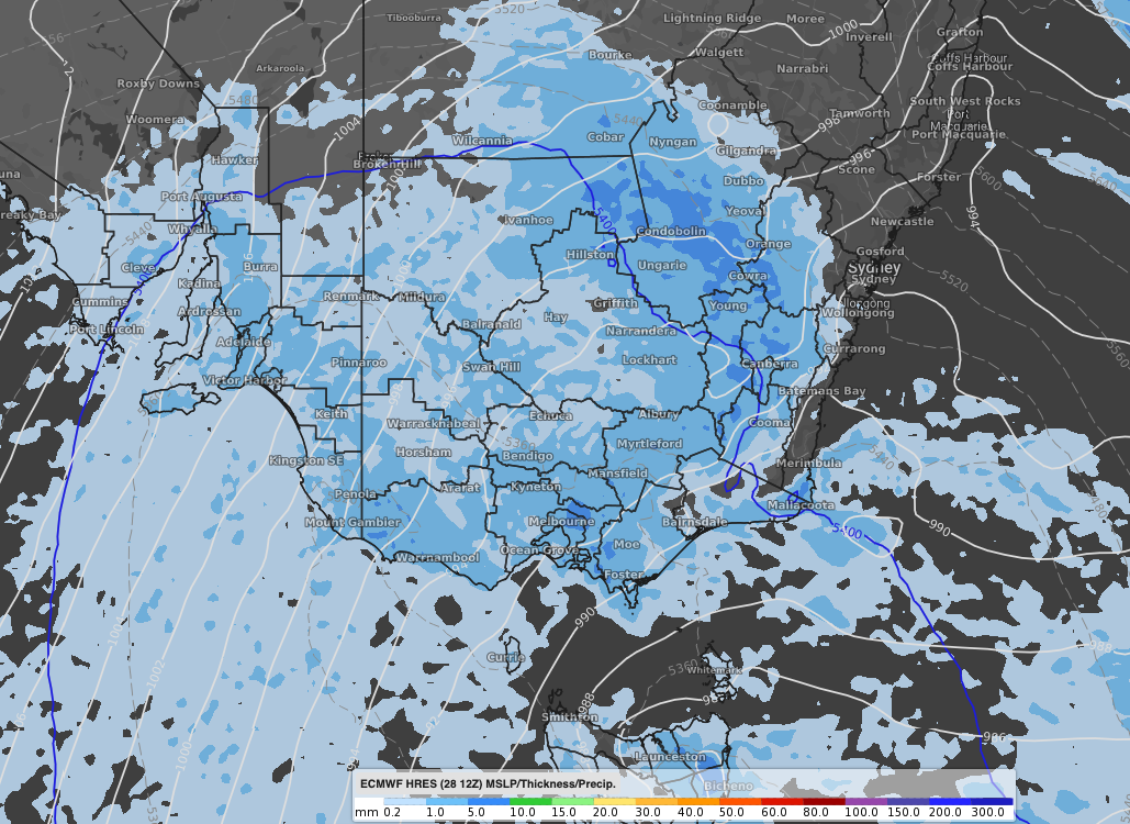
Temperatures along a whole west-east swathe of the country will likely be the coldest for October or November in years. Kalgoorlie's only expected to reach 14 degrees on Sunday; similar temperatures are forecast for Adelaide and Melbourne on Tuesday, complete with showers for Melbourne Cup Day. Canberra will be lucky to make it long above 10 degrees on Tuesday and it will feel about 5 degrees much of the day.
With such a cold system, snow is going to fall. Some flurries are a slight chance over the Stirling Ranges of southern WA on Sunday morning. Snow will begin for the eastern alpine peaks Monday evening, lowering to around 1000 metres and spreading north to the Central Tablelands Tuesday evening. Exact levels will become more definite as the system becomes closer. In terms of amounts, more than half a metre is likely for the alpine peaks between Tuesday and Thursday, a few centimetres for peaks of the Central Tablelands, most likely on Tuesday night.

Image: Rain (3-hourly) and mean sea level pressure (MSLP) Tuesday afternoon, showing a cold front progressing across the southeast.