
Warmth finally returns to Sydney, breaking lengthy cool spell
Sydney is likely to break a spell of 12 consecutive days colder than 18 degrees as temperatures finally warm up.
The last few days have been bleak, windy and cold for Sydney. A low over the Tasman has been keeping temperatures below the average July maximum of 16.4 degrees since Tuesday. This low has also been whipping up strong and gusty W/SW winds, gusts often exceeding 50km/h, and reaching as high as 74km/h for Sydney Observatory Hill. With wind chill, afternoons across these days felt a lot more like 9 or 10 degrees. The last time Sydney experienced 4 consecutive days below average in July was in 2012.
Sydney crept very close to 18 degrees last Monday ahead of this intensifying low, but failed to reach the mark. As a result, Sydney’s maximum temperature has not reached 18 degrees since Monday 6th, now a total of 12 consecutive days. The last time Sydney experienced this many days without reaching 18 degrees was in June/July 2010!.
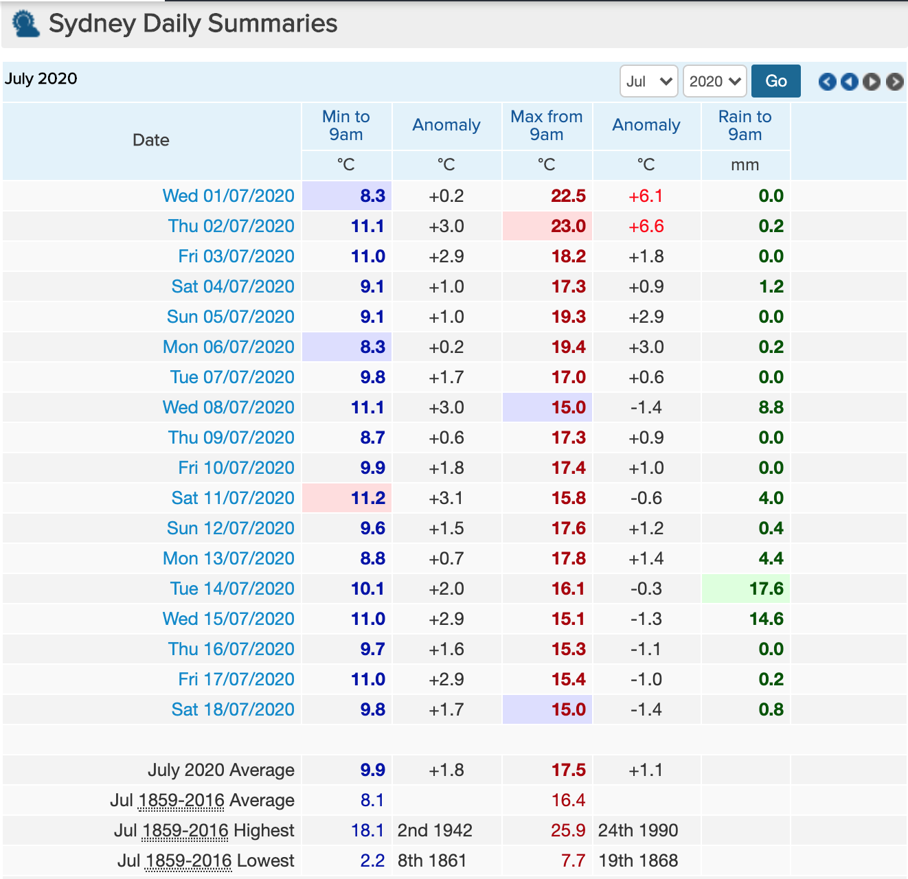
Daily summaries for Sydney Observation Hill showing an extended spell of below 18 degrees days from Mon 06/07/2020, and a spell of below average days between Tue 14/07/2020 and Fri 18/07/2020. Table sourced from: https://www.weatherzone.com.au/station.jsp?lt=site&lc=66062&list=ds
Temperatures over the first half of next week look to continue to be below 18 degrees but a definite end to the streak will come tomorrow. Forecast for Sydney on Sunday is 20 degrees as northwesterly winds and sunny skies bring a beautiful end to the weekend!