Warm and springlike July in the Australian snowfields
It was an extremely warm July across most of Australia (as we wrote yesterday) and one area that endured warmer temperatures than most was the Australian snowfields.
While Australia as a whole was 1.19°C above the 1961-1990 average in July – making it the country's 9th warmest July in records dating back to 1910 – the alpine regions of Tasmania, NSW, and Victoria were among the country’s warmest spots.
Take a look at the image below. See the orange blobs that indicate the highest temps on record? The whole of Tasmania and parts of the Australian Alps sit in the orange zone.
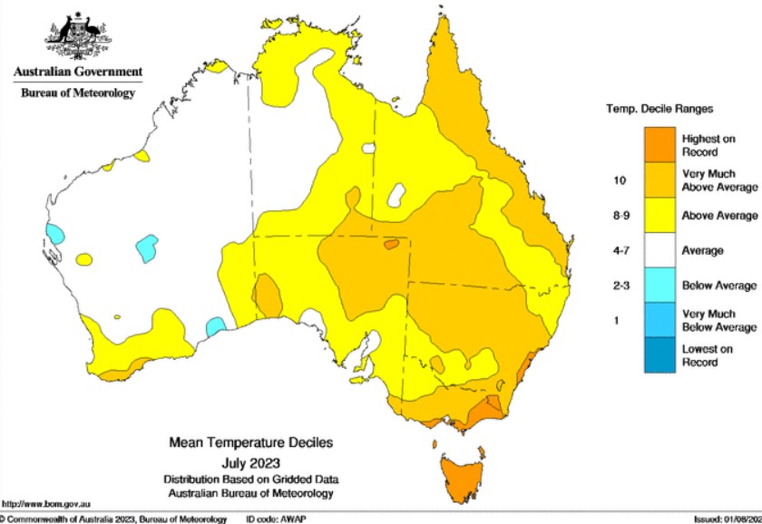
Image: They’ll be calling Tasmania the "Orange Isle" instead of the "Apple Isle". Source: BoM.
That's why ski slopes look grim at the lower Australian resorts right now.
Pictured below on August 2 are Mt Baw Baw (Victoria) and Selwyn Snow Resort (NSW). The peak elevations at those two resorts are in the 1500m to 1600m range.
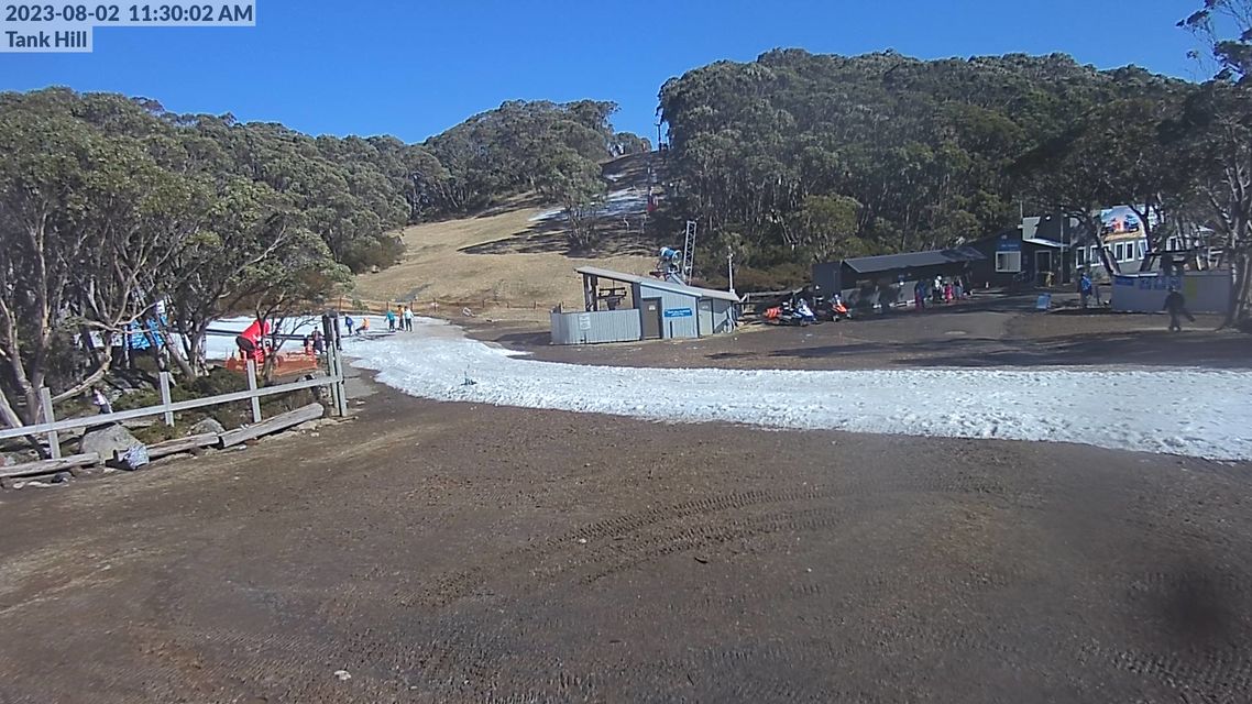
Image: Just a thin strip of snowmaking snow with only a patch or two of natural snow in the shaded areas of Mt Baw Baw. Two lifts are still open on slopes with more snowmaking. Source: ski.com.au.
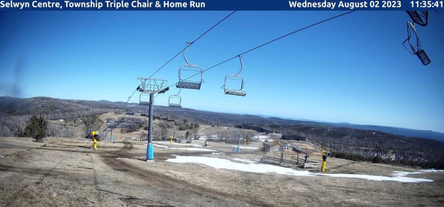
Image: All lifts are currently closed at Selwyn with insufficient snow even in snowmaking areas. Source: ski.com.au.
Fortunately, the higher parts of the higher resorts are still doing OK.
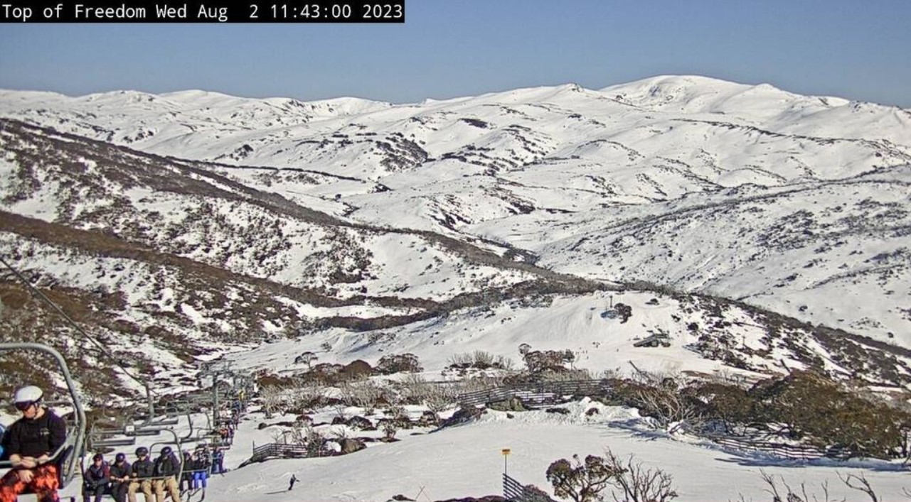
Below is the popular Freedom Quad chairlift at Guthega. The slopes in this part of Perisher resort rely 100% on natural snow with no snowmaking, and while the cover is thin for this time of year, conditions are still reasonable enough.
Here's the graph showing the most recent reading at Spencers Creek, at an elevation just over 1800m roughly halfway between the NSW resorts of Perisher and Thredbo.
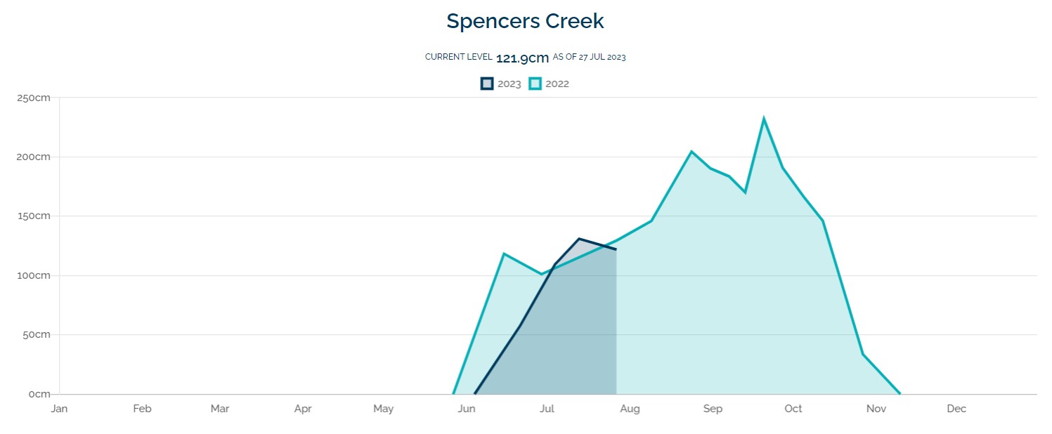
Image: It has been nearly a week (of very warm weather) since that reading, so expect the 121 cm level to have dropped significantly. Source: Snowy Hydro.
But overall, the exceedingly warm trend continues, and August has not gotten off to a good start from a snow-preservation perspective.
- Temps have already reached 8°C at Perisher Valley this Wednesday, after a max of 8.2°C on Tuesday
- Perisher's average August maximum is 3.3°C
Meanwhile July was so warm at Perisher that not a single day had a maximum of zero or lower.
- Perisher July 2023 max 4.6°C
- Perisher July long-term average max 2.3°C
- Perisher July 2023 min -2.1°C
- Perisher July long-term average min -5°C
It was a similar situation across the Australian Alps, as innumerable statistics indicate. But to cite just one more example, here are the averages form Victoria's highest weather station (elevation 1849m) at Mt Hoham ski resort.
- Hotham July 2023 average min -1.9°C
- Hotham July long-term average min -3.7°C
- Hotham July 2023 average max 1.7°C
- Hotham July long-term average max -0.2°C
So overall, Hotham and Perisher were around two-to-three degrees warmer than usual by day and night. While that might not sound like much, it makes all the difference to snowfalls, or lack thereof, as well as to retention of the existing snowpack.
Can this snow season be resuscitated?
There's a system coming later this week which may actually make things worse overall. Rain is likely on Friday ahead of snowfalls later that day into Saturday, but the snow totals may be insufficient to repair the rain damage.
There are encouraging signs of another snow system next week but it's still too early to make a confident call on that one, so it's best to keep checking the Weatherzone snow page for the latest forecasts, cams, and more.