
Very warm September morning for parts of NSW
A trough and cold front dragged warm air across NSW and Vic on Friday causing daytime maximum temperatures to soar more than 10 degrees above the mean for some areas.
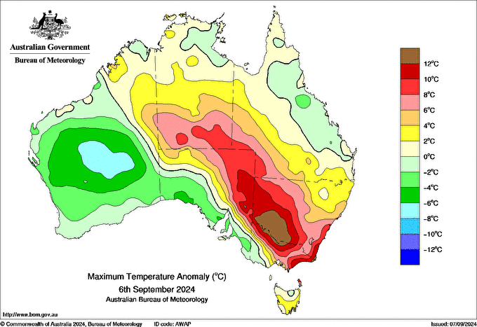
Image: Difference from average of maximum temperatures for 6th September. Source: BOM
The trough moved across Vic and southern NSW overnight, bringing rain and a few rumbles of thunder and flashes of lightning. The warm air to the northeast of the trough helped overnight temperatures stay elevated for parts of NSW.
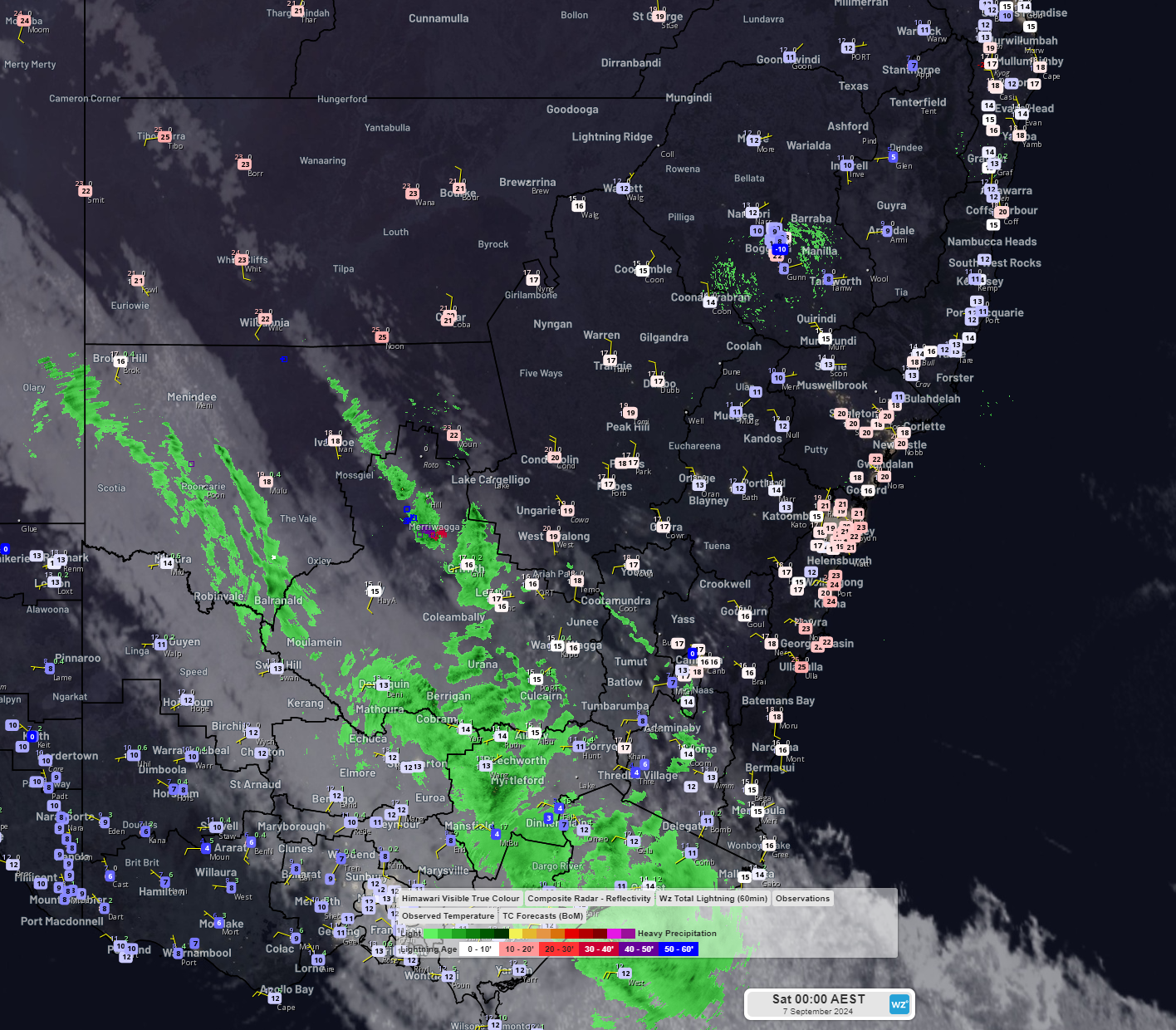
Image: Himawari-9 infrared satellite imagery, BOM radar, Weatherzone lightning, and observed temperatures at midnight 7th September.
It was particularly warm compared to average between the Shoalhaven and the Hunter. It was the warmest September morning in:
- At least 25 years at Albion Park (18°C)
- 21 years at Cessnock Airport (18.9°C)
- 7 years at Newcastle (19.6°C recorded at Nobbys signal station)
- 4 years at Sydney Harbour (19.5°C)
- 4 years at Bankstown (15.4°C)
Although these places experienced a warm night, and even though today is still a warm day by September standards, a cool change moving up the NSW coast is preventing some places from seeing the highs of yesterday. For example, Sydney reached 29.7°C yesterday (nearly 10 degrees above average) but as of about 3pm today has only reached 25.5°C (still 5 degrees above average).
The warm air from northwest and central Australia that has been dragged to the southeast by fronts and troughs should linger through the next week or so but there are signs of a cool down around the middle of this month as cold air may be drawn up from the Southern Ocean.
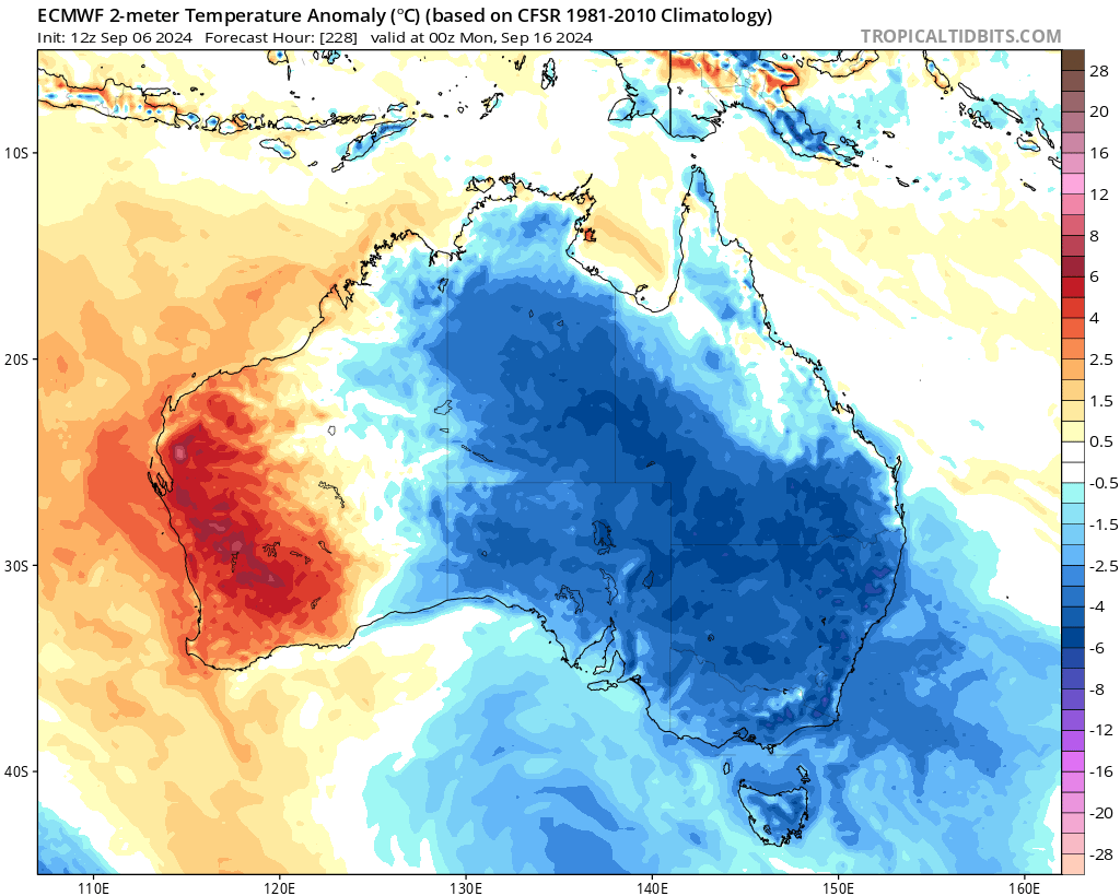
Image: European model forecast (ECMWF) of 2-metre temperature difference from average for 10am Monday 16th. Source: tropicaltidbits.com
Further ahead, with La Nina like conditions currently developing, and increasing the chances of wetter conditions in the east and north of the country later in spring and summer, daytime highs in NSW may be moderated by cloud and rain but overnight lows will be warmer. This can be seen in the latest forecast from the European Seasonal model released overnight.
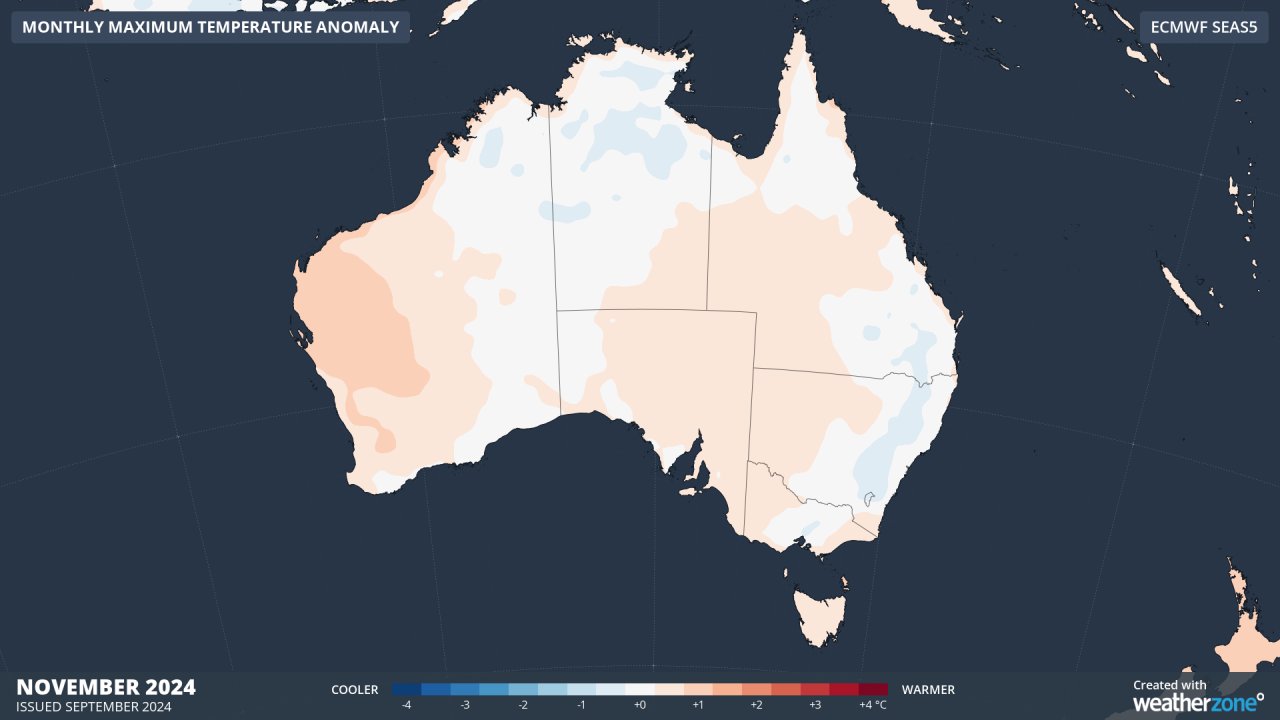
Image: European forecast for monthly maximum temperature anomaly for November.
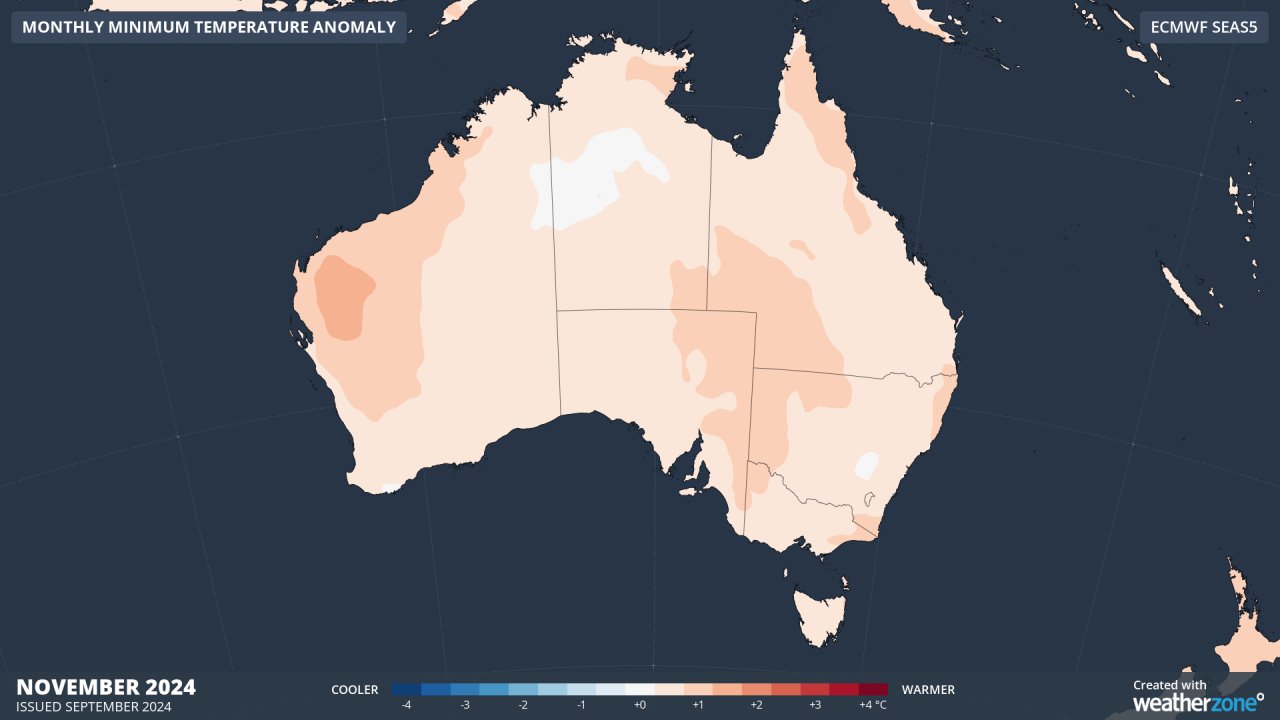
Image: European forecast for monthly minimum temperature anomaly for November.