
U.S. facing very active weather pattern for the next two weeks
Widespread areas of rain, thunderstorms, freezing rain, and snow will continue to affect parts of the U.S. during the next couple of weeks, under the ongoing influence of La Niña.
As noted last week, La Nina has set up to produce a very active weather pattern across the U.S. for the first couple of weeks of February.
This dynamic weather has already started playing out, with a storm that has moved through much of the Western U.S., dumping moderate to heavy precipitation in the Pacific Northwest, specifically in northern California. That system continued moving into the Plains on February 5 before cruising eastward with the wintry mix through February 6, then leaving off the East Coast.
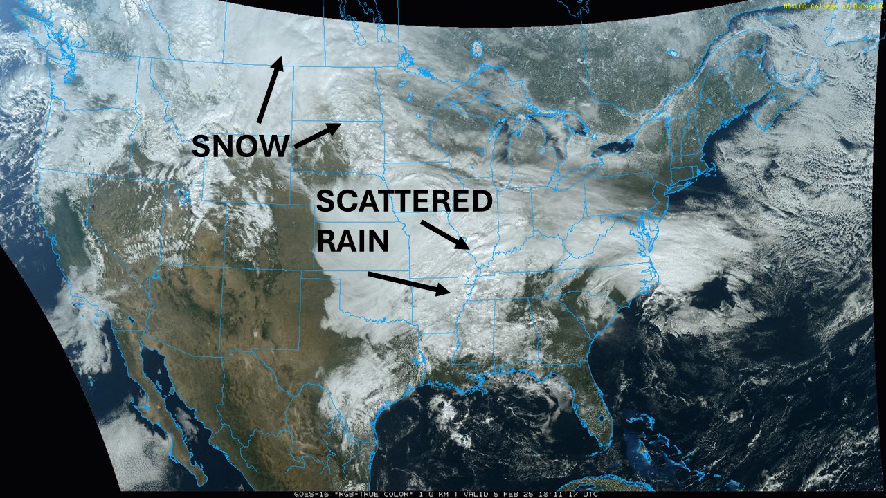
Image: The first in a series of major storm systems moving through the US with rain and snow on February 5. Source: College of DuPage.
The next system will be released through the U.S. in short order, moving into California on Thursday, February 6, then working through the country through the weekend. Like the first storm, this system is forecast to bring rain, thunderstorms, freezing rain, and snow.
While rain, thunderstorms and freezing rain could have very similar tracks and amounts across the country to the preceding system, the snowfall will be different. Instead of hitting the Canadian Prairies, this system is likely to bring a band of heavy snow from the Northern Plains through the northern Midwest, Great Lakes, and Northeast. Areas of more than six inches of snow are likely to be found again.
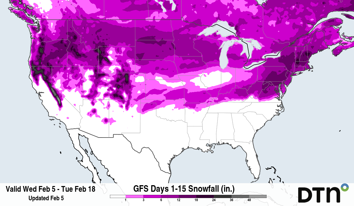
Image: The active pattern should bring plenty of chances for accumulating snow across a wide area of the U.S. over the next two weeks. Source: DTN
Colder air will push through behind this system, from its current pool in western Canada and the Northern Plains through more of the Central and Southern Plains and Midwest. The coldest temperatures will remain in Northwest, but this deeper penetration of colder air will setup another system or two for next week across the south.
Looking further ahead, another burst of atmospheric energy begins to move into the Southern Plains on Monday, February 11, and will move northeast through the Mid-Atlantic by Wednesday, February 12. The same concerns over freezing rain and heavy snow will apply to this system as well, though they will be located a few hundred miles south than the systems this week. That puts the Southern Plains, Ohio Valley, and Mid-Atlantic at more of a risk of the freezing rain and snow, and potential issues.
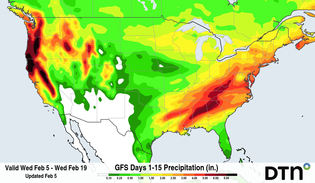
Image: The precipitation forecast from the GFS model shows heavy precipitation over the next two weeks across the West and from the Southern Plains through the Northeast. Source: DTN
Another dynamic system is likely to move through around February 14-16, with another the following week, probably around February 18-21. These systems could follow similar tracks to the southern storm, but that is a long way out and models may certainly change with regards to the track, timing, and impacts from these systems.