U.S. declares El Nino is here
The U.S. Climate Prediction Center has declared that El Niño is now present in the Pacific Ocean and warns that it will gain strength in the coming months.
The Climate Prediction Center (CPC) issued an El Niño Advisory on Thursday, June 8, indicating for the first time in 2023 that “El Niño conditions are present” in the tropical Pacific Ocean.
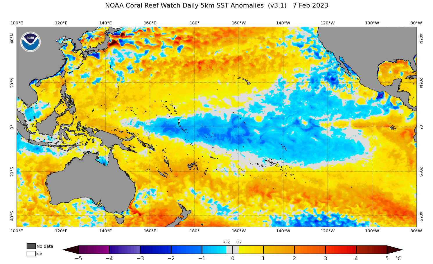
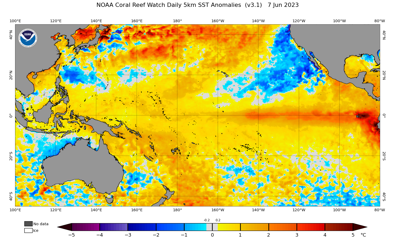
This week’s El Niño declaration follows a rapid breakdown of the La Niña conditions that were lingering in the tropical Pacific at the beginning of 2023. Impressively, the transition from La Nina to El Nino only took three months, with the CPC’s final La Niña Advisory issued on March 9 and this week’s El Niño Advisory dropping on June 8.


Images: Observed Pacific Ocean sea surface temperature anomalies on February 7 (top) and June 7 (bottom), showing the rapid transition between La Niña and El Niño patterns in 2023. Source: NOAA.
How long and strong will this El Niño be?
According to the latest forecast issued by the CPC, El Niño conditions are expected to persist through the rest of 2023 and possibly into the start of 2024. This period encompasses winter, spring and at least part of summer for Australia.
There are also signs that El Niño will gain strength in the coming months. The model used by the CPC predicts that there is an 84 percent chance El Niño will exceed moderate strength later this year, and a 56 percent chance that it will mature into a strong El Niño.
Stronger El Niño events are more likely to influence global weather patterns than weaker events.
Conflicting information
Earlier this week, Australia’s Bureau of Meteorology issued an El Niño Alert, indicating a 70 percent chance of El Niño forming in 2023. Two days later, the U.S. CPC declared that El Niño had arrived.
This conflicting information simply comes down to the CPC and The Bureau using different thresholds for classifying El Niño. The CPC’s thresholds are lower and easier to meet, meaning they typically declare the start of El Niño and La Niña before the Bureau of Meteorology.
Regardless of whether El Niño has officially arrived or not, the Pacific Ocean is clearly in an El Niño-like state and the latest monthly and seasonal climate outlooks reflect this.
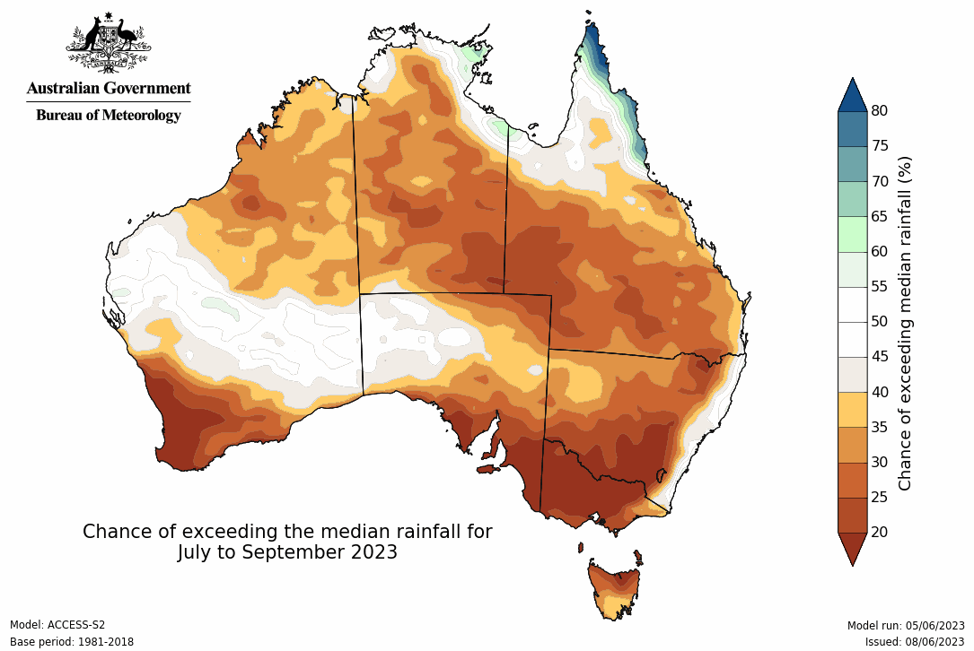
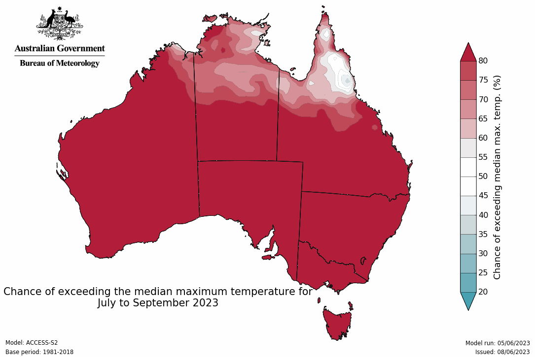
El Niño typically causes below average rainfall and above average daytime temperatures over large areas of Australia. The maps below show that these conditions are being predicted during the next three months in Australia.


Images: Rainfall (top) and maximum temperature (bottom) outlook for Australia, covering the three-month period between July and September. Source: Bureau of Meteorology.