
Unusual mix of heat, severe storms, flooding and bushfires impact Vic
On Sunday, Victoria experienced the rare combination of extreme heat and severe thunderstorms, which sparked several new fires across the state's southwest.
Sunday's mix of extreme heat, thunderstorms, rainfall, flooding, and bushfires in Vic was caused by a high pressure system in the Tasman Sea, bringing hot and unusually humid air across the state.
The thunderstorms were very lightning active with DTN’s total lightning network capturing over 80,000 cloud-to-ground lightning strikes in Vic on Sunday, with about 670,000 lightning flashes across the state in total.
%20(3).png)
The abundant atmospheric heat and moisture on Sunday generated severe thunderstorms which produced damaging winds and heavy rainfall in some areas.
Damaging wind gusts of 109km/h and 107km/h were recorded at around 9pm Sunday evening at Port Wilson, near Geelong and South Channel Island, respectively.
Meanwhile, heavy rainfall associated with these storms lashed Shelford to the northwest of Geelong, with 25mm falling in half an hour. This area experienced some flash flooding with storms lingering in the area for some time.
Some of Sunday’s storms caused dry lightning, which refers to lightning strikes that occur with little or no rainfall reaching the ground. This dry lightning sparked several new fires in the states southwest, which became out of control during the afternoon.
The animation below shows the convection and bushfire smoke across the states southwest Sunday. A pyrocumulonimbus cloud also formed over one of the major bushfires, with the intense heat causing hot air to rise and trigger a thunderstorm. In a rare feedback loop, bushfires sparked thunderstorms, which in turn fuelled more fires on Sunday.
Images: Himawari-9 satellite images between 1 and 7pm AEDT on Sunday, February 3.
Fortunately, the new bushfires were ignited on a day when fire danger ratings were not severe, despite the ongoing heatwave in Victoria.
What's behind this rare mix of severe weather?
Thunderstorms require heat, humidity and a trigger to form, all of which was abundant on Sunday.
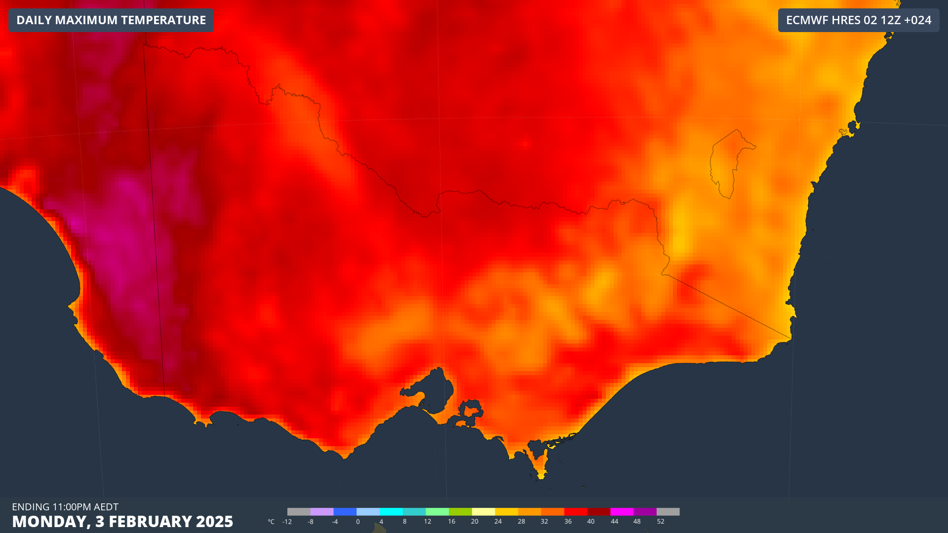
Temperatures across Vic soared into the high 30s or low 40s on Sunday, with humidity across the state making the temperature feel 2 to 4°C above the actual temperature.
The heat in the southern states is typically dry, driven by hot northerly winds from the interior, which is why afternoon thunderstorms are rare during periods of extreme heat.
However, on Sunday, the dew points were around 16 to 20°C across the states west and are forecast to remain high on Monday.
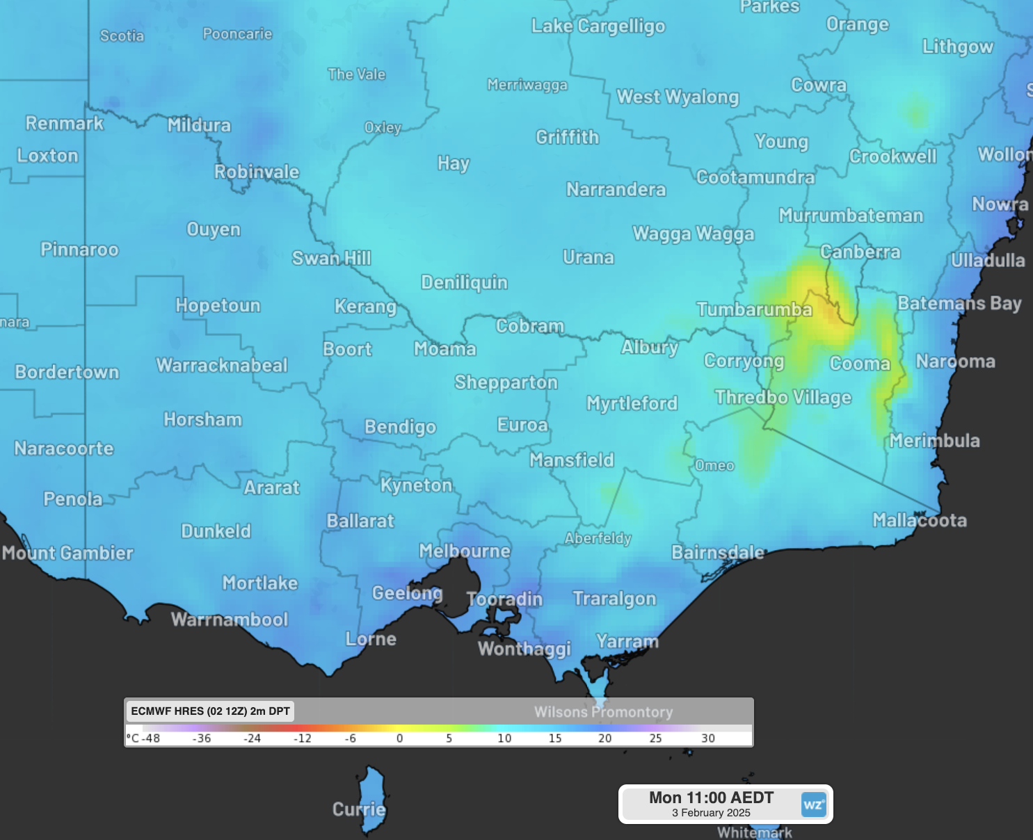
Image: Dew point forecast for 2pm AEDT on Monday, February 3, showing humid air across western and southern Vic.
Meteorologists monitor atmospheric moisture by measuring the dew point, which is the temperature the air must cool to for condensation to occur. The more moisture in the air, the higher the dew point.
The heat and abundant moisture are expected to stick around on Monday, with temperature forecast to soar into the 40s again across the west of the state.
These conditions could trigger severe thunderstorms again on Monday across western Vic, over the fire grounds which could provide a challenge to firefighters with wind gusts and lightning. Some thunderstorms have already begun across parts of the southwest of the state at around 4pm on Monday afternoon, near the fire grounds.
Looking further ahead, a cool and gusty southerly change will begin to move through the west of Vic on Tuesday morning. While this change will bring relief from the relentless heat, it could provide a challenge for firefighters with fires likely to change directions, possibly increasing the size of these fires.