
Understanding Hot Air Balloon Navigation
Hot air balloons are designed to be lighter than air, allowing them to ascend and float with the wind. Unlike traditional aircraft, commercial balloons lack flight control features such as ailerons, stabilizers, or rudders. Instead, balloon pilots navigate through changes in elevation, utilising varying wind directions and speeds at different altitudes.
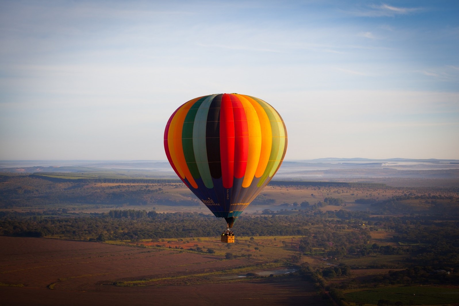
Credit: EnricoDias
In Australia, hot air balloons typically fly in the cooler periods around sunrise. Since hot air balloons only move with the wind, flights are scheduled to operate during the early morning when winds are calmer, ensuring a smooth and enjoyable experience for passengers.
With all that surface area exposed to the wind, a balloon can become difficult to handle if the surface wind exceeds 15-20 km/h. If the winds are too strong, a pilot will consider delaying or cancelling the flight.
For observers on the ground, the wind felt on one's face may not be the same as the wind blowing at 500 or 1,000 meters above. By knowing the wind direction and speed at higher levels, balloon pilots can pre-plan the flight path and establish target locations for landing.
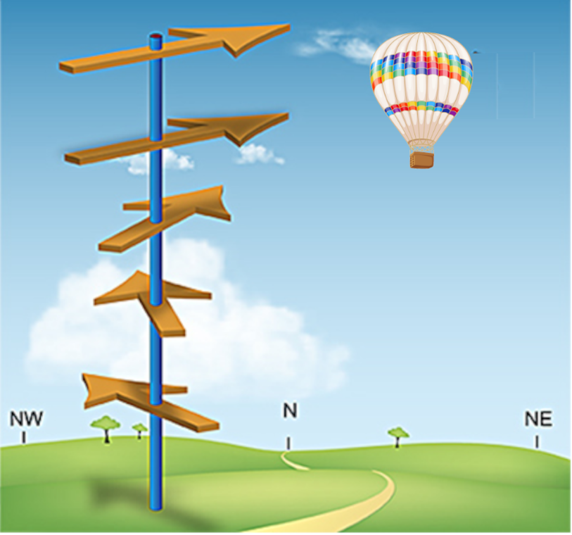
Directional shear: Wind direction changing with increasing height. (Source: US National Weather Service)
A change in wind direction or speed with height is known as wind shear. The image above illustrates wind blowing to the northwest at the surface, with the direction shifting clockwise with altitude and becoming northeast at the balloon's altitude. By adjusting the balloon's altitude, the pilot can take advantage of these varying wind directions to change the flight direction effectively.
The Importance of Pre-Flight Planning in Hot Air Ballooning
Pre-flight planning is crucial for a successful hot air balloon flight. Before a commercial flight, a pilot seeks to obtain wind observations from a nearby airport, capturing wind speed and direction within altitudes defined by aviation regulations. Additional information can also be accessed through wind forecasts provided by weather agencies that utilise numerical weather prediction models.
Below is the flight path of a weather balloon departing from Melbourne International Airport and heading toward Licola, approximately 150 kilometres to the east. As the balloon ascends, its flight path changes due to varying wind fields encountered at different altitudes.
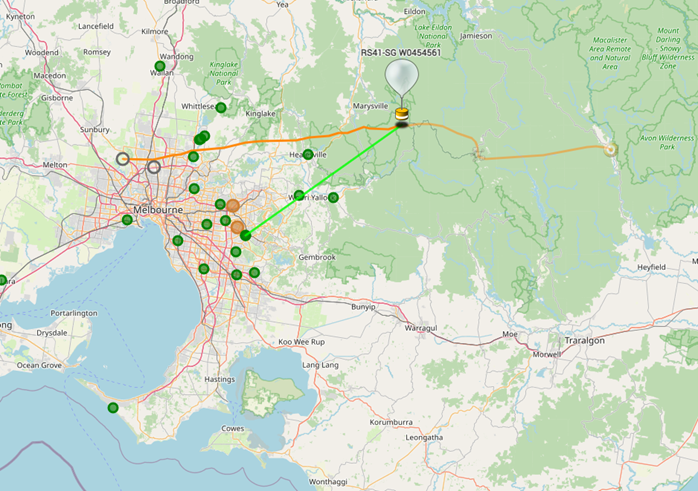
Flight path of a weather balloon launched from Melbourne International Airport by the Bureau of Meteorology (Source: SondeHub Tracker)
Numerical weather models generate forecasts not only for surface conditions but also for altitudes reaching up to 60 to 70 kilometres. Weather information, including wind forecasts above the surface, comes in various formats and can be tailored to meet pilots' needs. This detailed forecasting is essential for ensuring safe and successful hot air balloon flights.
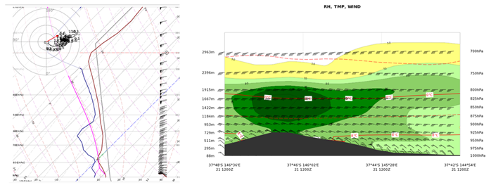
Radiosonde sounding (left image) and vertical wind profile forecast (right image) provide information on wind and temperature above the surface level.
The next time you embark on a scenic balloon flight, you can feel assured that your pilot knows where you're headed and where you will safely land. So relax and enjoy the breathtaking views—your journey is in good hands!