
Umbrellas up across Tasmania today
A wintry mix of showers, wind and highland snow will hit Tasmania today as a cold front sweeps over the state.
The sequence of satellite images below shows cloud and rain, associated with a cold front, reaching western Tasmania in the first hours of daylight on Tuesday.
.gif)
This frontal cloud and rain will spread across the rest of the state during the middle of the day, before showers contract to the state’s south and west into the afternoon and evening.
The passage of today’s front should see some rain falling in every one of the state’s 11 weather districts, with the heaviest falls expected in the western half of the state.
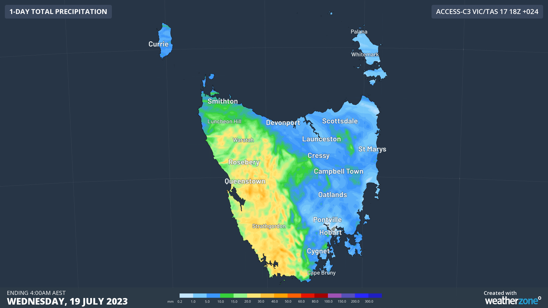
Image: Forecast accumulated rain during the 24 hours ending at 4am AEST on Wednesday, according to the ACCESS-C model.
This precipitation will fall as snow in elevated parts of the state, possibly reaching down to about 700 metres above sea level during the afternoon and evening.
In addition to the rain and snow, most of Tasmania will experience blustery winds on Tuesday, initially coming from the northwest in the morning before a brisk west to southwesterly change during the day.
While most areas will see winds below damaging strength, some exposed parts of the state will see gusts above 100 km/h on Tuesday. As of 10 am, wind gusts had already reached up to 106 km/h at Cape Grim, 104 km/h at kunanyi / Mount Wellington and 95 km/h at Mount Read during the morning.
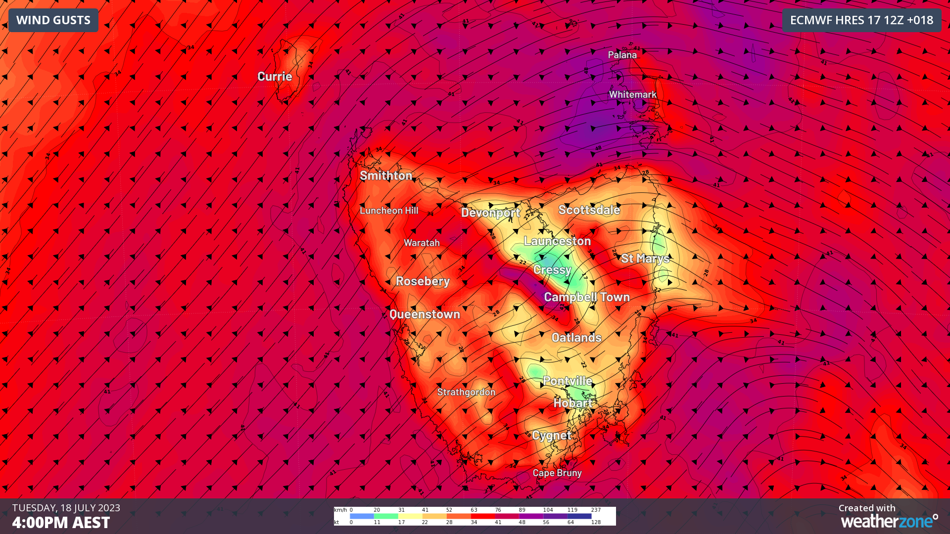
Image: Forecast wind gusts (speed and direction) at 4pm AEST on Tuesday, according to the ECMWF-HRES model.
A marine gale warning is in place for all coastal waters around Tasmania on Tuesday, while a sheep graziers warning has also been issued in the state’s South East forecast district.