Two 'northwest cloudbands' to soak Australia this week
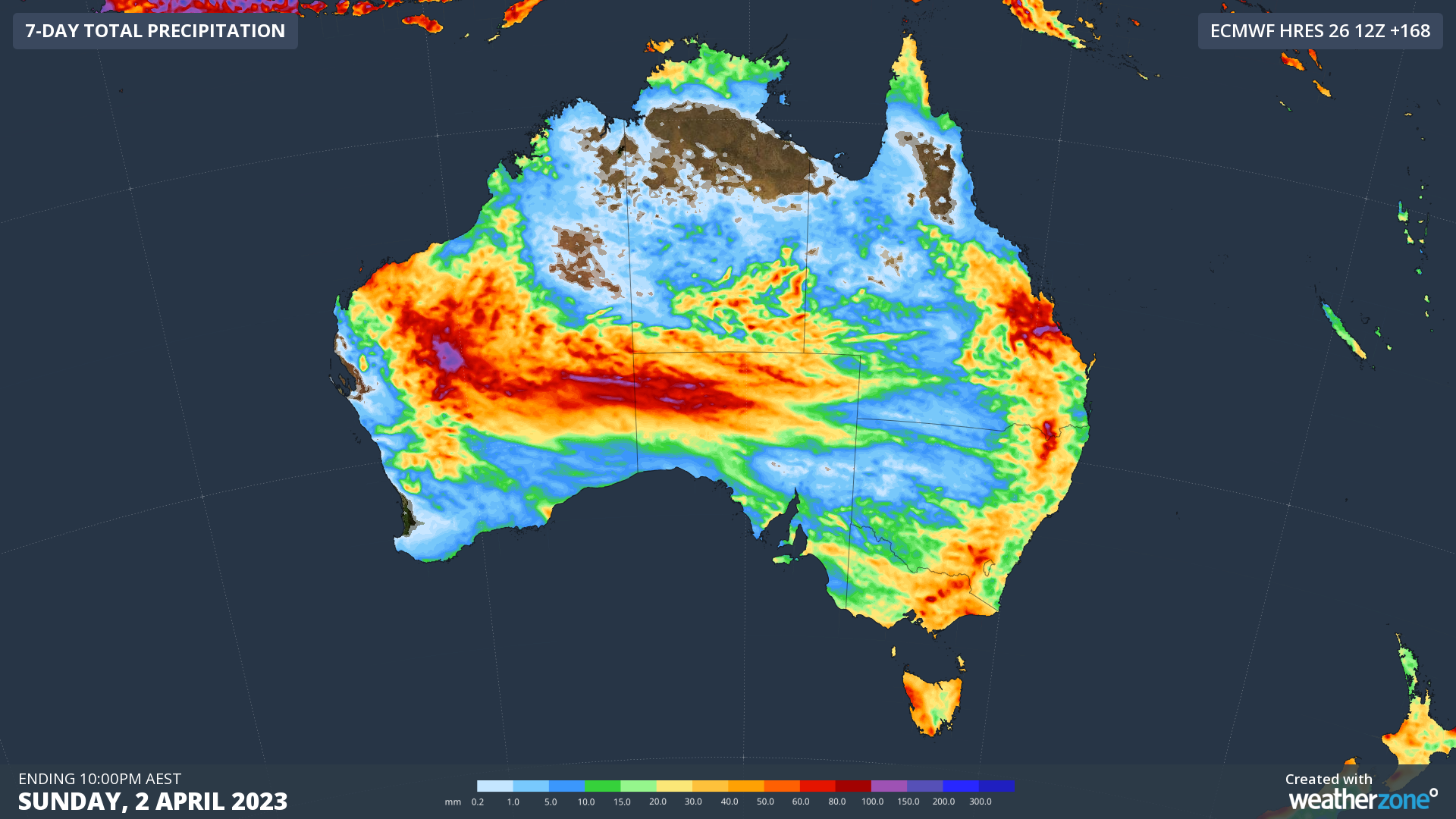
Rain will fall over large areas of every Australian state and territory this week as two northwest cloudbands sweep across the country.
Northwest cloudbands are large bands of cloud that spread across Australia from the northwest towards the southeast. They are caused by moisture-laden air from the tropical Indian Ocean and typically produce widespread rain over Australia between autumn and spring.
This week, two northwest cloudbands will pass over Australia as streams of Indian Ocean moisture move south and interact with a series of cut-off upper-level lows passing over the nation’s southern states.
The animation below shows precipitable water in the atmosphere during the next seven days, revealing the two pulses of airborne moisture spreading across Australia.
Video: Precipitable water and 500 hPa height during the coming week, according to the ECMWF-HRES model.
Rain will fall over much of every state and territory this week, with some places also likely to see thunderstorms. Pockets of heavy rain will produce areas of flooding, both with and independent of thunderstorms.

Image: Forecast accumulated rain this week, according to the ECMWF-HRES model.
You will find regular updates on this week’s wet and stormy weather on the Weatherzone news page, and you can also check the latest severe weather and thunderstorm warnings here.