
Two cyclones swirling near Australia
Tropical Cyclone Alfred and Bianca formed near Australia on Sunday, with the first severe cyclone of the season possible in the Coral Sea.
The image below shows Bianca over the Indian Ocean to the west of Australia and Alfred in the Coral Sea to the east of Qld. 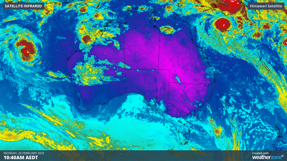
Images: Himawari-9 infrared satellite image at 10am AEDT on Monday February 24
Tropical cyclone Alfred is the first system this season to form to the east of Australia, with the other six systems forming to the west of WA, taking the Australian 2024/25 season total to seven.
Alfred is rapidly deepening and is forecast to become a severe tropical cyclone during the middle of this week, which would make it Australia’s 5th severe cyclone of the season.
If Alfred indeed becomes severe, this will take the seasons proportion to 70% severe tropical cyclones. This is higher than the typical 50% due to unusually warm waters surrounding Australia fuel these storms.
Tropical Cyclone Alfred was located 900km east to northeast of Cairns on Monday morning and forecast to move southeast and south in the coming days. The track of the system from later this week and into next week is very uncertain at this stage and meteorologists are watching this system closely.
An ensemble model from the European Centre for Medium-Range Weather Forecasts (ECMWF) gives about a 30% probability of a tropical cyclone hitting the central or southern Qld coast by the end of this week.
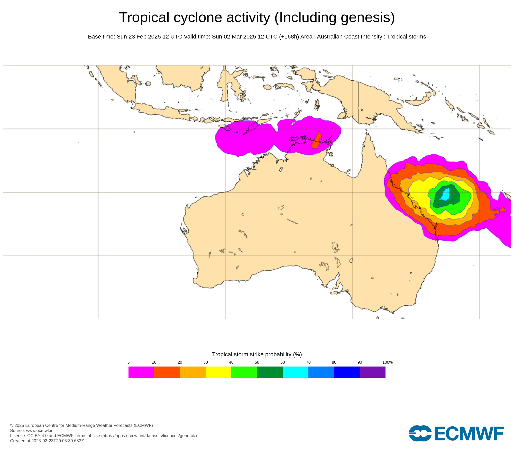
Image: Probability that a tropical cyclone will occur within a 300km radius of a given location within a time window of 48 hours from Sunday, March 2. Source: ECMWF
The Global Ensemble Forecast System (GEFS) is a weather model created by the National Centers for Environmental Prediction (NCEP) and it also shows the uncertainty in the track of Alfred with the 21 ensembles members each taking a different route.
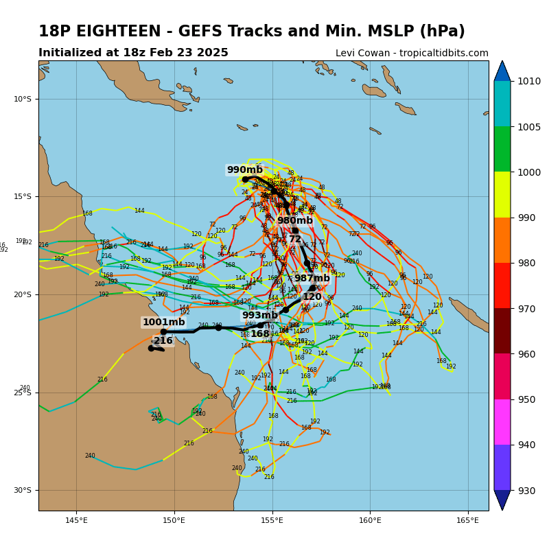
Image: GEFS ensemble member tracks for Tropical Cyclone Alfred (also designated 18P). Source: TropicalTidbits.com
The map above shows that the mean of the ensemble members moving south and possibly moving towards the central Qld coast later this week. It is too early to know whether this system will directly hit the Qld coast or not, however large waves and significant wind are likely to be generated by this system.
Tropical Cyclone Bianca
Tropical Cyclone Bianca is spinning over the Indian ocean to the northwest of Exmouth and will likely strengthen in the coming days. This system is forecast to move west to southwest away from Australia’s mainland sparing Western Australian after a busy few weeks of tropical activity.
We will be watching these systems closely as the week unfolds and providing updates here.