
Twin omega blocks to cause severe weather in Australia
A unique weather pattern involving two omega blocks, a tropical cyclone and a heatwave will cause a dynamic mix of severe weather in Australia from this weekend into next week.
The term ‘omega block’ is used by meteorologists to describe a broad-scale weather pattern that involves an area of high pressure being straddled by two adjacent areas of low pressure. These weather patterns cause the isobars on a northern hemisphere synoptic chart to form a shape similar to the Greek letter omega Ω, hence the name omega block.
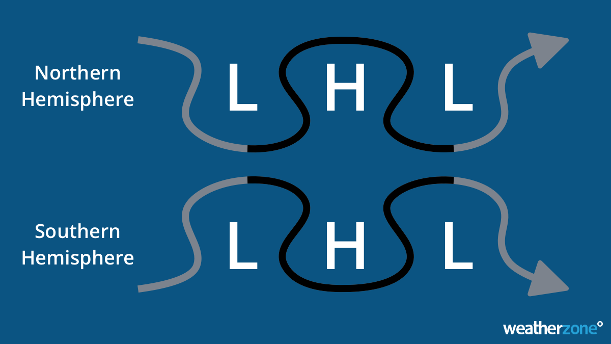 Image: Upper-level wind flow around omega block patterns in the Northern and Southern Hemispheres.
Omega blocks tend to cause severe weather because they slow or block the passage of weather systems that are trying to move from west to east across Earth’s surface.
Omega blocks were responsible for the record-breaking heat that hit Europe in June 2022 and Canada in June 2021.
Not one, but two
Forecast models are predicting that two omega blocks will form near Australia and across the South Pacific Ocean later this week. The map below shows the predicted twin omega blocks this Sunday evening Australian time.

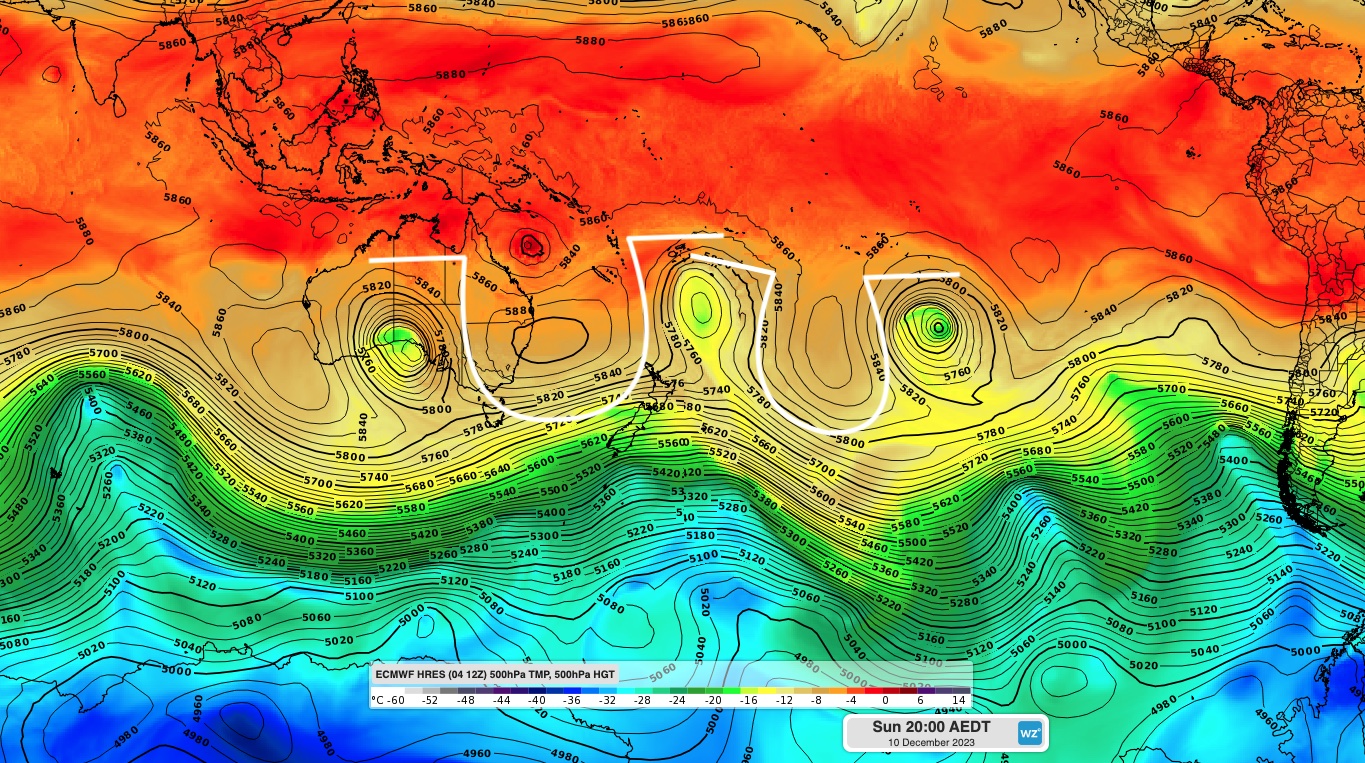
Images: Modelled 500 hPa temperature and geopotential height at 8pm AEDT on Sunday, December 10, 2023. The bottom image is annotated to show the omega blocks more clearly. Note than the omega-shape appears upside-down in the Southern Hemisphere.
This blocking pattern will cause an upper-level high to linger over eastern Australia through the second half of this week and into next week. The position of this stubborn high pressure system will allow a few things to happen in the Australian region:
- A hot air mass will spread across Australia on the western side of the upper-level high, causing a prolonged and intense heatwave over a large area of the country this week. This will affect part of every mainland state and territory, with temperatures in Western Sydney expected to reach the low-40s on Saturday.
- The northern flank of the high will straddle a tropical cyclone over the Coral Sea and likely direct it towards eastern Qld early next week. While there is still a lot of uncertainty around the future movement of this system, the presence of the upper-high increases the likelihood that it will track towards eastern Australia.
- The stubborn high may also cause an upper-level cut-off low to stall over South Australia this weekend or early next week. This low is likely to cause a mix of dangerous weather, possibly including heavy rain, severe thunderstorms and damaging winds.
This weather pattern could produce severe weather in multiple states concurrently, so be sure to stay up to date with the latest forecasts, warnings and tropical cyclone advisories.