
Trough and cold front cross western WA
A trough and cold front containing gusty winds and heavy showers is making its way through the west of the country this Sunday morning, with gale force winds affecting the southwestern WA coast and showers stretching right up to the Pilbara.
A severe weather warning for damaging winds was in effect overnight but was cancelled in the early hours of the morning as winds began to ease.
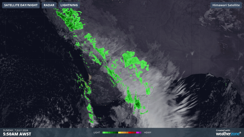
Gif: Himawari Satellite and radar for southwest WA on Sunday morning
Some of the strongest winds we have seen from this front overnight include:
- 102km/h at Rottnest Island
- 96km/h at Cape Naturaliste
- 85km/h at Busselton Jetty
- 83km/h at Cape Leeuwin
Rainfall associated with the system has been falling for most of the last 24 hours with accumulated falls generally higher in locations further north. Some of the highest 24-hour totals to 9am this morning are:
- 29mm at Kalbarri
- 22mm at Carnarvon Ap
- 21mm at Geraldton Ap
- 19mm at Badgingarra
- 16mm at Bunbury
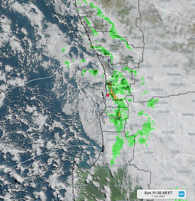
Image: Himawari Satellite, rain radar and lightning for Perth and surrounding areas on Sun 7th 9:30am WST
Areas south of Perth have picked up 5-15mm, while Perth itself and surrounding areas had picked up single digit totals in the same period. In addition to the rain falling yesterday and before dawn this morning, pockets of heavy showers have worked their way through the southwest of the state, making it a soggy start for anyone who had plans for a Sunday breakfast.
If you look closely at the above image, you’ll even see some lightning detected near Rockingham, meaning some people may have heard some rumbling to accompany the shower activity.
The cold front is stretching out from a low pressure system in the Southern Ocean, more than 2000km south of Perth, however there isn’t much cold air to be seen behind it. Temperatures across the west coast are forecast to reach the high teens to low 20s as skies quickly clear and winds tend west-northwesterly. Low cloud further inland will be responsible for it being a few degrees cooler while Kalgoorlie is looking at a chillier maximum of 15°C as the front passes over the town today.
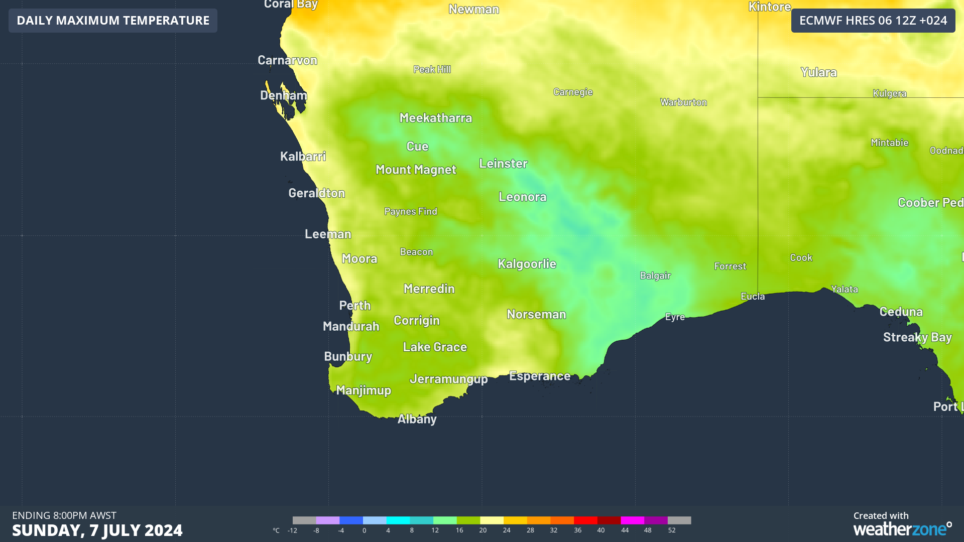
Image: Forecast maximum temperatures for southern WA on Sunday 7th
In the coming days, temperatures look to warm even further as winds tend northerly ahead of another trough and front. That system is expected to cross later on Tuesday, heralding a cooler spell that will last for the rest of the week.