
Tropical low to bring widespread rain
A tropical low that’s about to develop over the Gulf of Carpentaria could fuel another round of widespread rain and storms across central and southern Australia next week.
A low pressure system is likely to develop over the Gulf of Carpentaria on Friday or by Saturday at the latest, within the monsoon trough.
While over the Gulf, this tropical low will gain strength and cause wind and rain to increase in the region during the next couple of days. Some of this potentially dangerous weather could affect eastern coastal districts of the NT or northern Queensland if the low gets close enough to land. However if it remains over the Gulf waters for long enough, it could strengthen into a tropical cyclone.
There is still a fair amount of uncertainty regarding the future movement and strength of this low, particularly beyond the weekend. Most forecast models suggest that it will remain over the Gulf until Sunday before moving over the northeastern NT on Sunday or Monday.
A number of models suggest that the system will then move towards central Australia early next week. If this happens, the moisture from this southward-moving tropical low would likely get drawn down towards southern Australia next week, where it could produce widespread rain and storms.
There are early signs that this scenario could indeed play out mid-to-late next week, although it’s too early to know for sure. The maps below show how much rain is predicted between now (Friday) and the end of next week by three different forecast models. You can see that there is quite a bit of difference regarding when, and how much rain will fall, particularly over southern and southeastern Australia.
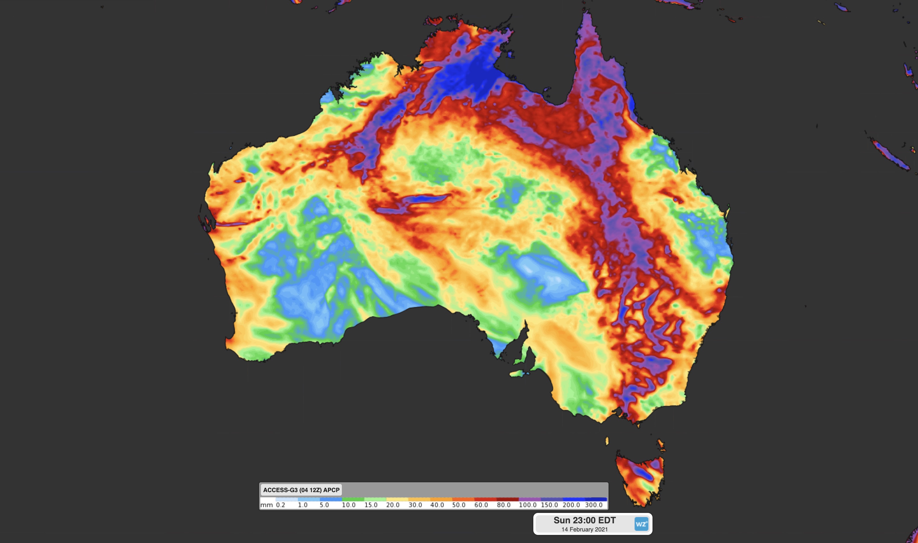
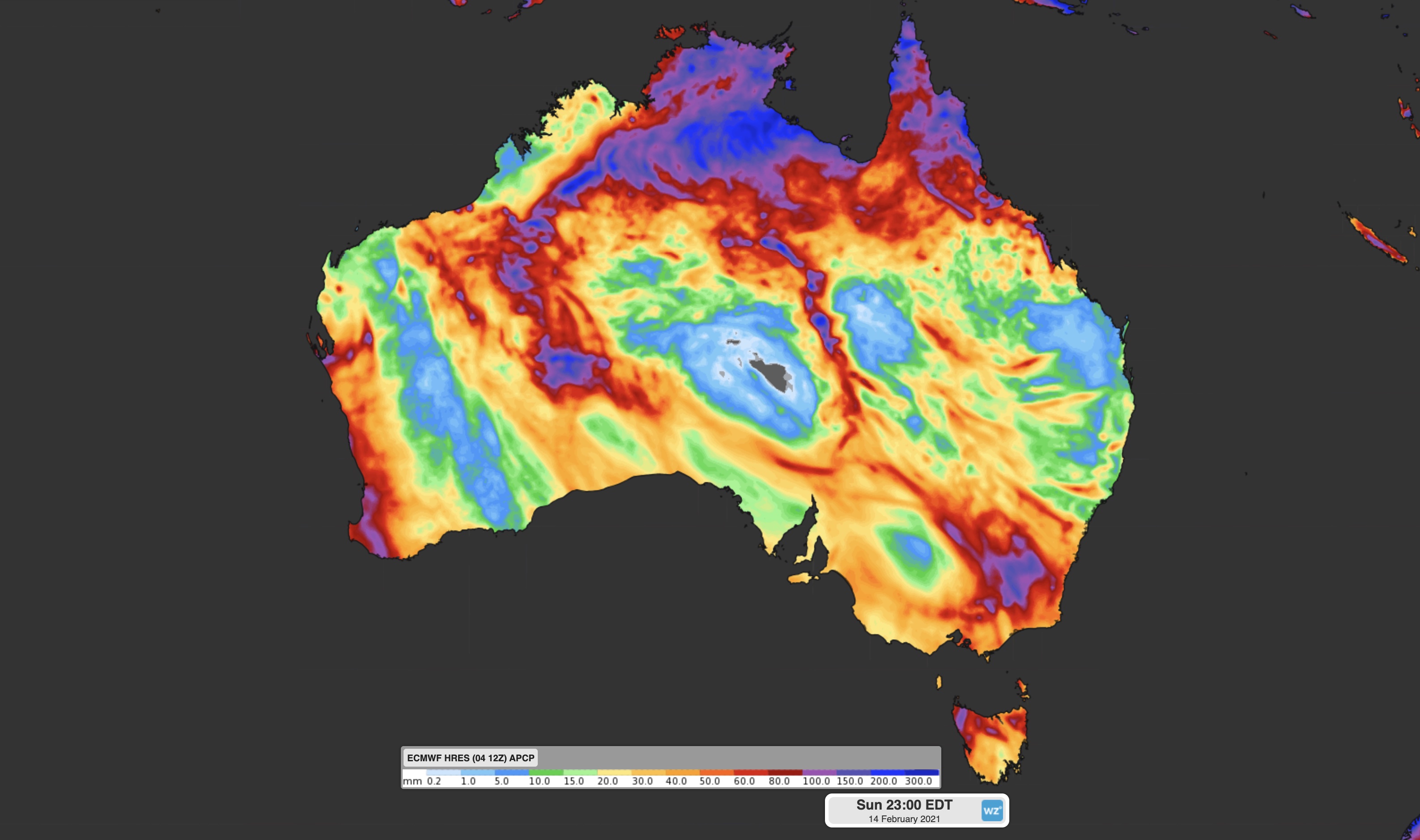
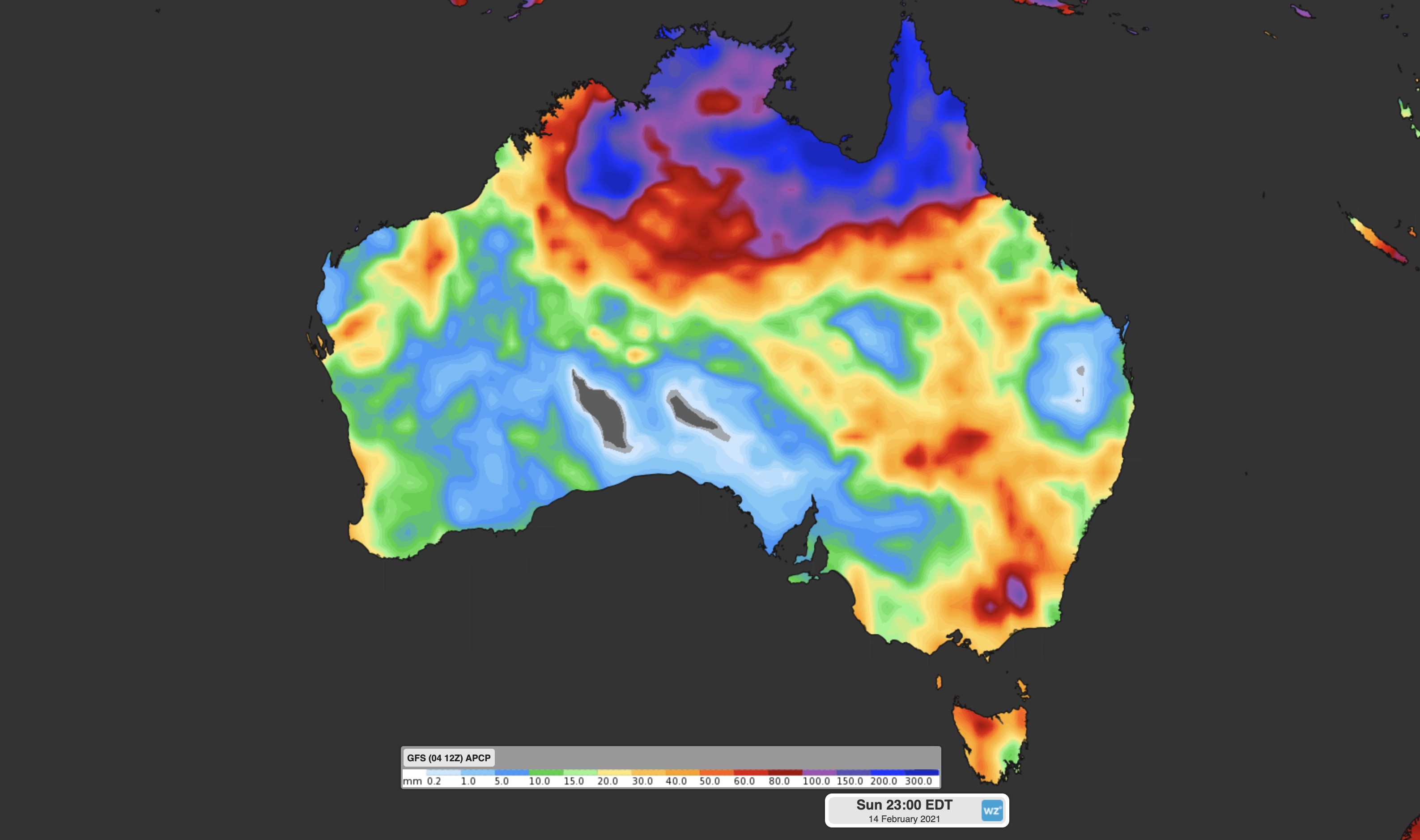
Images: Forecast accumulated rain during the 10 days ending on Sunday, February 14, according to the ACCESS-G (top), ECMWF (middle) and GFS (bottom) models.
If the low pressure system over the Gulf does become the next tropical cyclone in Australia’s area of responsibility, it will be named Marian.