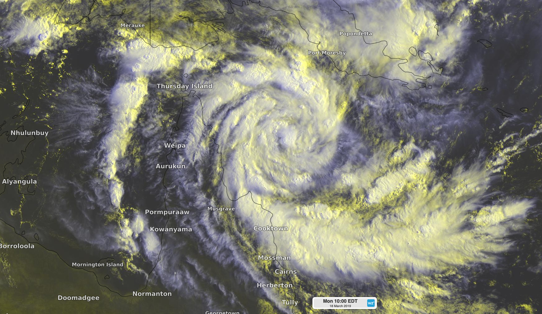
Tropical Cyclone Trevor approaching Queensland

Tropical Cyclone Trevor formed off the east coast of Queensland's Cape York Peninsula on Monday morning and could make landfall during the next 48 hours.
Trevor became Australia's fifth system to be named in Australian waters this tropical cyclone season, forming about 285km to the east of Lockhart River at 7am AEST on Monday.

Image: Satellite image of Tropical Cyclone Trevor on Monday morning.
Tropical Cyclone Trevor is in a favourable environment for further intensification and should become a category two system while approaching Cape York Peninsula during the next two days.
At this stage, Cyclone Trevor is expected to make landfall along the east coast of Cape York Peninsula on Tuesday night, most likely as a category two system. However, landfall as a category three severe tropical cyclone can't be ruled out, particularly if the system moves slower than anticipated.
A cyclone warning and cyclone watch have been issued across the eastern half of Cape York Peninsula, where gale force winds with destructive gusts, abnormally high tides and heavy rain are likely during the coming days. If Trevor reaches category three strength, very destructive wind gusts would also be possible.
If Cyclone Trevor makes landfall as expected, it will briefly lose some strength as it passes over Cape York Peninsula. However, most models suggest that the system will then travel over the Gulf of Carpentaria, where it is likely to re-intensify.
The future movement of Cyclone Trevor becomes more uncertain once the system enters the Gulf. More accurate information will become available on this during the coming days.
Anyone living in northern areas of Queensland and the Northern Territory should monitor the latest advisories closely by visiting http://www.bom.gov.au/cyclone/ throughout the week.