
Tropical Cyclone Seroja update
Tropical Cyclone Seroja is tracking in a south-southeast direction and is expected to make landfall just north of Geraldton later this evening or early on Monday morning.
The system should still be a category 2 cyclone as it passes over land, before losing strength and turning into a tropical low on Monday morning. Category 2 cyclones are defined as having wind gusts between 126-166 km/h and tropical lows tend to have wind gusts below 91 km/h.
Wind gusts associated with the cyclone could reach well over 100 km/h tonight along coastal areas of the Gascoyne and Central West districts. As the system tracks further southeast overland on Monday, 100 km/h plus wind gusts may continue across the Central West, Central Wheat Belt, Goldfields and South East Coastal. The cyclone will decrease in strength as it moves overland, becoming a tropical low on Monday.
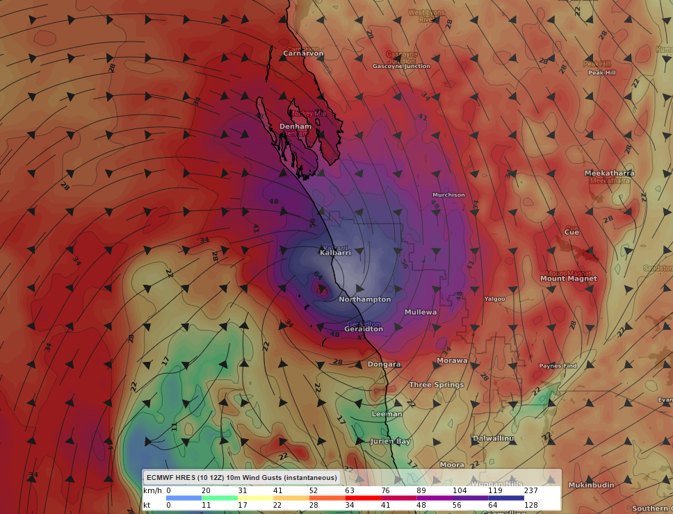
Image: Wind gusts (knots) associated with Tropical Cyclone Seroja at 8pm WST Sunday. Displayed using the ECMWF model.
Showers and rain will be consistent and heavy at times, with daily totals likely above 50 mm during Sunday and Monday. The heaviest falls today are likely to occur near the coast from Geraldton to Carnarvon and on Monday southwest of a line from about Kalbarri to Esperance.
Widespread-to-scattered thunderstorms are likely as the system moves closer and across land. Unstable air just to the north of the system will likely generate the most storms as well as possibly severe storms. Damaging wind gusts and isolated heavy rain may also occur with any storm.
Offshore swell may reach well over 7-9 metres along parts of the Gascoyne coast during Sunday and gradually decrease as the cyclone moves further southeast.