
Tropical Cyclone Ruby gaining strength in Coral Sea
Australia will escape any direct impacts from Tropical Cyclone Ruby, with the soon-to-be severe tropical cyclone now bearing down on New Caledonia.
Cyclone Ruby developed over the northeast Coral Sea on Sunday afternoon, becoming the second tropical cyclone to be named in Australia's area of responsibility so far this season.
By 4am AEST on Monday, Ruby has strengthened into a category two tropical cyclone as it gradually moved towards the south.
The satellite images below show Ruby's impressive size and structure on Monday morning, as seen from the Himawari-8 satellite around 36,000 km above the Earth's surface.
Fortunately for Australia, Ruby is far enough away to spare the country's mainland from any direct impacts. You can see in the images above that Ruby's outer cloud bands are not getting anywhere near Australia.
Ruby is expected to strengthen into a category three severe tropical cyclone over the next 24 hours before moving across New Caledonia from the northwest to southeast on Tuesday, roughly parallel to the territory's largest island, Grand Terre.
Wind speeds near Tropical Cyclone Ruby's eye could be averaging about 110 to 120 km/h as it traverses New Caledonia on Tuesday, with gusts possibly reaching 130 to 170 km/h. Wind of this speed is capable of causing significant structural damage.
In addition to the wind, heavy rain will also affect parts of New Caledonia on Monday and Tuesday, possibly exceeding 200mm within 12 hours. This is enough to cause flash flooding.
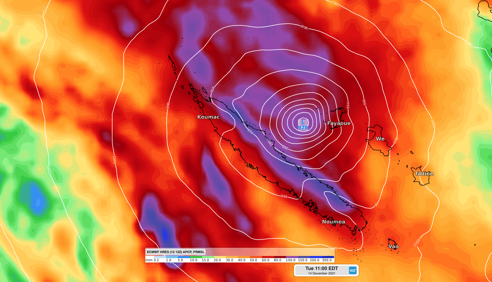
Image: Forecast 24-hour accumulated rain and mean sea level pressure at 11am AEDT on Tuesday, December 14, according to the ECMWF-HRES model.
Large waves and a storm surge could also impact New Caledonia with the passage of the cyclone.
Moisture associated with Tropical Cyclone Ruby is also streaming south towards New Zealand. This tropical moisture will fuel prolonged and heavy rain over the coming days, with several heavy rain Watches and Warnings already in place for parts of the North Island and upper South Island.
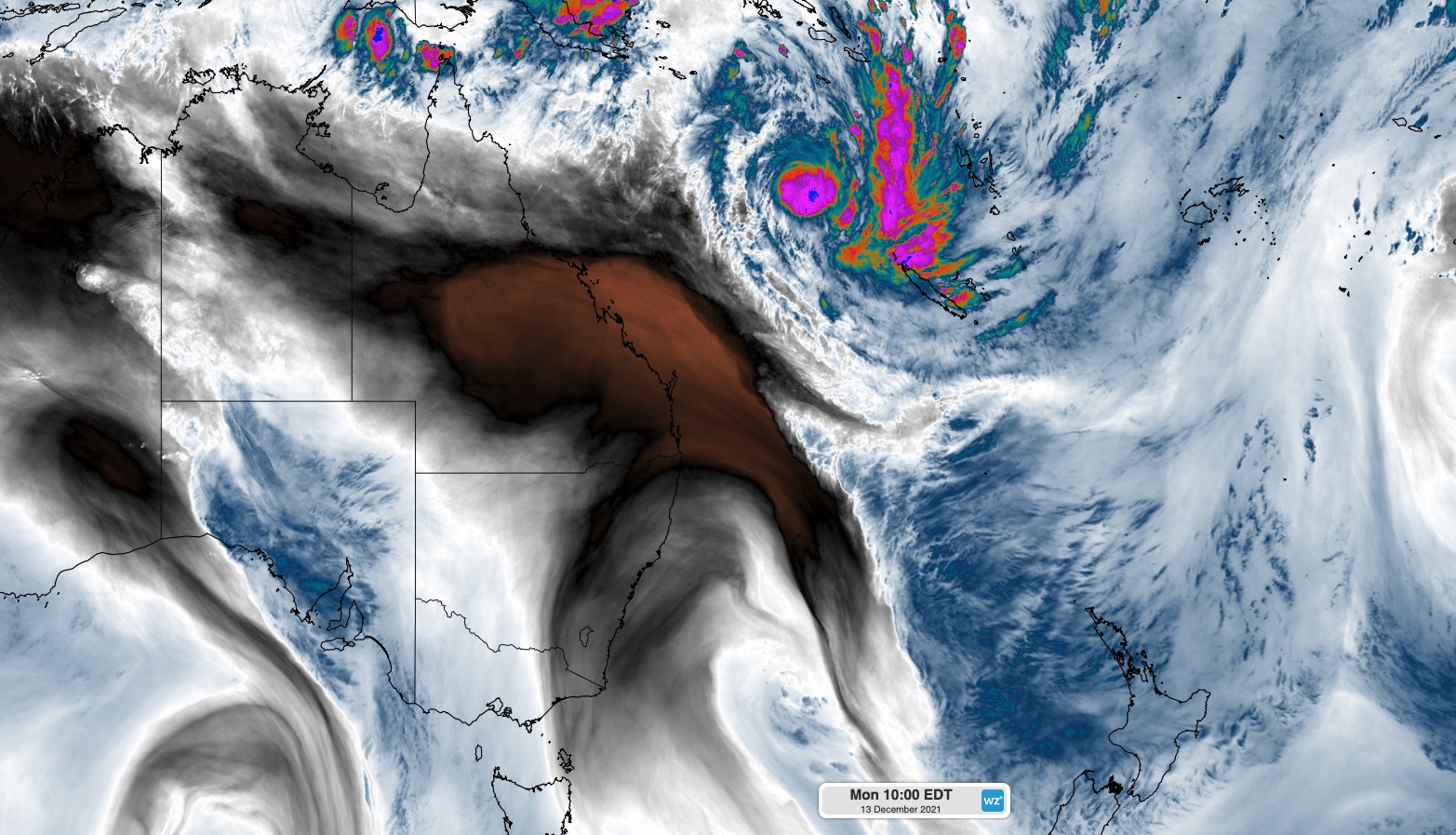
Image: Enhanced water vapour satellite image showing tropical moisture streaming down towards New Zealand on Monday, December 13.
Following the recent formation of Ruby, the next tropical cyclone to form in Australia's area of responsibility will be named Seth.