Tropical Cyclone Jasper reaches category 2 before landfall
Queensland’s North Tropical Coast could be hit with half a metre of rain, destructive winds and a dangerous storm tide as category 2 Tropical Cyclone Jasper makes landfall on Wednesday.
While Jasper started Tuesday as a category 1 tropical cyclone, it has been gaining strength while moving towards the coast in a favourable environment. At 1pm AEST on Tuesday, Jasper was a category 2 tropical cyclone located about 235 km to the east northeast of Cairns, with wind speeds of 95 km/h and gusts to 130 km/h near its core.
Jasper is expected to continue moving towards the state’s North Tropical Coast during the rest of Tuesday into Wednesday morning, before making landfall somewhere between Cooktown and Cairns on Wednesday. Forecast models suggest that Jasper will make landfall as a category 2 system, causing heavy rain, destructive winds and a storm tide as it crosses the coast.
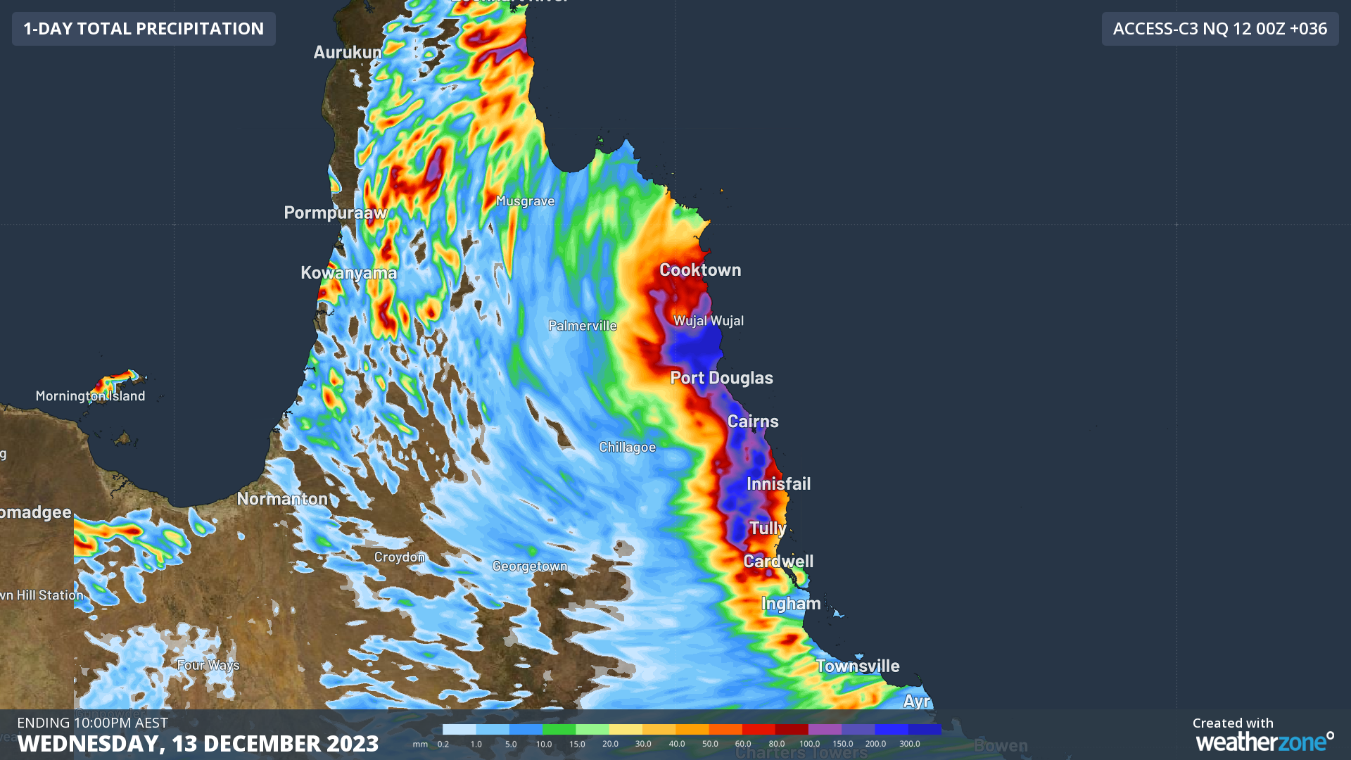
Rain should increase along the North Tropical Coast and Tablelands from Wednesday morning and extend further inland across Cape York Peninsula throughout Wednesday and Thursday. This injection of tropical moisture could cause 24-hour rainfall totals of 400 to 500 mm, with six-hourly rain rates reaching around 300 mm in some areas.

Image: Forecast accumulated rain during the 36 hours ending at 10pm AEST on Wednesday, according to the ACCESS-C model.
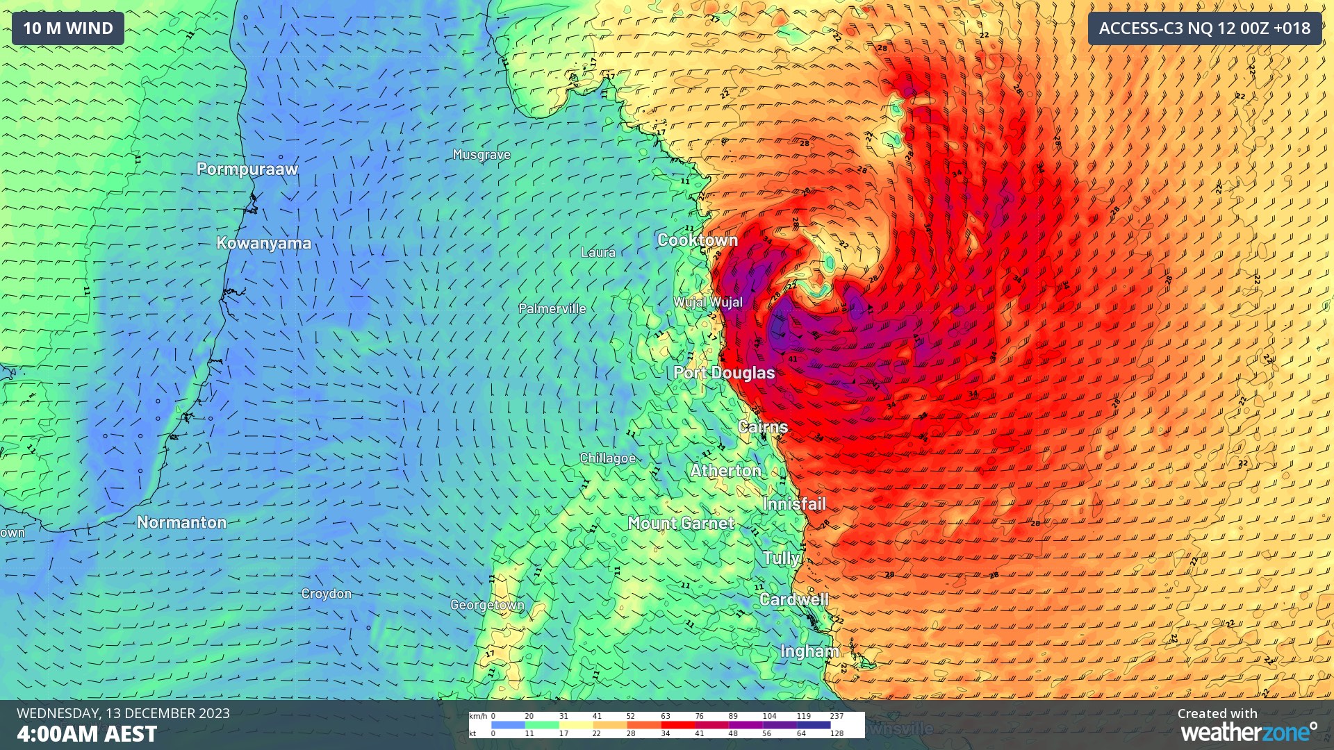
Damaging to destructive winds could develop between Cape Flattery and Lucinda as Jasper approaches and crosses the coast on Wednesday, with the strongest winds likely to occur between Wujal Wujal and Innisfail, including Cairns.

Image: Forecast wind speed and direction at 4am AEST on Wednesday, according to the ACCESS-C model.
The powerful onshore winds to the south of Jasper’s core, combined with its low atmospheric pressure, will cause dangerous storm tides around the time of high tides on Tuesday and Wednesday.
Be sure to check the latest tropical cyclone warnings and track maps for the most up-to-date information on Jasper.
