Tropical Cyclone Gabrielle declared
The first tropical cyclone of the 2022/23 cyclone season in Queensland waters was officially declared by the Bureau of Meteorology early on Wednesday afternoon.
At 1 pm Wednesday (AEST), Tropical Cyclone Gabrielle was located well off the Queensland coast, about 730 km northeast of Mackay and 340 km east northeast of Willis Island. The central pressure was 990 hPa.
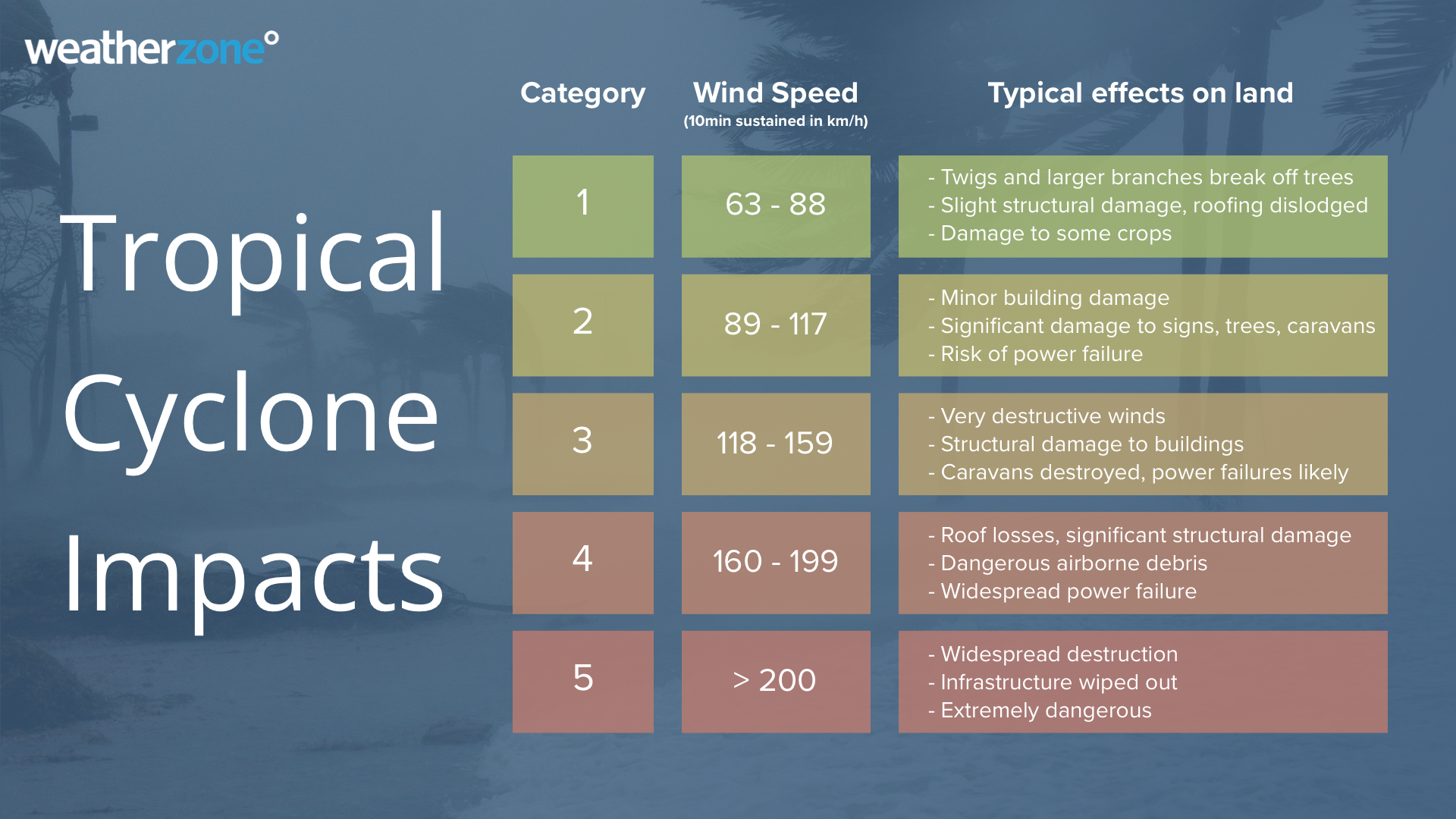
TC Gabrielle is currently rated as a Category 1 cyclone, but is expected to strengthen further during Thursday, becoming a severe tropical cyclone.

Where will its impacts be felt?
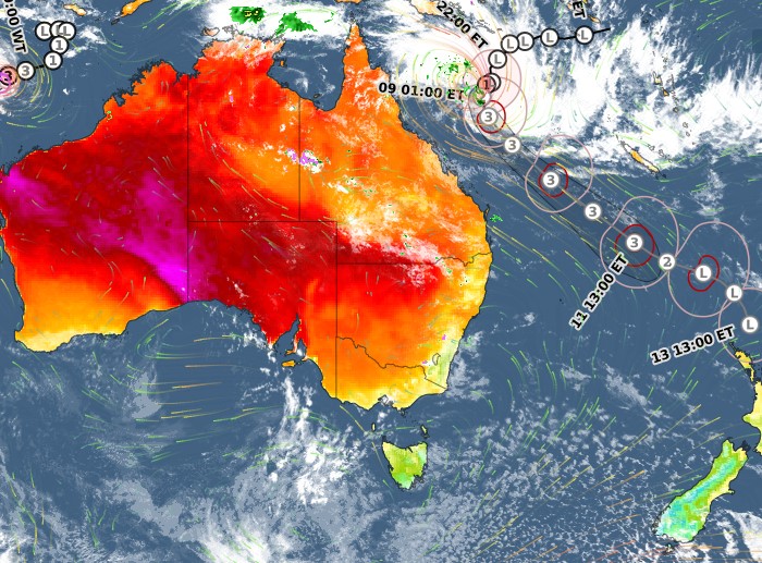
It is currently moving steadily in a south to southwesterly direction at 14 kilometres per hour. As you can see on the current track map below, it is predicted to continue moving south before swinging in a southeasterly direction as it intensifies.

This is reasonably good news for the majority of Queensland coastal residents who should avoid cyclone-strength winds, although exposed coastal areas may experience large waves and fresh to strong winds, especially on Thursday and Friday.
The cyclone's predicted path will be much more worrying for residents of Norfolk Island. As we told you in our story on Tuesday, Gabrielle is forecast to track close to Norfolk Island over the weekend.
We'll update this story as more information comes through, including the next Information Bulletin from the BoM at 5 pm AEST Wednesday.
Please also check our warnings page.