
Tropical Cyclone Gabrielle brings pumping surf
Large surf generated from Tropical Cyclone Gabrielle is filling into the coastlines of southeast QLD and NSW this weekend.
Category two Tropical Cyclone Gabrielle is now 1160km east of the Gold Coast, with a broad swathe of the upper Tasman Sea blowing easterly gales directed towards the eastern seaboard (see image below). These winds are generating large swell heading towards southeast Queensland and NSW.
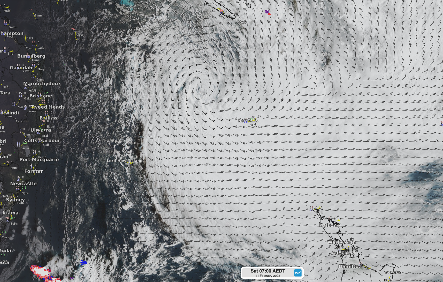
Satellite imagery showing Tropical Cyclone Gabrielle on Saturday morning, with modelled 10m winds showing a broad and long fetch of easterly gales pointing towards eastern Australia.
Significant wave heights reaching 10-12 metres are likely near the centre of this system, with a broader and more widespread field of 4-6 metres waves over much of the Coral Sea and Tasman Sea this weekend (image below). Swell from this system will spread across the Basin and filter into the east coast, bringing wave heights of 2.5-3 metres. Surf conditions will be powerful with a longer swell period of 13-15 seconds, leading to sometimes deceivingly calm conditions. Surf size should reach 6-8 feet from Sunday over southeast Queensland and northern NSW, and 4-6 feet later on Sunday and into Monday further south into NSW.
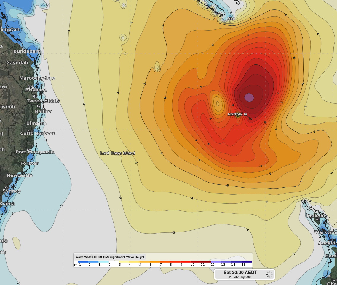
Wave Watch III significant wave heights on Saturday evening showing large and broad swell generated by Tropical Cyclone Gabrielle.
While the swell will be there, surfing conditions will be a little less promising, with weak winds in the mornings, and seabreezes adding texture to the points in the afternoon for more northern locations. A southerly wind change will push into southern and central NSW on Sunday, and reach into southeast Queensland and northern NSW on Monday and Tuesday, bringing more opportune conditions for the more sheltered point breaks of the region. By Wednesday, the bulk of the swell will have hit our coastline, and a gradual easing trend will commence into the remainder of the working week.
Hazardous Surf Warnings are currently in place for coasts between Fraser Island Coast and Macquarie Coast for today and tomorrow, with the risk of further extension southwards from Monday onwards. The longer wave period and easterly direction will also enhance beach erosion across exposed locations.