Tropical Cyclone Esther to bring flooding rain in QLD, NT

Tropical Cyclone Esther, which developed over the southern Gulf of Carpentaria on Monday morning, will bring flooding rain to parts of Queensland and the NT over the next several days.
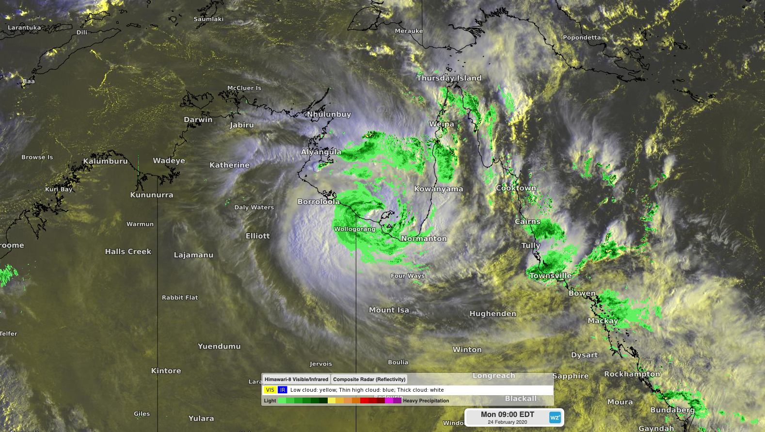
A tropical low pressure system that meandered around the Gulf of Carpentaria on the weekend became Tropical Cyclone Esther at 7am AEST on Monday, roughly 45 kilometres northwest of Mornington Island.

Image: Satellite and radar showing Tropical Cyclone Esther over the southern Gulf of Carpentaria at 8am AEST on Monday.
Since forming, Esther has been moving towards the southwest on Monday morning and should make landfall somewhere near or east of the NT/Queensland border as a category one tropical cyclone later in the day.
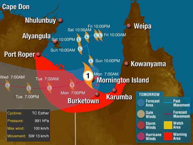
At 9am AEST on Monday, a cyclone warning was in place for the coast and adjacent inland areas between Port Roper in the NT and Gilbert River Mouth in Queensland. Gale force winds are possible in this warning area during Monday, although the extent of these winds will depend on the future movement and strength of Esther.

Image: Track map for Tropical Cyclone Esther, valid at 9am AEST on Monday.
In addition to dangerous wind, Tropical Cyclone Esther will cause a storm surge as it crosses the coast on Monday. This could result in damaging waves and coastal inundation between Port McArthur in the NT and Karumba in Queensland.
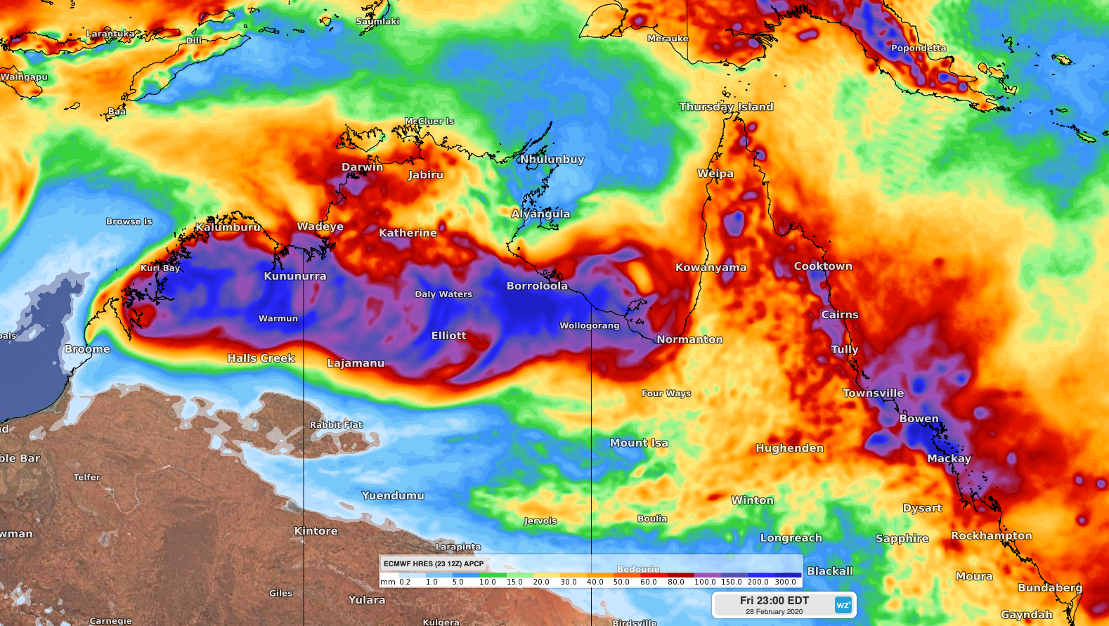
The most widespread impact from Esther will be rain. On Monday, heavy falls could cause flash flooding over coastal districts around the Gulf, particularly the NT's Carpentaria District and Queensland Gulf Country District.
On Tuesday and Wednesday, rain and potentially damaging winds will spread inland over the NT's Carpentaria and northern Barkly districts. This inland rain is likely to cause riverine flooding and cut off roads in some areas.
Later in the week, Ex-Tropical Cyclone Esther should track further west and cause rain and thunderstorms to spread over the NT's Gregory and Daly Districts and WA's Kimberley District, including Darwin.

Image: Forecast accumulated rain between Monday and Friday, according to the ECMWF-HRES model.
Some forecast models suggest that Ex-Tropical Cyclone Esther could move off the Kimberley coast at the end of this week, where it may reintensify into a tropical cyclone. If models keep predicting this scenario, additional warnings will be issued later in the week.
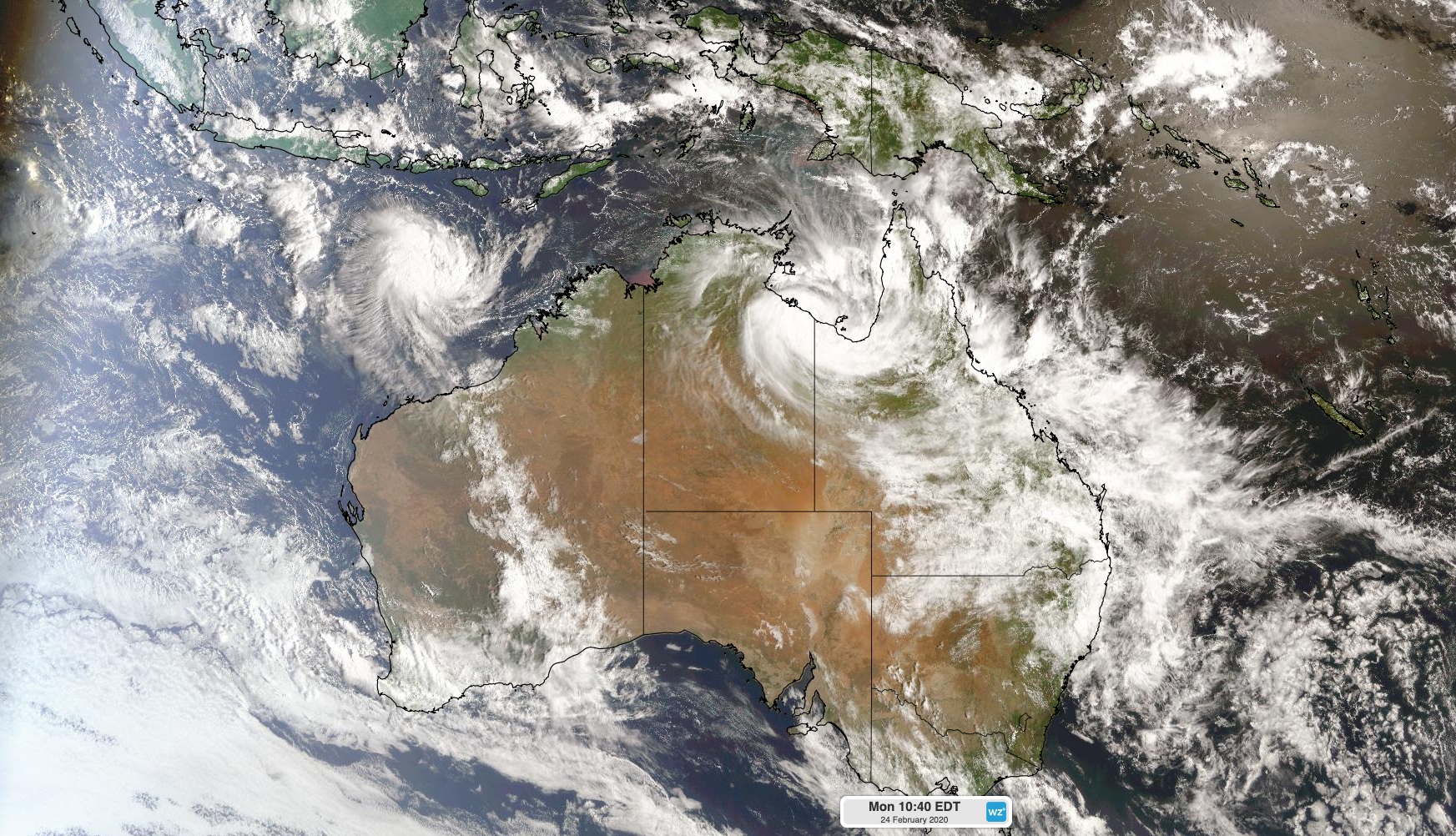
Meanwhile, another tropical low pressure system was located to the south of Indonesia on Monday morning, roughly 600km northwest of Broome at 2am AWST. This low is expected to become Tropical Cyclone Ferdinand later on Monday, which will be the fifth tropical cyclone to form in Australia's area of responsibility so far this season.

Image: Satellite image taken at 10:40am AEDT on Monday, showing Tropical Cyclone Esther over the Gulf of Carpentaria and soon-to-be Tropical Cyclone Ferdinand south of Indonesia.
Once formed, Ferdinand is expected to move towards the west southwest while gaining strength over the next few days, possibly reaching category three intensity by Wednesday. After peaking in strength mid-week, the system should head out to the Indian Ocean while weakening.
Tropical Cyclone Ferdinand is not likely to have any direct impacts on mainland Australia.