
Tropical Cyclone Blake forms off north coast of WA

Tropical Cyclone Blake has developed off Australia's northwest coast, becoming the country's first named tropical cyclone of the 2019/20 season.
Blake formed around 240 kilometres to the north of Broome at 8am WST on Monday. At that time, the system was moving towards the east at nine kilometres per hour.
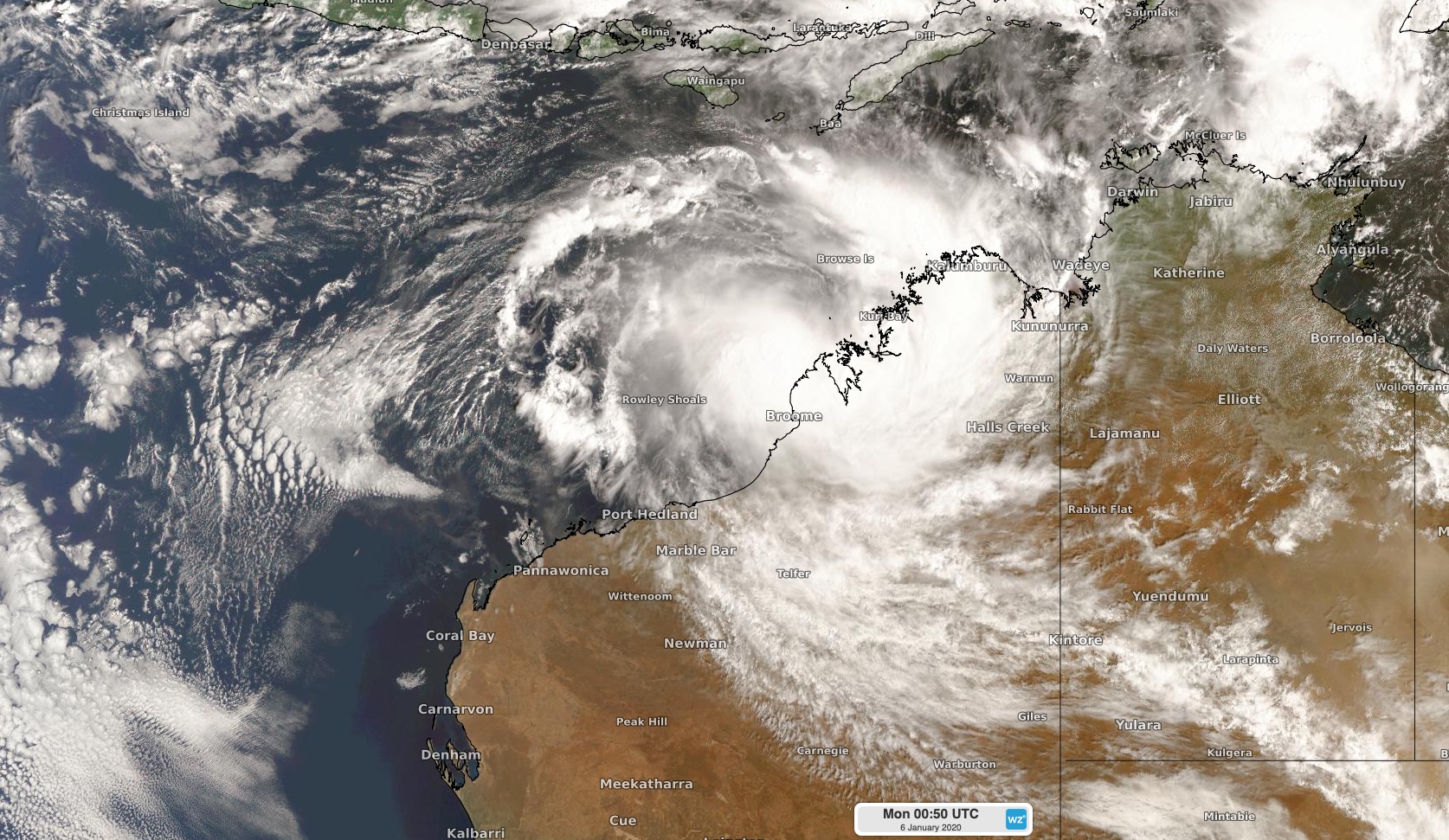
Image: Tropical Cyclone Blake to the northwest of WA on Monday morning.
The cyclone should start to move south and approach Western Australia's north coast later on Monday, possibly making landfall over the East Pilbara coast on Tuesday or early on Wednesday. At this stage, Blake could reach category two strength before crossing the coast.
While there is still some uncertainty with the future movement and development of this system, heavy rain and damaging to destructive winds are likely to develop along parts of the state's West Kimberley and East Pilbara coasts between Monday and Wednesday.
A tropical cyclone warning was in place at 9am WST for the coast and adjacent inland between Kuri Bay and De Gre, including Broome.
After making landfall, the remnants of Tropical Cyclone Blake could travel southwards across WA later in the week, dragging moisture-laden air towards southern Australia. Models suggest that this injection of tropical moisture could cause some much-needed rain and thunderstorm activity over parts of southern WA, SA, Victoria, Tasmania and NSW between Thursday and Sunday. Unfortunately, it doesn't look like this rain will be heavy enough to put out the fires in southeastern Australia.
Visit http://www.bom.gov.au/cyclone for the latest tropical cyclone warnings.