Triple Typhoon Trajectory! The courses of the current storms in the West Pacific
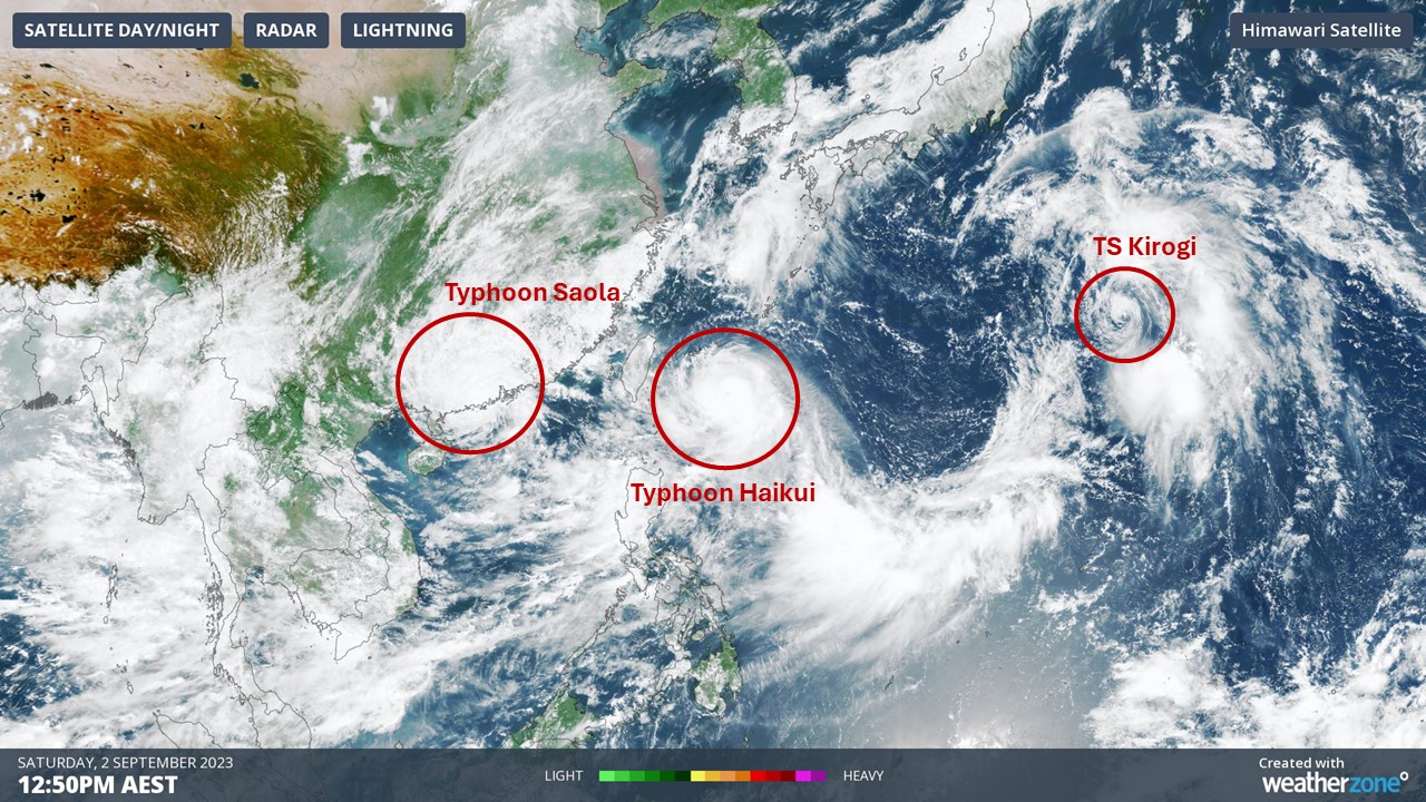
There are currently three Tropical Storms in the West Pacific... Typhoon Saola, Typhoon Haikui (known as Hanna in the Philippines) and Tropical Storm Kirogi. See them all below:

Fig 1. Satellite Image of the three current tropical storms in the West Pacific at 12:50pm (Australian Eastern Standard Time) on Saturday 2nd of September 2023.
Typhoon Saola has been an active Typhoon since August 25th, further west in the Philippine Sea. It had threatened to make landfall over the northernmost island of the Philippines, Luzon, but decided to double back eastward towards the sea, saving Luzon from direct contact. However, as Saola made its way through the Bashi Channel (waters between the Philippines and Taiwan), it intensified into a Super Typhoon, with sustained winds reaching 135 knots (that’s 250km/h!). Imagine what the gusts were like!
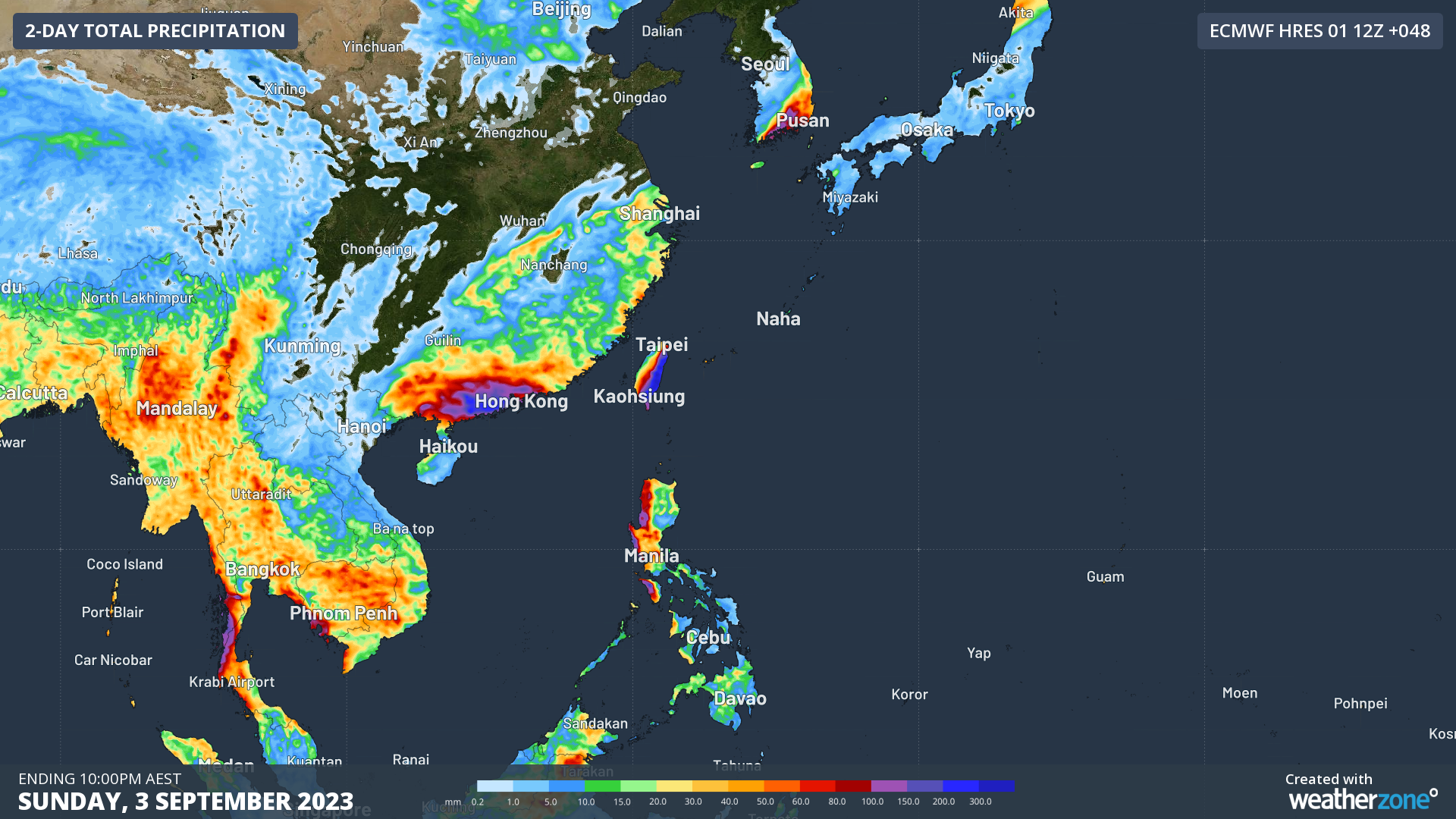
Saola then headed due east to Southeast China. It is now travelling along the South China coast as a Super Typhoon-turned-Typhoon (sustained winds dropping from 185km/h to 157km/h in the past 6 hours). It has already caused immense flooding along the coast of the Chinese Province of Guangdong and is expected to do so until Monday. Trees have been ripped from their roots with wind gusts clocking in at 209km/h, and many cities have flooded due to the 120mm/3hrs rains near Hong Kong and harbour levels rising by 2-4m. It's lucky that measures were undertaken beforehand by the Chinese and Hong Kong governments, such as evacuations and closing of businesses and schools, to prevent significant losses of life. As Saola continues along the coast is expected to slow down more and more until it is no more than a low-pressure system.
On the other hand, Typhoon Haikui only became an active typhoon on August 31st. Unlike the much slower cruising Saola, Haikui is heading straight for Taiwan at the speed of 13km/h. It's a typhoon on a mission! Haikui will likely strengthen into a Very Strong Typhoon by tomorrow morning, gusting at 240km/h with steady winds going at 195km/h. If it continues on this current trajectory, Haikui will make landfall in Taiwan after it strengthens to a Very Strong Typhoon... around tomorrow evening. Similarly to Saola, Haikui will bring high rainfall totals when it lands in Taiwan.

Fig 2. Total precipitation expected to fall over the West Pacific over the next 2 days. See high totals along the South China coast and Taiwan due to the Typhoons (as given by ECMWF 01 12Z run)
Last, but not least, Tropical Storm Kirogi. It was first considered an area of interest on the 27th of August, all the way in Micronesia. It has been slowly heading NNW towards Japan for the past few days and is expected to move more westward over the next three days. Given that it’s moving into cooler waters, and it does not have that much energy already, it’s unlikely for it to develop into a typhoon. Instead, it will more likely stay as a storm and sprinkle its showers over the islands of Okinawa and Kyushu in Japan, or it'll weaken on the way and stop short.
It's crazy to think that in the span of a few days we were able to see three completely different atmospheric storms form and develop; the slow-moving, energy-reserving storm (Typhoon Saola), the fast-and-furious storm (Typhoon Haikui) and the storm that didn't fulfill its potential because the odds were not in its favour (Tropical Storm Kirogi). Regardless, we are currently at the peak of the West Pacific Cyclone season... so there is a chance we will see more typhoons coming soon.