Total fire bans in Melbourne, most of Victoria
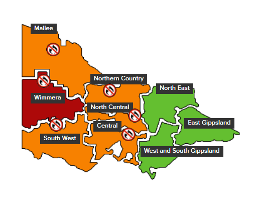
The day of extremely dangerous fire weather which has been on the cards all week has arrived in Victoria, with total fire bans declared in six of the state's nine forecast districts.
The CFA map below shows the districts where the bans are in place, with only the state's east and northeast, including the High Country, exempt from a total fire ban.
The CFA has a page where you can check what you can and can't do on days of total fire ban, which you can read here. The short version is don't light any sort of fire and be extremely careful if you are working outdoors with machinery.

Source: CFA.
The Australian Fire Danger Rating System was unified across all states and territories a couple of years ago, and the four ratings used nationally are: Moderate, High, Extreme, Catastrophic.
Fire danger is extreme in five Victorian districts this Wednesday and catastrophic in the parched Wimmera district. There are five main factors fuelling today's ratings:
- The first is the ongoing dry spell in the second half of the summer which has left the country tinder dry over the western half of Victoria. No rain, or less than one millimetre of rainfall in total, has been recorded in many districts, especially in the state’s central and western districts.
- Secondly, it will be hot in Victoria today, with temperatures reaching the mid-thirties in Melbourne and around 44°C in Mildura in the state's far northwest corner.
- Thirdly, there will be gusty northwesterly winds. Melbourne Airport had already reported a gust of 56 km/h just after 9 am.
- Fourthly, a gusty southwesterly change later in the day will drop temps but there will be only small amounts of moisture with the change, so any fires that have started during the day could shift in direction and intensity, making containment extremely tricky for firefighters.
- Finally, some thunderstorms may also occur, possibly severe, with the obvious associated danger of fires sparked by dry lightning strikes.

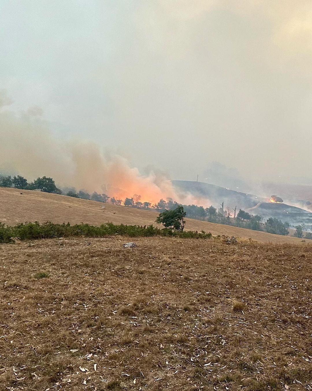
Image: The fire near Beaufort, Vic (near Ballarat) earlier this week. Source: @johnfwright and @shmark82 on Instagram.
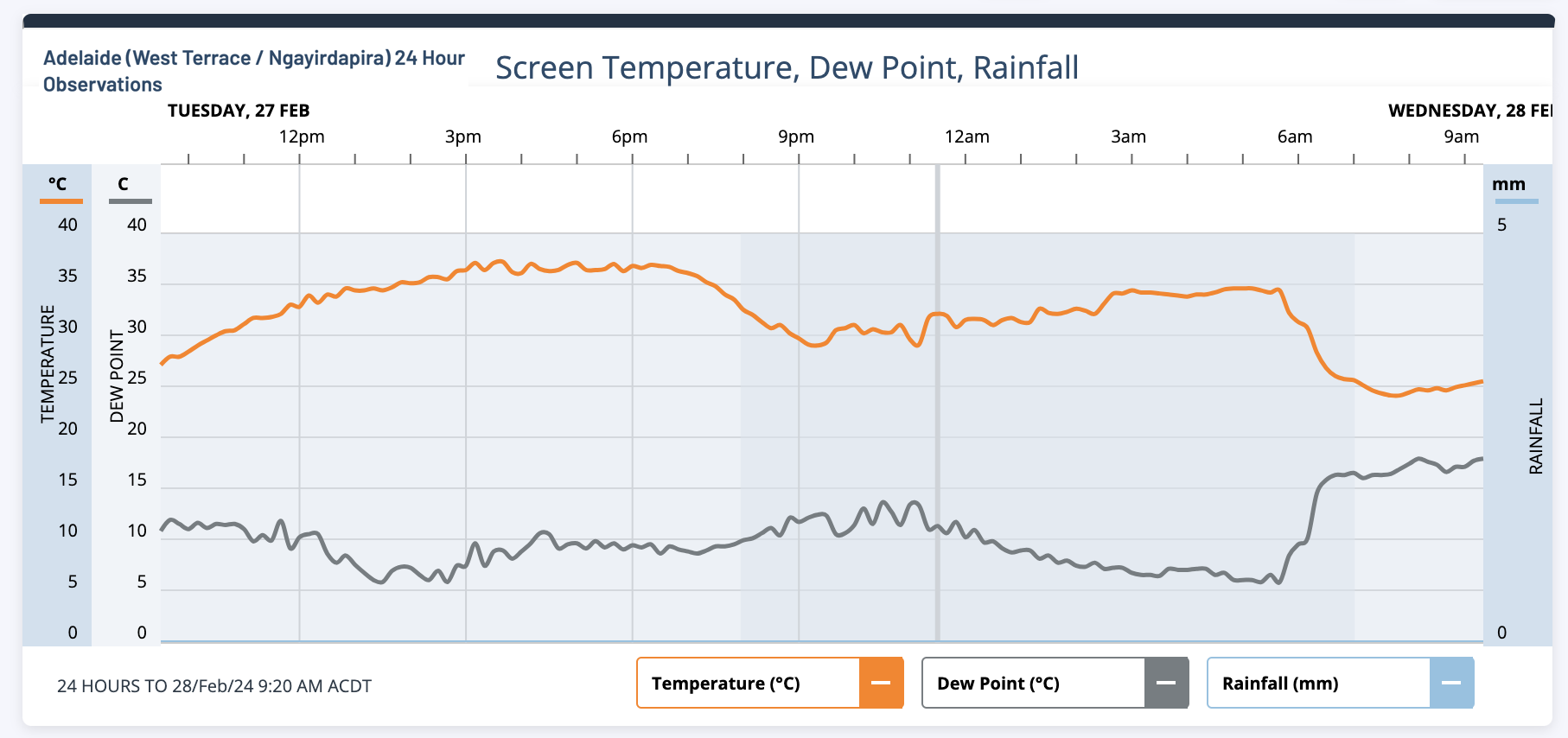
Meanwhile as you'd expect ahead of scorching hot late summer day, there were some pretty uncomfortable overnight minimums. Not all of those will be reflected in the official stats.
For example, Adelaide's minimum in the 24 hours to 9 am Wednesday was 24°C just before 8 am. But Adelaide was still almost 35°C at 5 am before the cool change finally arrived, dropping temps by 10 degrees within a couple of hours.

That cooler weather will edge its way across Victoria from west to east throughout the day.
For a comprehensive wrap of the dangerous weather conditions in Victoria this Wednesday, check Ben Domensino's story. And as ever, please check our warnings page for all the latest info.