Torrential rain, wild winds for Tasmania this weekend
A serious soaking is in store for Tasmania this weekend, with a complex low set to bring rain, powerful winds, and storms to our southernmost state on both Saturday and Sunday.
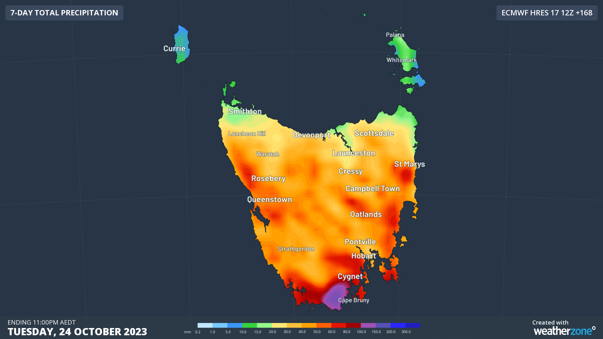
Rain should affect the whole state in this very dynamic and potentially dangerous weather system, with the heaviest falls at this stage likely to occur in the southeast.
As you can see on the map below – which shows 7-day rainfall up till next Tuesday – some places could see more than 100mm, with most of that falling on the weekend.

To put that potential weekend total of 100 mm of rainfall in perspective:
- October just happens to be Hobart's wettest month, with a monthly average of 62.1 mm since records began way back in 1882.
- So Hobart could exceed its average October rainfall over the space of just a day or two.
- Bear in mind that Hobart tends to see relatively frequent but not particularly heavy rainfall. For example, October 2023 has so far seen 12 days with recorded rain, totalling just 18 mm.
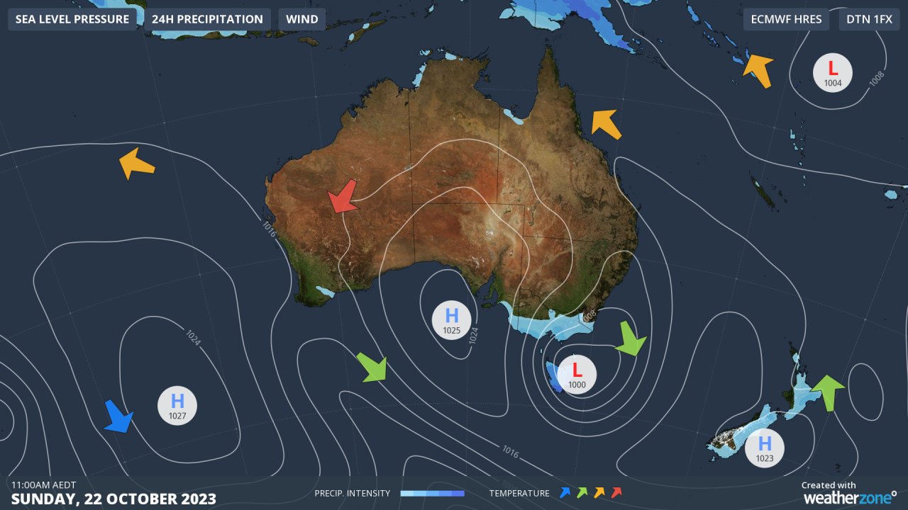
Weatherzone's synoptic chart for Sunday shows the predicted position of the low in the Tasman Sea just east of Tasmania.
As you can see, moist east to southeasterly winds will lash the state and damaging winds are possible in some areas, most likely on Sunday as southerlies strengthen on the western flank of the low.

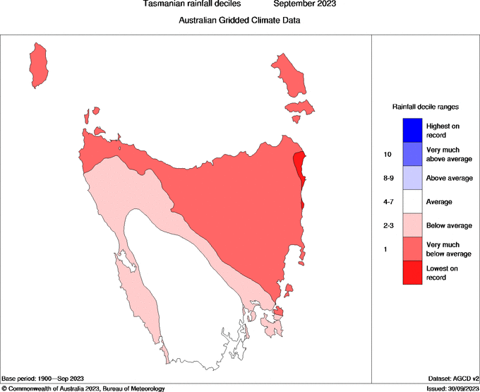
The good news with this weather system is that most of Tasmania had a relatively dry winter, and also a dry first month of spring, with some east coast locations even seeing their driest September on record.

Image: Rain will fall where it is needed, but it could come at the cost of flooding and wind damage. Source: BoM.
But while the coming rainfall will be welcome in the long-term, in the short-term this system has the potential for both wind damage and flooding, especially in the state's east and southeast.
- Usually western and southwestern Tasmania receive the state's wildest weather from cold fronts that come out of the west and southwest.
- But with Tasman lows like this one (which are generally much less frequent), the east and southeast tend to cop the worst of it.
Keep safe this weekend and please stay up to date with the latest on our warnings page.